
File:Arriva Guildford & West Surrey 4017 GN58 BUA and Horsell Crown.JPG
Size of this preview: 800 × 450 pixels. Other resolutions: 320 × 180 pixels | 640 × 360 pixels | 1,024 × 576 pixels | 1,280 × 720 pixels | 2,560 × 1,440 pixels | 3,712 × 2,088 pixels.
Original file (3,712 × 2,088 pixels, file size: 3.06 MB, MIME type: image/jpeg)
| This is a file from the Wikimedia Commons. Information from its description page there is shown below. Commons is a freely licensed media file repository. You can help. |
Summary
| Description |
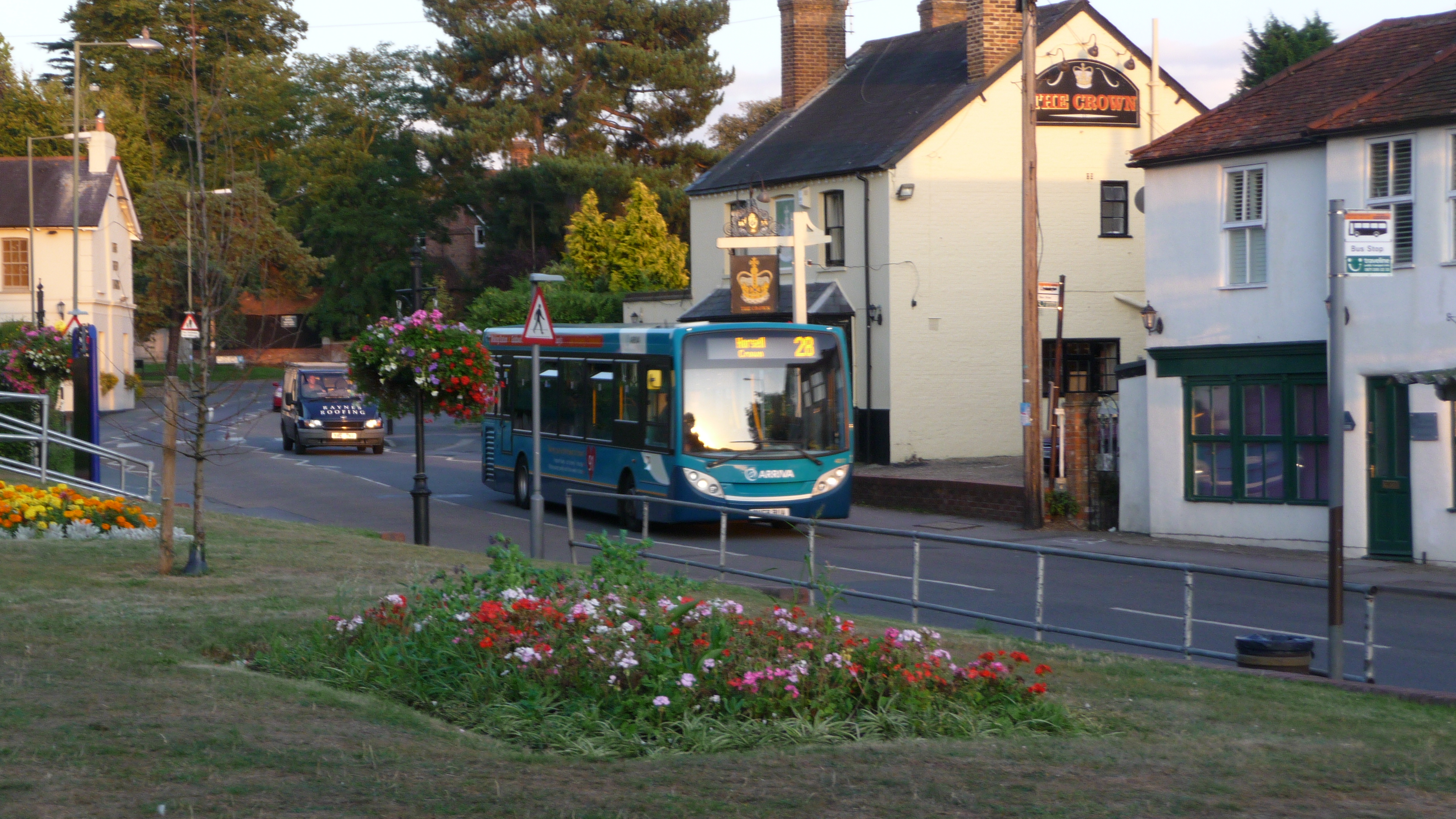
English: Arriva Guildford & West Surrey 4017 (GN58 BUA), an Alexander Dennis Enviro200 Dart, in Horsell High Street, Horsell, Surrey, passing the Crown pub on route 28. From 1 September 2009, route 28 was cut to only operate between Guildford and Knaphill Sainsbury's, rather than continuing to Woking via Goldsworth Park and Horsell as it had done previously. At the time there were four extra evening journeys, running from Woking to Horsell and back only, after the main Woking - Guildford service had finished. These journeys utilised buses between their duties on the evening service of route 91 (this meant that 91-branded Enviros were allocated to it, as seen here). The journeys were operated under contract to Surrey County Council, so when the 28 was cut back from Woking by Arriva commercially, there was still Surrey CC funding for the evening journeys. The evening journeys were renumbered to 73 (the other route to serve Horsell and Woking). They continued to run from Woking via the route of service 28, but were amended to run back to Woking via the route of the 73, to provide a service to more of the area, as the route became one big loop. Route 28 does not run on Sundays, so therefore the last day of the service running the full route was Saturday 29 August 2009, when this photo was taken. It shows the first evening journey of the night, the 1932 from Woking. The same bus was scheduled to run all four evening journeys, so 4017 should have run them all (and been the last bus to depart Woking on a 28) if everything went as normal. The two buses used on the main daytime service were 3090 and 4021. After a year's gap, as part of Phase 1 of Surrey County Council's Bus Review, route 28 was extended back to Woking from August 2010. The evening journeys were renumbered back to 28 (though kept the same routing of going back to Woking via the 73 route) - so it turned out this wasn't the last evening of the 28 in Horsell after all. |
| Date | |
| Source | Own work |
| Author | Arriva436 |
| Camera location | | View this and other nearby images on: OpenStreetMap |
|---|
Licensing
I, the copyright holder of this work, hereby publish it under the following licenses:

|
Permission is granted to copy, distribute and/or modify this document under the terms of the GNU Free Documentation License, Version 1.2 or any later version published by the Free Software Foundation; with no Invariant Sections, no Front-Cover Texts, and no Back-Cover Texts. A copy of the license is included in the section entitled GNU Free Documentation License. |
This file is licensed under the Creative Commons Attribution 3.0 Unported license.
- You are free:
- to share – to copy, distribute and transmit the work
- to remix – to adapt the work
- Under the following conditions:
- attribution – You must give appropriate credit, provide a link to the license, and indicate if changes were made. You may do so in any reasonable manner, but not in any way that suggests the licensor endorses you or your use.
You may select the license of your choice.
File history
Click on a date/time to view the file as it appeared at that time.
| Date/Time | Thumbnail | Dimensions | User | Comment | |
|---|---|---|---|---|---|
| current | 22:20, 14 December 2010 | | 3,712 × 2,088 (3.06 MB) | Arriva436 |
File usage
The following pages on the English Wikipedia use this file (pages on other projects are not listed):