
File:Arch Wanderpfad Fischbeker Heide Station 09.jpg
Size of this preview: 800 × 600 pixels. Other resolutions: 320 × 240 pixels | 640 × 480 pixels | 1,024 × 768 pixels | 1,280 × 960 pixels | 2,560 × 1,920 pixels | 3,648 × 2,736 pixels.
Original file (3,648 × 2,736 pixels, file size: 3.62 MB, MIME type: image/jpeg)
| This is a file from the Wikimedia Commons. Information from its description page there is shown below. Commons is a freely licensed media file repository. You can help. |
Summary
| Description |
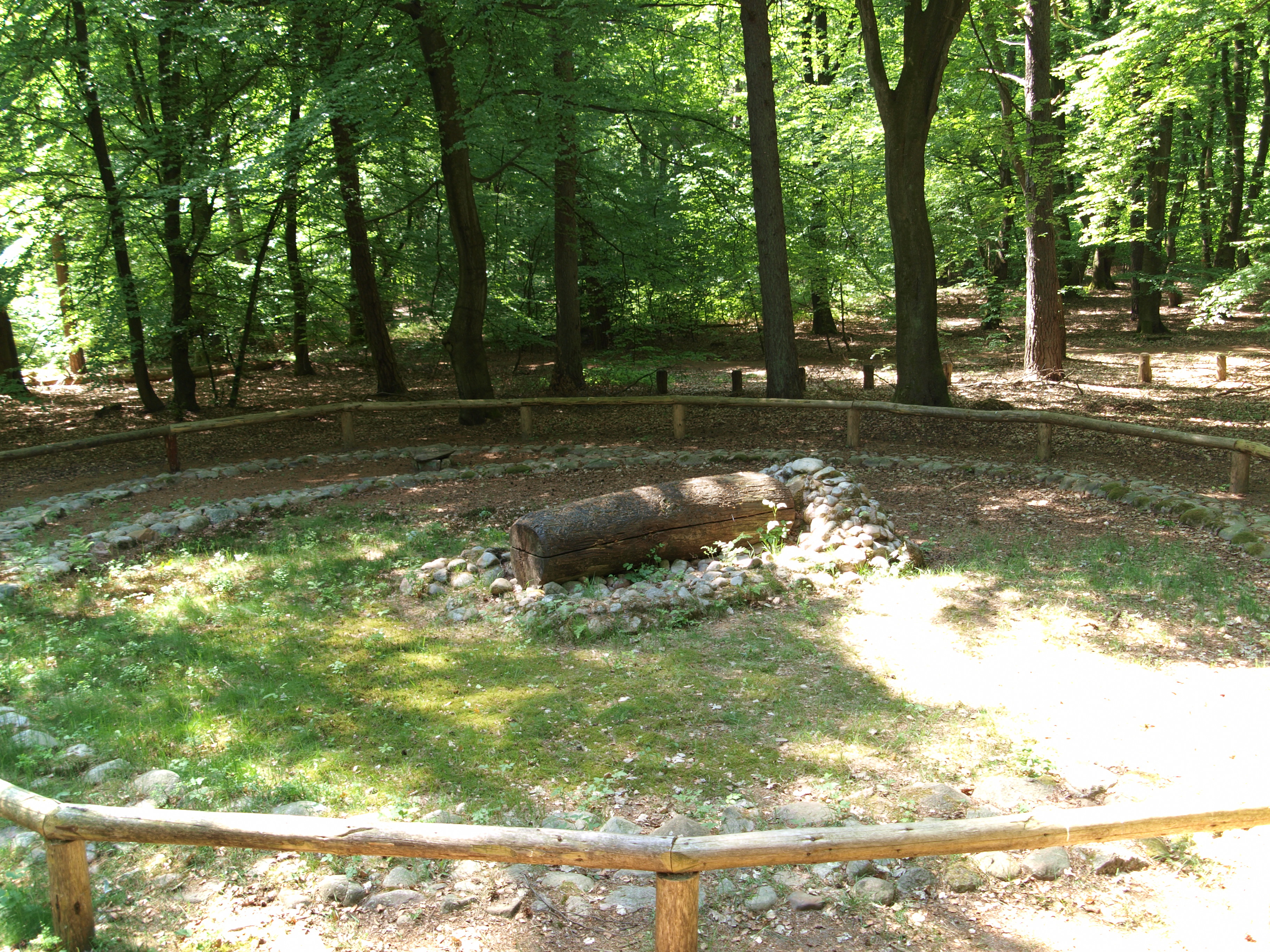
Deutsch: Archäologischer Wanderpfad in der Fischbeker Heide, Station 8. Rekonstruierte Baumsargbestattung der mittleren Bronzezeit, ohne aufgeschüttetem Grabhügel. Im Hintergrund ist eine jüngere, an dem Grabhügel angebaute Bestattung sichtbar. Rekonstruiert durch das Archäologische Museum Hamburg | Helms-Museum, Hamburg-Harburg.
English: Archaeologic scenic route at Fischbeker Heide, station 8. Reconstructed trunk coffin burial of the middle Bronze Age without mounted tumulus. At the background is an a younger burial attached to the older existing tumulus. Reconstructed Archaeological useum Hamburg | Helms-Museum, Hamburg-Harburg, Germany. |
| Date | |
| Source | Own work |
| Author | Photographed by User:Bullenwächter |
| Camera location | | View this and other nearby images on: OpenStreetMap |
|---|
Licensing
I, the copyright holder of this work, hereby publish it under the following license:
This file is licensed under the Creative Commons Attribution-Share Alike 3.0 Unported license.
- You are free:
- to share – to copy, distribute and transmit the work
- to remix – to adapt the work
- Under the following conditions:
- attribution – You must give appropriate credit, provide a link to the license, and indicate if changes were made. You may do so in any reasonable manner, but not in any way that suggests the licensor endorses you or your use.
- share alike – If you remix, transform, or build upon the material, you must distribute your contributions under the same or compatible license as the original.
|
This file was made by Andreas Franzkowiak alias User Bullenwächter. If you use one of my files, an email (account needed) or a message or direct to: my email account would be greatly appreciated. |
| Annotations | This image is annotated: View the annotations at Commons |
File history
Click on a date/time to view the file as it appeared at that time.
| Date/Time | Thumbnail | Dimensions | User | Comment | |
|---|---|---|---|---|---|
| current | 15:18, 25 May 2012 | | 3,648 × 2,736 (3.62 MB) | Bullenwächter |
File usage
The following pages on the English Wikipedia use this file (pages on other projects are not listed):
Global file usage
The following other wikis use this file:
- Usage on de.wikipedia.org
- Usage on es.wikipedia.org
- Usage on he.wikipedia.org
- Usage on nl.wikipedia.org