
File:Amsterdam centre map.png

Size of this preview: 651 × 599 pixels. Other resolutions: 261 × 240 pixels | 521 × 480 pixels | 834 × 768 pixels | 1,112 × 1,024 pixels | 1,648 × 1,517 pixels.
Original file (1,648 × 1,517 pixels, file size: 3.22 MB, MIME type: image/png)
| This is a file from the Wikimedia Commons. Information from its description page there is shown below. Commons is a freely licensed media file repository. You can help. |
| Description |
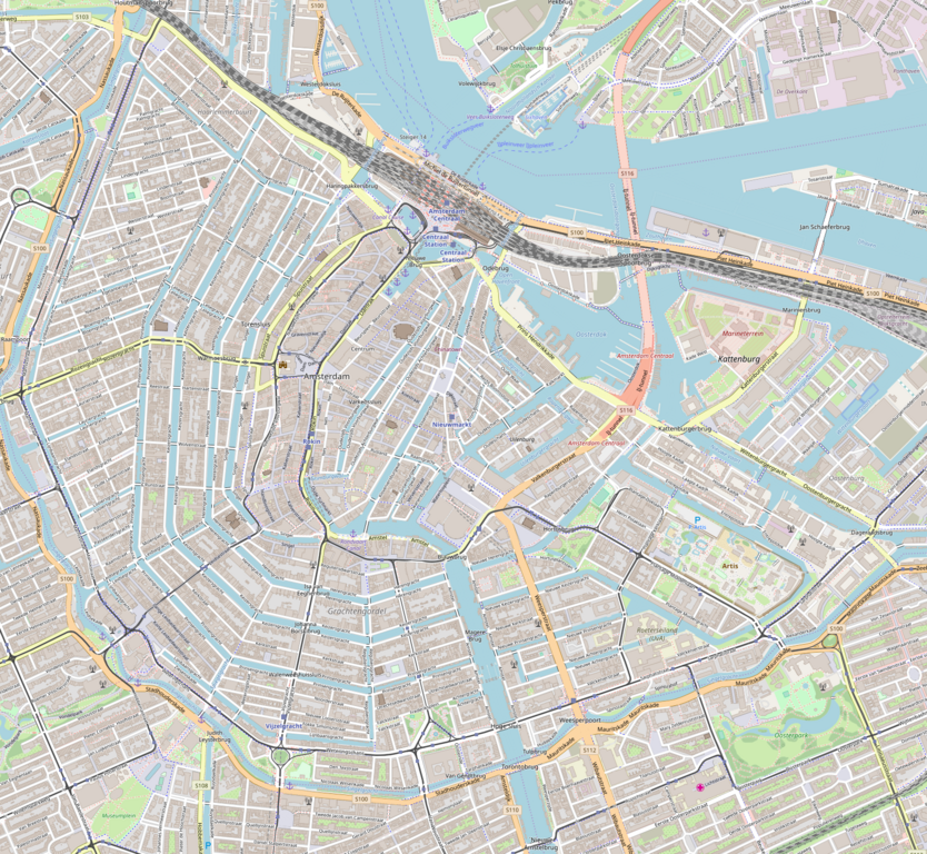
English: Map of Amsterdam
Geographic limits of the map:
This file is licensed under the Creative Commons Attribution-Share Alike 2.0 Generic license.
|
| Source | OpenStreetMap (reRender) |
| Author | Dr. Blofeld |
File history
Click on a date/time to view the file as it appeared at that time.
| Date/Time | Thumbnail | Dimensions | User | Comment | |
|---|---|---|---|---|---|
| current | 20:22, 25 August 2018 | | 1,648 × 1,517 (3.22 MB) | Wvdp | update in 2018 |
| 14:55, 14 May 2010 |  | 779 × 717 (670 KB) | Dr. Blofeld~commonswiki | {{Information |Description={{en|1=r}} |Source=r |Author=r |Date=r |Permission= |other_versions= }} |
File usage
The following pages on the English Wikipedia use this file (pages on other projects are not listed):
- Achtergracht
- Ajax Experience
- Allard Pierson Museum
- American Hotel, Amsterdam
- Amsterdam Centre for Architecture
- Amsterdam City Archives
- Anjeliersgracht
- Anne Frank House
- Basilica of Saint Nicholas, Amsterdam
- Blauwburgwal
- Dam Square
- De L'Europe Amsterdam
- Diamond Museum Amsterdam
- Dijksgracht
- Electric Ladyland (museum)
- Embassy of the Free Mind
- Foam Fotografiemuseum Amsterdam
- Geldersekade
- Goudsbloemgracht
- Groenburgwal
- H'ART Museum
- Hash, Marihuana & Hemp Museum
- Heineken Experience
- Het Scheepvaartmuseum
- Hollandsche Schouwburg
- Hortus Botanicus (Amsterdam)
- Hotel Pulitzer
- Houtgracht
- Houtkopersburgwal
- Huis Marseille, Museum for Photography
- InterContinental Amstel Amsterdam
- Joods Historisch Museum
- Kattenburgervaart
- Koningsplein
- Kromboomssloot
- Kromme Waal
- Leidseplein
- Leprozengracht
- Markengracht
- Markenplein
- Martelaarsgracht
- Micropia (museum)
- Multatuli Museum (Netherlands)
- Muntplein, Amsterdam
- Museum Fodor
- Museum of Bags and Purses
- Museumplein
- NEMO (museum)
- Nieuwe Kerk, Amsterdam
- Nieuwendijk, Amsterdam
- Nieuwezijds Voorburgwal
- Nieuwmarkt
- Noordermarkt
- Oostenburgervaart
- Oude Kerk, Amsterdam
- Oudekerksplein
- Oudeschans, Amsterdam
- Oudezijds Achterburgwal
- Oudezijds Kolk
- Oudezijds Voorburgwal
- Palmgracht
- Plantage Muidergracht
- Portuguese Synagogue (Amsterdam)
- Prins Hendrikkade
- Raamgracht
- Rapenburgwal
- Rechtboomssloot
- Rembrandt House Museum
- Rembrandtplein
- Schippersgracht
- Schreierstoren
- Snoekjesgracht
- Spui (Amsterdam)
- Stedelijk Museum Amsterdam
- Uilenburgergracht
- Vijzelgracht
- Waalseilandsgracht
- Waterlooplein
- Westerstraat
- Wittenburgervaart
- User:Thesatirechap/sandbox
- Module:Location map/data/Netherlands Amsterdam Central
- Module:Location map/data/Netherlands Amsterdam Central/doc
Global file usage
The following other wikis use this file:
- Usage on ar.wikipedia.org
- Usage on ban.wikipedia.org
- Usage on bg.wikipedia.org
- Usage on ceb.wikipedia.org
- Usage on fa.wikipedia.org
- Usage on hr.wikipedia.org
- Usage on id.wikipedia.org
- Usage on ja.wikipedia.org
- Usage on kn.wikipedia.org
- Usage on ko.wikipedia.org
- Usage on mk.wikipedia.org
- Usage on my.wikipedia.org
- Usage on nl.wiktionary.org
- Usage on sco.wikipedia.org
- Usage on si.wikipedia.org
- Usage on tr.wikipedia.org
- Usage on uz.wikipedia.org
- Usage on war.wikipedia.org
- Usage on zh.wikipedia.org
View more global usage of this file.