
File:Am Chüebodensee bei Elm.jpg
Size of this preview: 800 × 537 pixels. Other resolutions: 320 × 215 pixels | 640 × 429 pixels | 1,024 × 687 pixels | 1,280 × 859 pixels | 2,560 × 1,717 pixels | 3,852 × 2,584 pixels.
Original file (3,852 × 2,584 pixels, file size: 5.82 MB, MIME type: image/jpeg)
| This is a file from the Wikimedia Commons. Information from its description page there is shown below. Commons is a freely licensed media file repository. You can help. |
| Description |
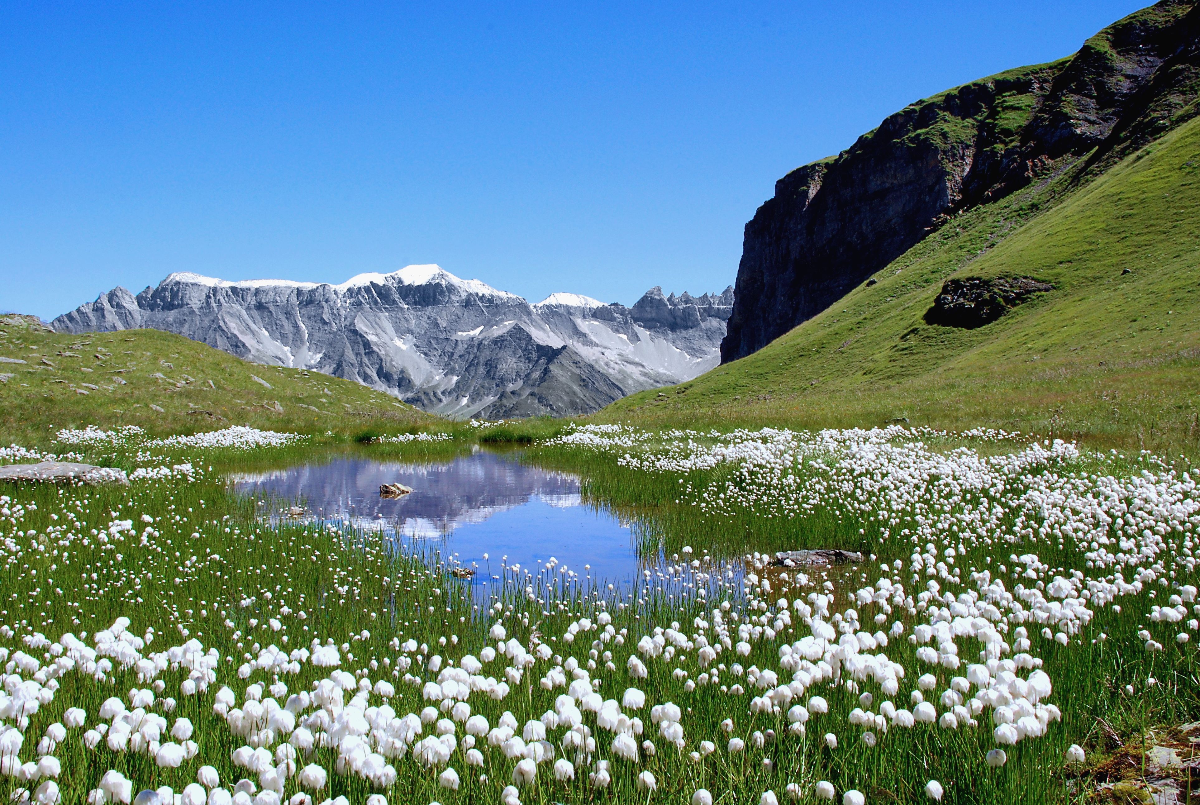
Deutsch: Der von Wollgras gesäumte Ablauf des Chüebodensees oberhalb von Elm, Kanton Glarus. Blick auf den Piz Sardona (3056m) und rechts davon auf die Tschingelhoren (2849 m).
English: The outflow of the Chüebodensee close to Elm, Kanton Glarus. The niveous mountain is the Piz Sardona (3056m) and the peaks on the right, just before the rock spur blocks the sight are the Tschingelhoren (2849 m). |
| Date | |
| Source | Own work |
| Author | Matthias Zepper |
| Permission (Reusing this file) |
I, the copyright holder of this work, hereby publish it under the following license: This file is licensed under the Creative Commons Attribution-Share Alike 3.0 Unported license.
|
| Camera location | | View this and other nearby images on: OpenStreetMap |
|---|
File history
Click on a date/time to view the file as it appeared at that time.
| Date/Time | Thumbnail | Dimensions | User | Comment | |
|---|---|---|---|---|---|
| current | 10:54, 20 September 2011 | | 3,852 × 2,584 (5.82 MB) | Curnen | Original file was unedited. This version is edited, especially the sharpness was increased. |
| 12:14, 7 October 2007 |  | 2,896 × 1,944 (1.33 MB) | Curnen | {{Information |Description= Am Chüebodensee oberhalb von Elm, Kanton Glarus. Blick auf den Piz Segnes (3099m)und rechts davon auf die Tschingelhoren (2849 m).<br />At the Chüebodensee close to Elm, Kanton Glarus. The niveous mountain is the Piz Segnes ( |
File usage
The following pages on the English Wikipedia use this file (pages on other projects are not listed):
Global file usage
The following other wikis use this file:
- Usage on de.wikipedia.org
- Usage on es.wikipedia.org
- Usage on hr.wikipedia.org
- Usage on hy.wikipedia.org
- Usage on nn.wikipedia.org
- Usage on pl.wikipedia.org
- Usage on sh.wikipedia.org
- Usage on vi.wikipedia.org
- Usage on zh.wikipedia.org