
File:Aluemeri-Territorialhavet.sijainti-läge.svg

Size of this PNG preview of this SVG file: 375 × 600 pixels. Other resolutions: 150 × 240 pixels | 300 × 480 pixels | 480 × 768 pixels | 640 × 1,024 pixels | 1,280 × 2,048 pixels | 7,000 × 11,200 pixels.
Original file (SVG file, nominally 7,000 × 11,200 pixels, file size: 315 KB)
| This is a file from the Wikimedia Commons. Information from its description page there is shown below. Commons is a freely licensed media file repository. You can help. |
| Description |
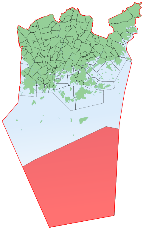
English: Aluemeri, the Helsinki sub-district that consists of the territorial sea. Suomi: Aluemeri, Helsingin osa-alue, joka koostuu pelkästä aluemerestä. |
| Date | |
| Source | |
| Author |
|
| This is a retouched picture, which means that it has been digitally altered from its original version. The original can be viewed here: Helsinki districts.svg:
|
I, the copyright holder of this work, hereby publish it under the following license:
This file is licensed under the Creative Commons Attribution 3.0 Unported license.
- You are free:
- to share – to copy, distribute and transmit the work
- to remix – to adapt the work
- Under the following conditions:
- attribution – You must give appropriate credit, provide a link to the license, and indicate if changes were made. You may do so in any reasonable manner, but not in any way that suggests the licensor endorses you or your use.
Original upload log
This image is a derivative work of the following images:
- File:Helsinki_districts.svg licensed with Cc-by-3.0
- 2010-07-12T14:08:13Z Stadscykel 6145x5068 (275278 Bytes) Talinranta-Talistranden
- 2010-07-12T14:06:47Z Stadscykel 6145x5068 (275242 Bytes) Talinranta-Talistranden
- 2010-07-12T13:44:01Z Stadscykel 6145x5068 (275219 Bytes) Niemenmäki-Näshöjden
- 2010-07-12T13:39:53Z Stadscykel 6145x5068 (274958 Bytes) Niemenmäki-Näshöjden
- 2010-07-11T06:13:17Z Stadscykel 6145x5068 (274113 Bytes) Ala-Malmi-Nedre Malm, Ylä-Malmi-Övre Malm
- 2010-07-10T10:53:17Z Stadscykel 6145x5068 (273514 Bytes) Landbo, Puroniitty-Bäckängen, Östersundom, Karhusaari-Björnsö, Talosaari-Husö
- 2010-07-10T10:44:28Z Stadscykel 6145x5070 (255504 Bytes) Reverted to version as of 13:19, 18 September 2009
- 2010-07-10T10:31:45Z Stadscykel 6145x5070 (260203 Bytes) Landbo, Puroniitty-Bäckängen, Östersundom, Karhusaari-Björnsö, Talosaari-Husö
- 2009-09-18T13:19:10Z Ningyou 6145x5070 (255504 Bytes) {{Information |Description={{en|1=SVG-map of all Helsinki districts, should be used as a basis for any other maps. Recommended color for coloring districts is "ff00008e" which is slightly transparent.}} {{fi|1=SVG-kartta kai
Uploaded with derivativeFX
File history
Click on a date/time to view the file as it appeared at that time.
| Date/Time | Thumbnail | Dimensions | User | Comment | |
|---|---|---|---|---|---|
| current | 07:41, 29 July 2010 | | 7,000 × 11,200 (315 KB) | Jmk | {{Information |Description={{en|1=Aluemeri, the Helsinki sub-district that consists of the territorial sea.}} {{fi|1=Aluemeri, Helsingin osa-alue, joka koostuu pelkästä aluemerestä.}} |Source=*File:Helsinki_districts.svg |Date=2010-07-29 07:38 (U |
File usage
The following pages on the English Wikipedia use this file (pages on other projects are not listed):
Global file usage
The following other wikis use this file:
- Usage on fa.wikipedia.org
- Usage on fi.wikipedia.org
- Usage on fr.wikipedia.org
- Usage on ko.wikipedia.org
- Usage on sv.wikipedia.org
- Usage on www.wikidata.org