
File:Alsea Bay Bridge at Low Tide.jpg
Original file (5,969 × 3,976 pixels, file size: 14.89 MB, MIME type: image/jpeg)
| This is a file from the Wikimedia Commons. Information from its description page there is shown below. Commons is a freely licensed media file repository. You can help. |
Summary
| Description |
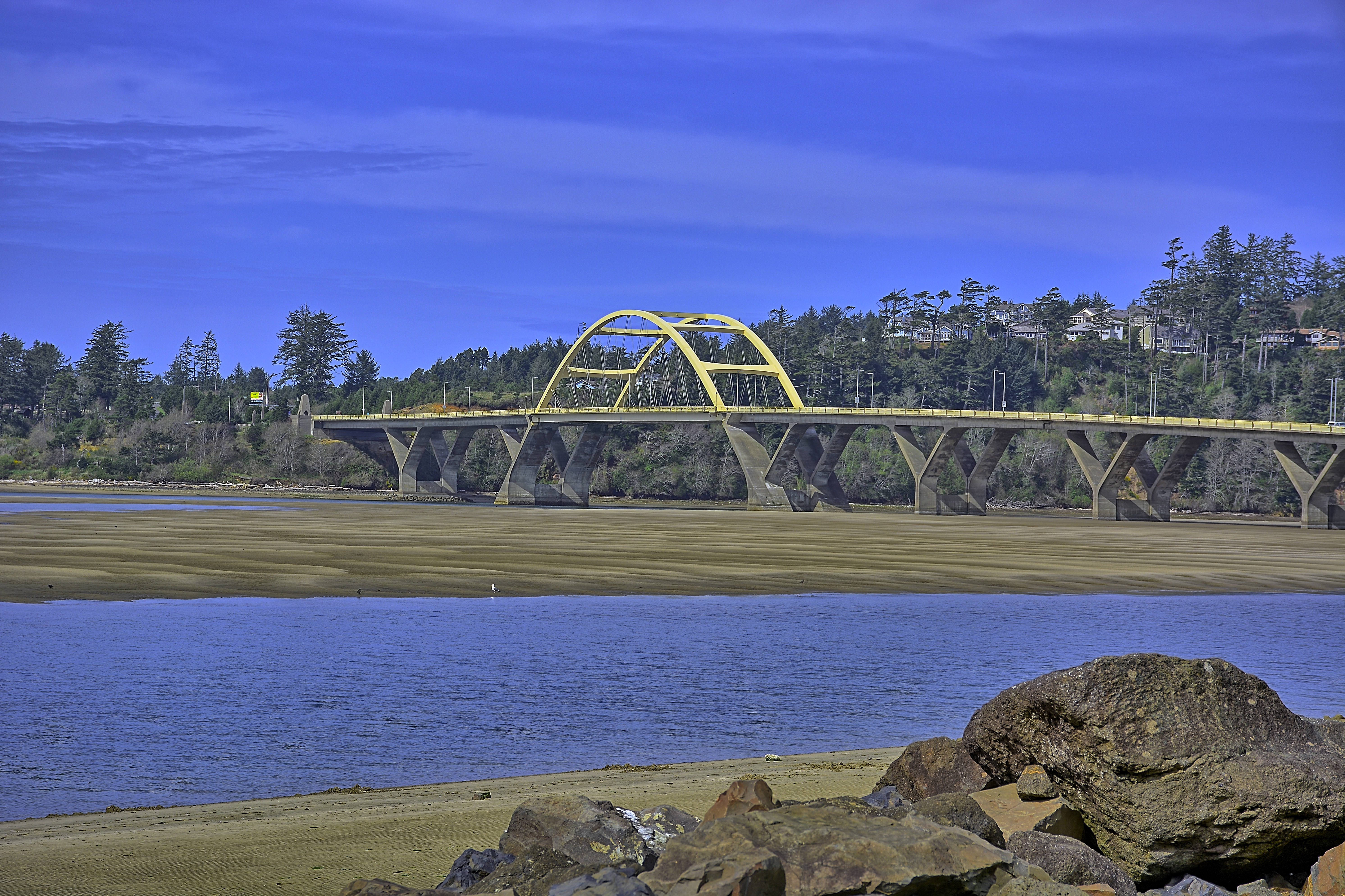
The Alsea Bay Bridge is a concrete arch bridge that spans the Alsea Bay on U.S. Route 101 near Waldport, Oregon. The first bridge over the Alsea Bay was designed by Conde McCullough and opened in 1936. It was a 3,011 feet long. The hostile environment caused significant corrosion to the steel reinforcements. In 1972 the Oregon Department of Transportation began projects aimed at extending the life of the bridge. By the mid-1980's it was decided to replace the bridge rather than continuing costly rehabilitation efforts. The first bridge was demolished in 1991. Construction of the second bridge, began in 1988, and it was opened in the fall of 1991 at a cost of $42.4 million. The bridge is 2,910 ft in total length, with a 450 ft main span that provides 70 ft of vertical clearance. The bridge has a latex concrete deck and the piers are significantly thicker than normal in an attempt to thwart corrosion. Its life expectancy is 75 to 100 years. Description from Wikipedia. |
| Date | |
| Source | Alsea Bay Bridge at Low Tide |
| Author | Kirt Edblom from Corvallis, Oregon, United States |
| Camera location | | View this and other nearby images on: OpenStreetMap |
|---|
Licensing
- You are free:
- to share – to copy, distribute and transmit the work
- to remix – to adapt the work
- Under the following conditions:
- attribution – You must give appropriate credit, provide a link to the license, and indicate if changes were made. You may do so in any reasonable manner, but not in any way that suggests the licensor endorses you or your use.
- share alike – If you remix, transform, or build upon the material, you must distribute your contributions under the same or compatible license as the original.
| This image was originally posted to Flickr by Kirt Edblom at https://flickr.com/photos/27190564@N02/16868658029. It was reviewed on 23 January 2016 by FlickreviewR and was confirmed to be licensed under the terms of the cc-by-sa-2.0. |
File history
Click on a date/time to view the file as it appeared at that time.
| Date/Time | Thumbnail | Dimensions | User | Comment | |
|---|---|---|---|---|---|
| current | 03:47, 22 January 2016 | | 5,969 × 3,976 (14.89 MB) | Kingofthedead | Transferred from Flickr via Flickr2Commons |
File usage
Global file usage
The following other wikis use this file:
- Usage on fr.wikipedia.org