
File:Alpine, California western town limit sign (2010).jpg

Size of this preview: 800 × 600 pixels. Other resolutions: 320 × 240 pixels | 640 × 480 pixels | 1,024 × 768 pixels | 1,280 × 960 pixels | 2,560 × 1,920 pixels | 3,648 × 2,736 pixels.
Original file (3,648 × 2,736 pixels, file size: 4.92 MB, MIME type: image/jpeg)
| This is a file from the Wikimedia Commons. Information from its description page there is shown below. Commons is a freely licensed media file repository. You can help. |
.jpg)
Summary
| Description |
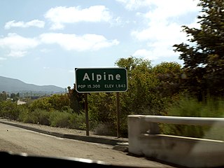
English: Western town limit sign for the census-designated place of Alpine, California as seen from the eastbound lane of Interstate 8 at the Dunbar Lane/Viewside Lane overpass. View looking southeast. This photograph was taken with an Olympus E-510 DSLR camera and edited (color balance, brightness, contrast, saturation, sharpness) using ArcSoft PhotoStudio 5.5 |
| Date | |
| Source | Own work |
| Author | Amin Eshaiker |
| Permission (Reusing this file) |
If you use this photograph outside Wikimedia, I would highly appreciate if you let me know by email or on my talk page, as I'm curious where my work is used. |
| Camera location | | View this and other nearby images on: OpenStreetMap |
|---|
.jpg¶ms=032.856765_N_-116.819378_E_globe:Earth_type:camera_region:US-CA_scale:50_heading:135.00&language=en)
| This is a retouched picture, which means that it has been digitally altered from its original version. Modifications: color balance, brightness, contrast, saturation, sharpness. Modifications made by Amineshaker.
|
Licensing
I, the copyright holder of this work, hereby publish it under the following licenses:
This file is licensed under the Creative Commons Attribution-Share Alike 3.0 Unported license.
- You are free:
- to share – to copy, distribute and transmit the work
- to remix – to adapt the work
- Under the following conditions:
- attribution – You must give appropriate credit, provide a link to the license, and indicate if changes were made. You may do so in any reasonable manner, but not in any way that suggests the licensor endorses you or your use.
- share alike – If you remix, transform, or build upon the material, you must distribute your contributions under the same or compatible license as the original.

|
Permission is granted to copy, distribute and/or modify this document under the terms of the GNU Free Documentation License, Version 1.2 or any later version published by the Free Software Foundation; with no Invariant Sections, no Front-Cover Texts, and no Back-Cover Texts. A copy of the license is included in the section entitled GNU Free Documentation License. |
You may select the license of your choice.
File history
Click on a date/time to view the file as it appeared at that time.
| Date/Time | Thumbnail | Dimensions | User | Comment | |
|---|---|---|---|---|---|
| current | 22:58, 7 January 2012 | | 3,648 × 2,736 (4.92 MB) | Amineshaker | {{Information |Description ={{en|1=Western town limit sign for the census-designated place of Alpine, California as seen from the eastbound lane of Interstate 8 at the Dunbar Lane/Viewside L |
File usage
The following pages on the English Wikipedia use this file (pages on other projects are not listed):
Global file usage
The following other wikis use this file:
- Usage on azb.wikipedia.org
- Usage on ceb.wikipedia.org
- Usage on ce.wikipedia.org
- Usage on es.wikipedia.org
- Usage on eu.wikipedia.org
- Usage on fa.wikipedia.org
- Usage on fr.wikipedia.org
- Usage on it.wikipedia.org
- Usage on lld.wikipedia.org
- Usage on nl.wikipedia.org
- Usage on nv.wikipedia.org
- Usage on pl.wikipedia.org
- Usage on pt.wikipedia.org
- Usage on sh.wikipedia.org
- Usage on sr.wikipedia.org
- Usage on tt.wikipedia.org
- Usage on uk.wikipedia.org
- Usage on vo.wikipedia.org
- Usage on www.wikidata.org
- Usage on zh-min-nan.wikipedia.org
- Usage on zh.wikipedia.org
.jpg)