
File:Ali mcp.png
No higher resolution available.
Ali_mcp.png (499 × 357 pixels, file size: 31 KB, MIME type: image/png)
| This is a file from the Wikimedia Commons. Information from its description page there is shown below. Commons is a freely licensed media file repository. You can help. |
Summary
| Description |
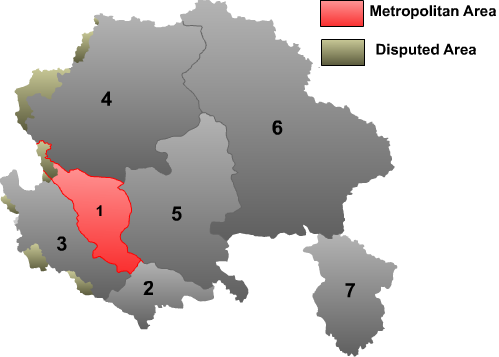
English: Map of Ngari prefecture in Tibet Autonomous Region. |
| Source | Own work |
| Author | Maggern87 |
Licensing
| This file is made available under the Creative Commons CC0 1.0 Universal Public Domain Dedication. | |
| The person who associated a work with this deed has dedicated the work to the public domain by waiving all of their rights to the work worldwide under copyright law, including all related and neighboring rights, to the extent allowed by law. You can copy, modify, distribute and perform the work, even for commercial purposes, all without asking permission.
|
File history
Click on a date/time to view the file as it appeared at that time.
| Date/Time | Thumbnail | Dimensions | User | Comment | |
|---|---|---|---|---|---|
| current | 16:09, 10 September 2010 | | 499 × 357 (31 KB) | Maggern87 | changed color |
| 03:14, 11 April 2010 |  | 682 × 488 (33 KB) | Maggern87 | Changed color, font size, more disputed areas added | |
| 17:23, 18 February 2010 |  | 769 × 624 (41 KB) | Maggern87 | Added disputed area | |
| 05:23, 1 February 2010 |  | 489 × 447 (26 KB) | Maggern87 | {{Information |Description={{en|1=Map of Ngari prefecture in Tibet Autonomous Region.}} |Source={{own}} |Author=Maggern87 |Date= |Permission= |other_versions= }} |
File usage
No pages on the English Wikipedia use this file (pages on other projects are not listed).
Global file usage
The following other wikis use this file:
- Usage on bn.wikipedia.org
- Usage on da.wikipedia.org
- Usage on fa.wikipedia.org
- Usage on fi.wikipedia.org
- Usage on hi.wikipedia.org
- Usage on it.wikipedia.org
- Usage on lt.wikipedia.org
- Usage on nl.wikipedia.org
- Usage on no.wikipedia.org
- Usage on pnb.wikipedia.org
- Usage on pt.wikipedia.org
- Usage on ru.wikipedia.org
- Usage on sv.wikipedia.org
- Usage on tr.wikipedia.org
- Usage on vi.wikipedia.org