
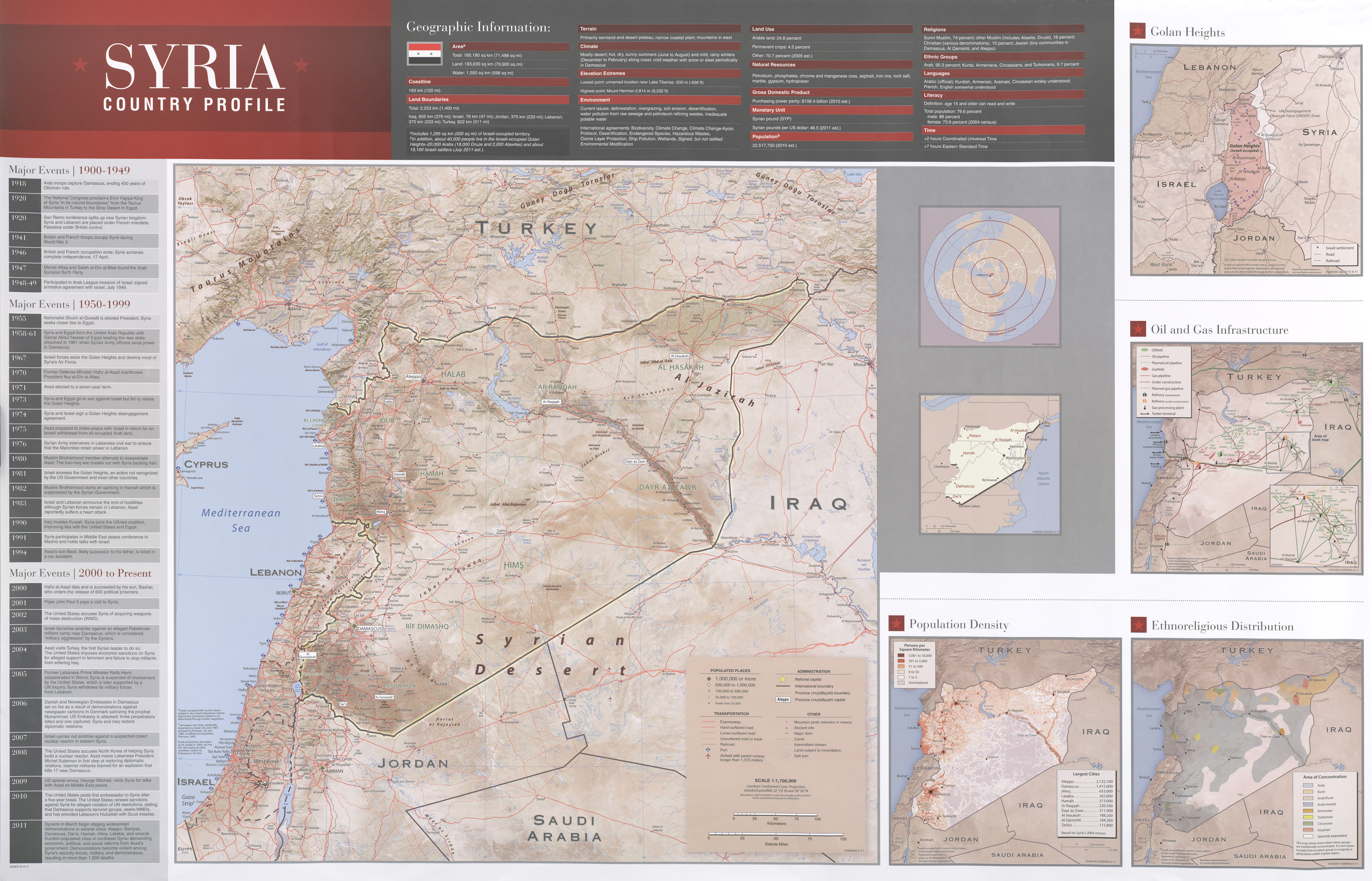
File:Aleppo governorate map.png

Size of this preview: 699 × 600 pixels. Other resolutions: 280 × 240 pixels | 559 × 480 pixels | 939 × 806 pixels.
Original file (939 × 806 pixels, file size: 1.7 MB, MIME type: image/png)
| This is a file from the Wikimedia Commons. Information from its description page there is shown below. Commons is a freely licensed media file repository. You can help. |
Summary
| Description |
English: Aleppo governorate map |
| Source | http://legacy.lib.utexas.edu/maps/middle_east_and_asia/txu-pclmaps-oclc-746758449-syria_country_profile-2011.jpg |
| Author | CIA |
Licensing
| This image is a work of a Central Intelligence Agency employee, taken or made as part of that person's official duties. As a Work of the United States Government, this image or media is in the public domain in the United States.
|

|
File history
Click on a date/time to view the file as it appeared at that time.
| Date/Time | Thumbnail | Dimensions | User | Comment | |
|---|---|---|---|---|---|
| current | 13:58, 26 March 2020 | | 939 × 806 (1.7 MB) | WisDom-UK | Uploading a public-domain item using File Upload Wizard |
File usage
No pages on the English Wikipedia use this file (pages on other projects are not listed).
Global file usage
The following other wikis use this file:
- Usage on ru.wikipedia.org