
File:Akashi-Strait 1.png

Size of this preview: 796 × 600 pixels. Other resolutions: 319 × 240 pixels | 637 × 480 pixels | 1,019 × 768 pixels | 1,194 × 900 pixels.
Original file (1,194 × 900 pixels, file size: 690 KB, MIME type: image/png)
| This is a file from the Wikimedia Commons. Information from its description page there is shown below. Commons is a freely licensed media file repository. You can help. |
Summary
| Description |
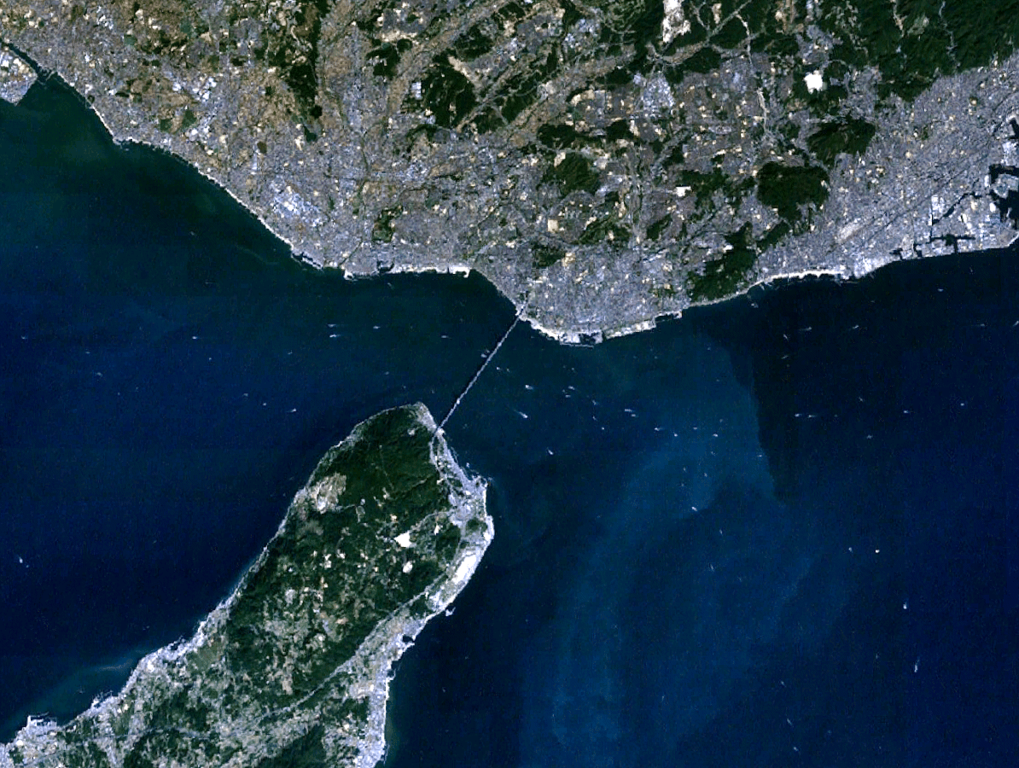
English: the view of Akashi Strait in Japan, from Landsat, generated on NASA World Wind.
日本語: 衛星ランドサットからの明石海峡。NASA World Windで作成。 |
| Date | |
| Source | NASA World Wind (http://worldwind.arc.nasa.gov/java/ ) |
| Author | Pinqui |
Licensing
| This image is in the public domain because it is a screenshot from NASA’s globe software World Wind using a public domain layer, such as Blue Marble, MODIS, Landsat, SRTM, USGS or GLOBE.
|
 |
File history
Click on a date/time to view the file as it appeared at that time.
| Date/Time | Thumbnail | Dimensions | User | Comment | |
|---|---|---|---|---|---|
| current | 08:36, 1 December 2010 | | 1,194 × 900 (690 KB) | Pinqui | {{Information |Description={{en|1=the view of Akashi Strait in Japan, from Landsat, generated on NASA World Wind.}} {{ja|1=衛星ランドサットからの明石海峡。NASA World Windで作成。}} |Source=NASA World Wind (http://worldwind.arc.nasa.gov |
File usage
The following pages on the English Wikipedia use this file (pages on other projects are not listed):
Global file usage
The following other wikis use this file:
- Usage on cs.wikipedia.org
- Usage on es.wikipedia.org
- Usage on fr.wikipedia.org
- Usage on he.wikipedia.org
- Usage on id.wikipedia.org
- Usage on ja.wikipedia.org
- Usage on ko.wikipedia.org
- Usage on pt.wikipedia.org
- Usage on th.wikipedia.org