
File:Afghanistan insurgency 1985.jpg
Size of this preview: 767 × 599 pixels. Other resolutions: 307 × 240 pixels | 614 × 480 pixels | 983 × 768 pixels | 1,280 × 1,000 pixels | 2,401 × 1,876 pixels.
Original file (2,401 × 1,876 pixels, file size: 4.18 MB, MIME type: image/jpeg)
| This is a file from the Wikimedia Commons. Information from its description page there is shown below. Commons is a freely licensed media file repository. You can help. |

|
This file has been superseded by Afghanistan insurgency 1985.png. It is recommended to use the other file. Please note that deleting superseded images requires consent. Reason to use the other file: "A PNG version of this file is now available."
|

|
Summary
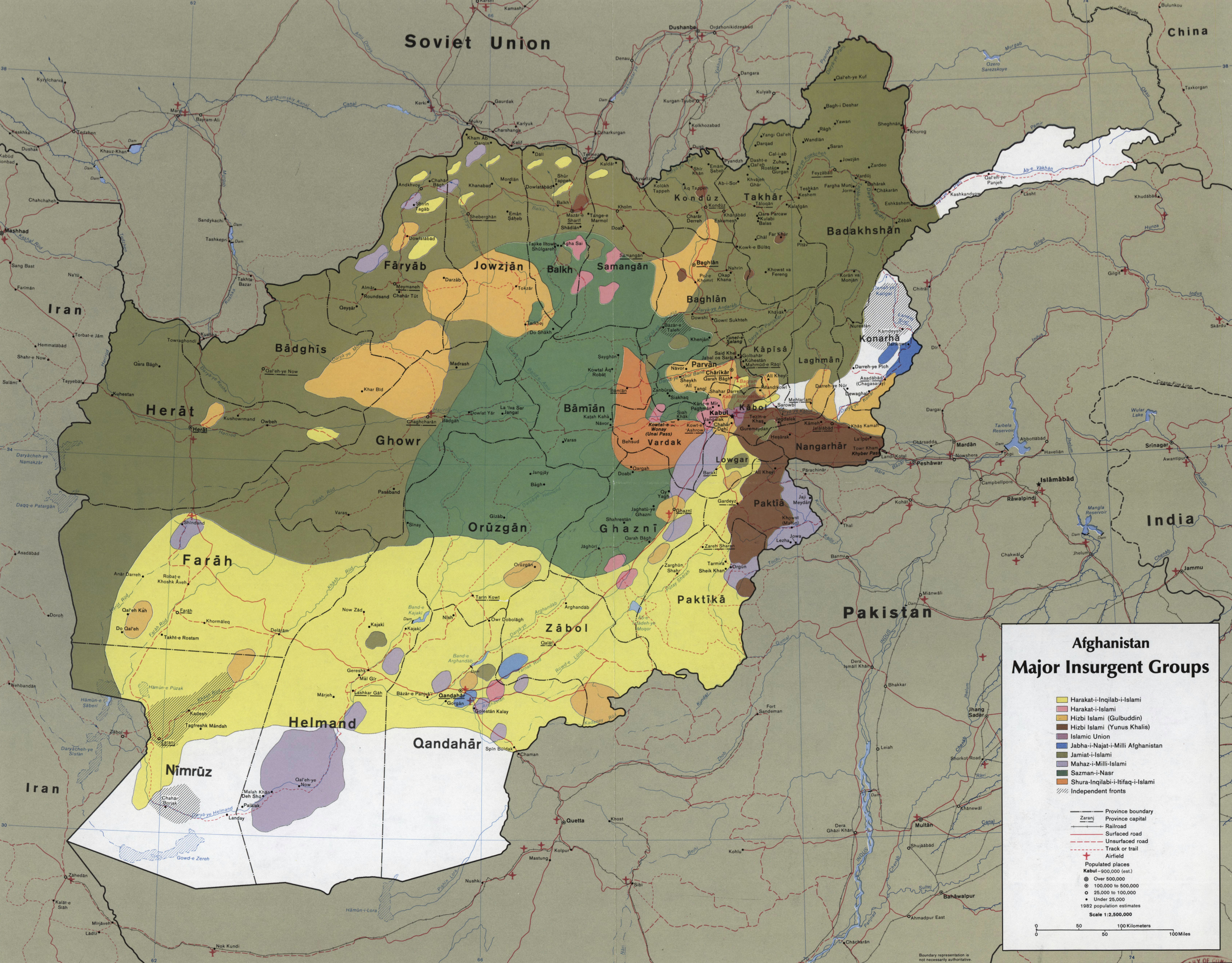
| Description | CIA map showing the areas where the main Mujahideen factions operated in 1985, during the Soviet war in Afghanistan. Scale 1:2,500,000 (E 600--E 750/N 380--N 290). | ||
| Date | |||
| Source |
|
||
| Author | Central Intelligence Agency | ||
| Permission (Reusing this file) |
US Federal publication, in public domain. |

Licensing
| This image is a work of a Central Intelligence Agency employee, taken or made as part of that person's official duties. As a Work of the United States Government, this image or media is in the public domain in the United States.
|

|
File history
Click on a date/time to view the file as it appeared at that time.
| Date/Time | Thumbnail | Dimensions | User | Comment | |
|---|---|---|---|---|---|
| current | 03:57, 22 March 2010 | | 2,401 × 1,876 (4.18 MB) | Ras67 | losslessly cropped with Jpegcrop |
| 15:33, 1 October 2007 |  | 2,459 × 2,000 (4.59 MB) | Raoulduke47 | *Description: CIA map showing the areas where the main Mujahideen factions operated in 1985, during the Soviet war in Afghanistan. *Source: [http://memory.loc.gov/cgi-bin/query/D?gmd:1:./temp/~ammem_23Qj::] (Library of Congress Map Collections) *Date: S |
File usage
The following pages on the English Wikipedia use this file (pages on other projects are not listed):
Global file usage
The following other wikis use this file:
- Usage on bn.wikipedia.org
- Usage on es.wikipedia.org
- Usage on et.wikipedia.org
- Usage on fa.wikipedia.org
- Usage on id.wikipedia.org
- Usage on kk.wikipedia.org
- Usage on ms.wikipedia.org
- Usage on vi.wikipedia.org