
File:Aerial view of flooding in a Minot, N.D., residential area.jpg
Size of this preview: 800 × 571 pixels. Other resolutions: 320 × 229 pixels | 640 × 457 pixels | 1,024 × 731 pixels | 1,400 × 1,000 pixels.
Original file (1,400 × 1,000 pixels, file size: 725 KB, MIME type: image/jpeg)
| This is a file from the Wikimedia Commons. Information from its description page there is shown below. Commons is a freely licensed media file repository. You can help. |
Summary
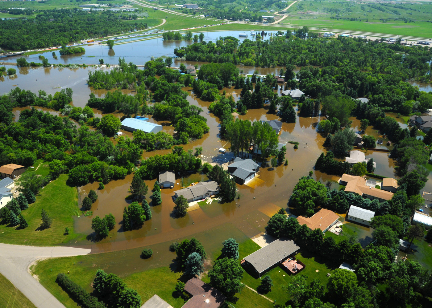
| Description | MINOT, N.D. -- Water engulfs a neighborhood in Minot, N.D., June 23, 2011. As many as 10,000 residents, about one-fourth of the city's population, have evacuated as the fast-rising Souris River inundates thousands of homes and businesses. The deluge from the Souris River is expected to exceed that of the city's historical 1969 flood, making this the region's worst flooding in four decades. (U.S. Air Force photo by Staff Sgt. Sharida Jackson) (RELEASED) |
| Date | |
| Source | Aerial view of flooding in a Minot, N.D., residential area |
| Author | Staff Sgt. Sharida Jackson of The National Guard |
Licensing
This file is licensed under the Creative Commons Attribution 2.0 Generic license.
- You are free:
- to share – to copy, distribute and transmit the work
- to remix – to adapt the work
- Under the following conditions:
- attribution – You must give appropriate credit, provide a link to the license, and indicate if changes were made. You may do so in any reasonable manner, but not in any way that suggests the licensor endorses you or your use.
| This image, originally posted to Flickr, was reviewed on June 24, 2011 by the administrator or reviewer File Upload Bot (Magnus Manske), who confirmed that it was available on Flickr under the stated license on that date. |
File history
Click on a date/time to view the file as it appeared at that time.
| Date/Time | Thumbnail | Dimensions | User | Comment | |
|---|---|---|---|---|---|
| current | 20:58, 24 June 2011 | | 1,400 × 1,000 (725 KB) | File Upload Bot (Magnus Manske) | {{Information |Description=MINOT, N.D. -- Water engulfs a neighborhood in Minot, N.D., June 23, 2011. As many as 10,000 residents, about one-fourth of the city's population, have evacuated as the fast-rising Souris River inundates thousands of homes and b |
File usage
The following pages on the English Wikipedia use this file (pages on other projects are not listed):