
File:Aerial view of Seattle Center.jpg

Size of this preview: 800 × 573 pixels. Other resolutions: 320 × 229 pixels | 640 × 458 pixels | 1,024 × 733 pixels | 1,280 × 917 pixels | 2,560 × 1,833 pixels | 3,012 × 2,157 pixels.
Original file (3,012 × 2,157 pixels, file size: 5.18 MB, MIME type: image/jpeg)
| This is a file from the Wikimedia Commons. Information from its description page there is shown below. Commons is a freely licensed media file repository. You can help. |
Summary
| Description |
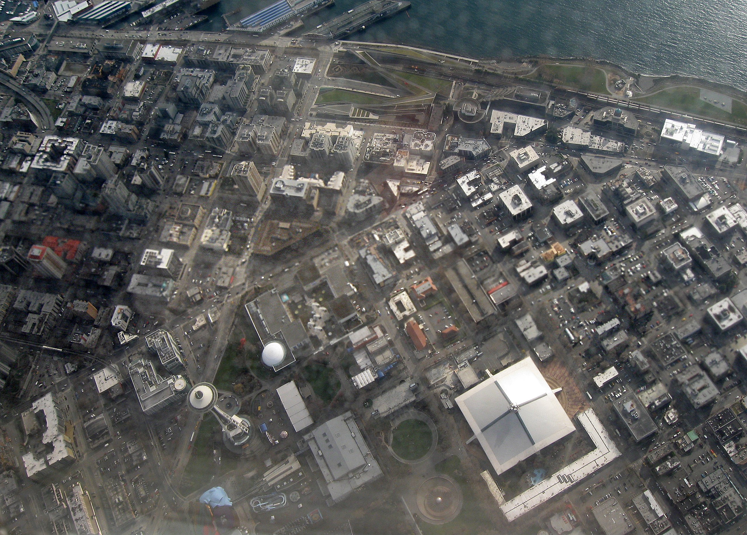
English: Aerial view of Seattle Center. Space Needle is in bottom left-of-center, Seattle Center on bottom right-of-center, Myrtle Edwards Park on top right, Elliot Bay on top. |
| Date | |
| Source | Own work |
| Author | Dcoetzee |
| Camera location | | View this and other nearby images on: OpenStreetMap |
|---|
]
Licensing
| I, the copyright holder of this work, release this work into the public domain. This applies worldwide. In some countries this may not be legally possible; if so: I grant anyone the right to use this work for any purpose, without any conditions, unless such conditions are required by law. |
File history
Click on a date/time to view the file as it appeared at that time.
| Date/Time | Thumbnail | Dimensions | User | Comment | |
|---|---|---|---|---|---|
| current | 08:39, 3 June 2009 | | 3,012 × 2,157 (5.18 MB) | Dcoetzee | {{Information |Description={{en|1=Aerial view of Seattle Center. Space Needle is in bottom left-of-center, Seattle Center on bottom right-of-center, Myrtle Edwards Park on top right, Elliot Bay on top.}} |Source=Own work by uploader |Author=[[User:Dcoetze |
File usage
The following pages on the English Wikipedia use this file (pages on other projects are not listed):