
File:Aceh Sultanate en.svg

Size of this PNG preview of this SVG file: 512 × 539 pixels. Other resolutions: 228 × 240 pixels | 456 × 480 pixels | 730 × 768 pixels | 973 × 1,024 pixels | 1,945 × 2,048 pixels.
Original file (SVG file, nominally 512 × 539 pixels, file size: 259 KB)
| This is a file from the Wikimedia Commons. Information from its description page there is shown below. Commons is a freely licensed media file repository. You can help. |
Summary
| Description |
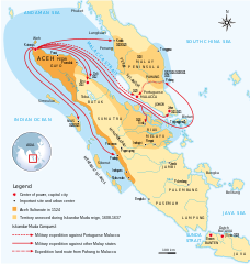
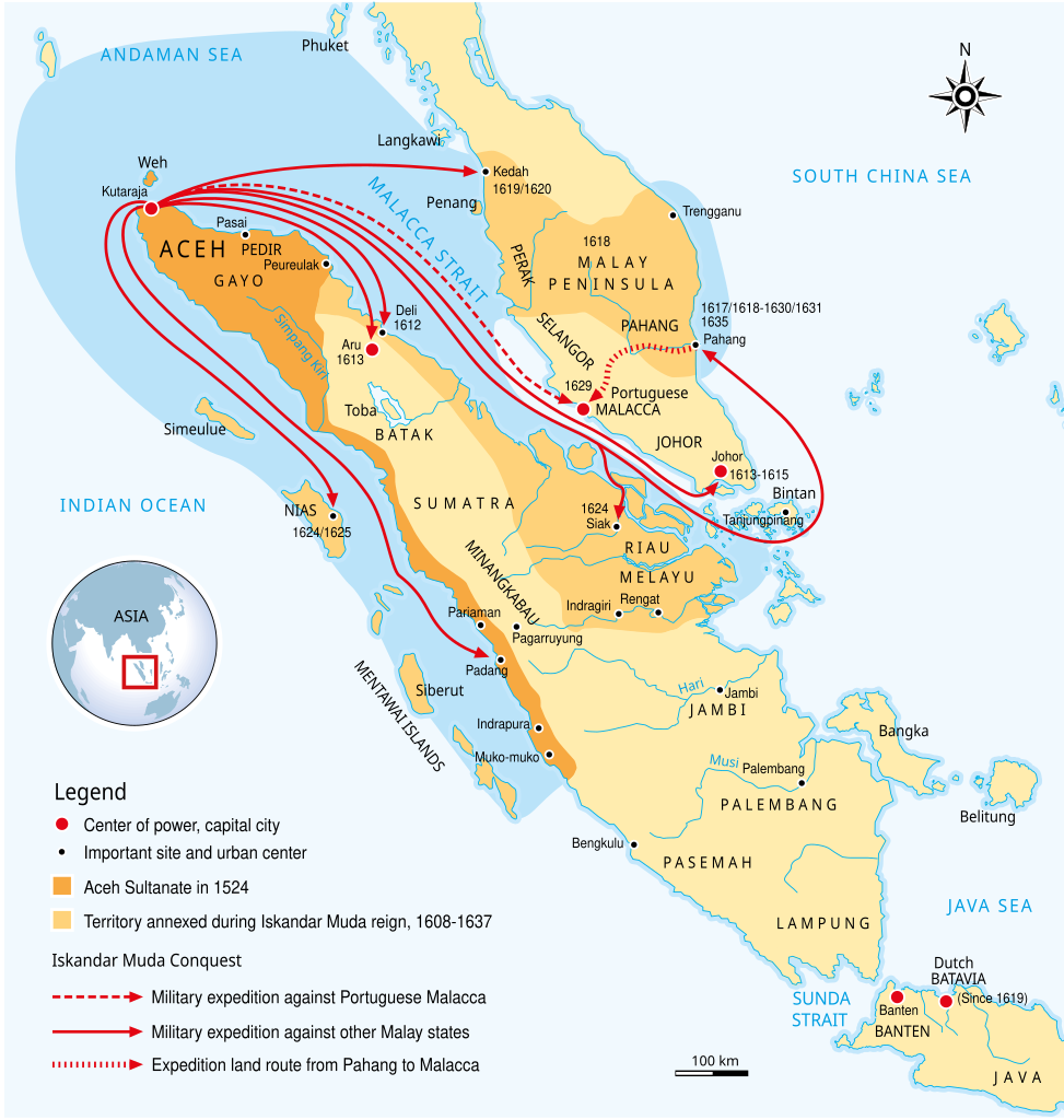
English: The maximum extent of Aceh Sultanate during Iskandar Muda reign, 1608-1637. During this period the series of naval expeditions and military campaigns launched by Iskandar Muda against Portuguese Malacca, Johor Sultanate, and other Malay states in Sumatra and Malay Peninsula, the map completed with the year of campaign conducted. During this period the Sultanate of Aceh rose to become the dominant power in the region. |
||
| Date | |||
| Source | Own work Various sources | ||
| Author | Gunawan Kartapranata | ||
| Permission (Reusing this file) |
I, the copyright holder of this work, hereby publish it under the following licenses: This file is licensed under the Creative Commons Attribution-Share Alike 3.0 Unported license.
You may select the license of your choice. |
||
| Other versions |
[]
|


|
This SVG file contains embedded text that can be translated into your language, using any capable SVG editor, text editor or the SVG Translate tool. For more information see: About translating SVG files. |
File history
Click on a date/time to view the file as it appeared at that time.
| Date/Time | Thumbnail | Dimensions | User | Comment | |
|---|---|---|---|---|---|
| current | 12:06, 12 May 2017 | | 512 × 539 (259 KB) | Gunkarta | Correction on Deli and Aru |
| 12:02, 12 May 2017 |  | 536 × 563 (363 KB) | Gunkarta | Reverted to version as of 15:00, 9 July 2014 (UTC) | |
| 11:56, 12 May 2017 |  | 512 × 539 (358 KB) | Gunkarta | Correction on Deli and Aru | |
| 15:00, 9 July 2014 |  | 536 × 563 (363 KB) | Kopiersperre | fix | |
| 18:22, 5 July 2014 |  | 536 × 563 (363 KB) | Kopiersperre | begin <switch> translation | |
| 16:21, 13 October 2011 |  | 536 × 563 (361 KB) | Gunkarta | Add naval sphere of influence | |
| 18:14, 28 December 2009 |  | 539 × 565 (359 KB) | Gunkarta | {{Information |Description={{en|1=The maximum extent of Aceh Sultanate during Iskandar Muda reign, 1608-1637. During this period the series of naval expeditions and military campaigns launched by Iskandar Muda against Portuguese Malacca, Johor Sultanate, |
File usage
The following pages on the English Wikipedia use this file (pages on other projects are not listed):
Global file usage
The following other wikis use this file:
- Usage on ace.wikipedia.org
- Usage on af.wikipedia.org
- Usage on ar.wikipedia.org
- Usage on azb.wikipedia.org
- Usage on bn.wikipedia.org
- Usage on ca.wikipedia.org
- Usage on cs.wikipedia.org
- Usage on de.wikipedia.org
- Usage on de.wikiversity.org
- Usage on fa.wikipedia.org
- Usage on fi.wikipedia.org
- Usage on fr.wikipedia.org
- Usage on he.wikipedia.org
- Usage on hy.wikipedia.org
- Usage on id.wikibooks.org
- Usage on is.wikipedia.org
- Usage on it.wikipedia.org
- Usage on ja.wikipedia.org
- Usage on lt.wikipedia.org
- Usage on ml.wikipedia.org
- Usage on ms.wikipedia.org
- Usage on mt.wikipedia.org
- Usage on nl.wikipedia.org
- Usage on pnb.wikipedia.org
- Usage on pt.wikipedia.org
- Usage on ru.wikipedia.org
- Usage on ta.wikipedia.org
- Usage on th.wikipedia.org
- Usage on tr.wikipedia.org
View more global usage of this file.