
File:Abbey Junction station (site-remains) geograph-3222246-by-Ben-Brooksbank.jpg

Size of this preview: 800 × 460 pixels. Other resolutions: 320 × 184 pixels | 640 × 368 pixels | 1,024 × 588 pixels | 1,280 × 735 pixels | 2,395 × 1,376 pixels.
Original file (2,395 × 1,376 pixels, file size: 2.49 MB, MIME type: image/jpeg)
| This is a file from the Wikimedia Commons. Information from its description page there is shown below. Commons is a freely licensed media file repository. You can help. |
_geograph-3222246-by-Ben-Brooksbank.jpg)
Summary
| Description |
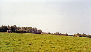
English: Abbey Junction station (site/remains). A regrettably uninspiring view northwestwards from the B5307: ex-NBR & Caledonian Joint junction of the NBR Carlisle (to right) - Silloth (upper left) line with the short-lived Solway Junction Joint line from Brayton (Maryport & Carlisle Rly.)(lower left) over the Solway at Bowness to Annan (Caledonian)(near right). The station closed on 1/9/21 when the Joint line (with its own platform here) was closed over the Solway Viaduct as long ago as 20/5/21, then reopened in 5/22 just from Abbey Junction to Brayton for goods and excursion traffic until eventual closure on 13/2/33. The NBR Silloth line through Abbey Town (nearby to the left) was closed on 7/9/64. |
| Date | |
| Source | From geograph.org.uk |
| Author | Ben Brooksbank |
| Permission (Reusing this file) |
Creative Commons Attribution Share-alike license 2.0 |
| Attribution (required by the license) | Ben Brooksbank / Abbey Junction station (site/remains) / |
| Camera location | | View this and other nearby images on: OpenStreetMap |
|---|
_geograph-3222246-by-Ben-Brooksbank.jpg¶ms=054.850612_N_-003.274458_E_globe:Earth_type:camera_heading:315.00&language=en)
Licensing

|
This image was taken from the Geograph project collection. See this photograph's page on the Geograph website for the photographer's contact details. The copyright on this image is owned by Ben Brooksbank and is licensed for reuse under the Creative Commons Attribution-ShareAlike 2.0 license.
|
This file is licensed under the Creative Commons Attribution-Share Alike 2.0 Generic license.
Attribution: Ben Brooksbank
- You are free:
- to share – to copy, distribute and transmit the work
- to remix – to adapt the work
- Under the following conditions:
- attribution – You must give appropriate credit, provide a link to the license, and indicate if changes were made. You may do so in any reasonable manner, but not in any way that suggests the licensor endorses you or your use.
- share alike – If you remix, transform, or build upon the material, you must distribute your contributions under the same or compatible license as the original.
File history
Click on a date/time to view the file as it appeared at that time.
| Date/Time | Thumbnail | Dimensions | User | Comment | |
|---|---|---|---|---|---|
| current | 21:33, 23 November 2012 | | 2,395 × 1,376 (2.49 MB) | Chevin | == {{int:filedesc}} == {{Information |Description={{en|1='''Abbey Junction station (site/remains).'''<br/> A regrettably uninspiring view northwestwards from the B5307: ex-NBR & Caledonian Joint junction of the NBR Carlisle (to right) - Silloth (upper ... |
File usage
The following pages on the English Wikipedia use this file (pages on other projects are not listed):
Global file usage
The following other wikis use this file:
- Usage on www.wikidata.org
_geograph-3222246-by-Ben-Brooksbank.jpg)