
File:4641Elpidio Quirino Avenue Parañaque City Landmarks 17.jpg

Size of this preview: 800 × 600 pixels. Other resolutions: 320 × 240 pixels | 640 × 480 pixels | 1,024 × 768 pixels | 1,280 × 960 pixels | 2,560 × 1,920 pixels | 4,608 × 3,456 pixels.
Original file (4,608 × 3,456 pixels, file size: 6.81 MB, MIME type: image/jpeg)
| This is a file from the Wikimedia Commons. Information from its description page there is shown below. Commons is a freely licensed media file repository. You can help. |
Summary
| Description |
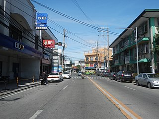
English: Elpidio Quirino Avenue (Tambo, Don Galo, La Huerta and San Dionisio, Parañaque City section) La Huerta National High School (Elpidio Quirino Avenue, Parañaque City) La Huerta, Parañaque, Parañaque; St. Andrew's School Interior of the Diocesan Shrine of Nuestra Señora de Buen Suceso and The Cathedral-Parish of Saint Andrew (Quirino Avenue, La Huerta, Parañaque City) Pedro Dandan Y Masangkay Pamilihang Bayan ng Bagong Parañaque Ospital ng Parañaque City Building 3 Construction Construction of R. C. Box Culverts (Elpidio Quirino Avenue, San Dionisio, Parañaque City) City of Las Piñas-Parañaque City Welcome arch-sign in Barangays San Dionisio and Manuyo Uno, Elpidio Quirino Avenue Manuyo Uno, Las Piñas City Diego Cera Legislative districts of Parañaque 1st District, Districts and barangays, Barangay La Huerta 14°29'50"N 120°59'43"E beside Don Galo 14°30'26"N 120°59'4"E Tambo 14°30'59"N 120°59'20"E San Dionisio 14°29'2"N 120°59'33"E Baclaran, Parañaque City along Elpidio Quirino Avenue Don Galo-La Huerta Bridge, Parañaque City Sta. 9+766-Sta.9+841 Load limit 20 metric tons upon Parañaque River from and to Roxas Boulevard, Radial Road 2 from Baclaran LRT station (Note: Judge Florentino Floro, the owner, to repeat, Donor Florentino Floro of all these photos hereby donate gratuitously, freely and unconditionally Judge Floro all these photos to and for Wikimedia Commons, exclusively, for public use of the public domain, and again without any condition whatsoever). |
| Date | |
| Source | Own work |
| Author | Judgefloro |
| Camera location | | View this and other nearby images on: OpenStreetMap |
|---|
La Huerta 14°29'50"N 120°59'43"E Don Galo 14°30'26"N 120°59'4"E
Licensing
I, the copyright holder of this work, hereby publish it under the following license:
| This file is made available under the Creative Commons CC0 1.0 Universal Public Domain Dedication. | |
| The person who associated a work with this deed has dedicated the work to the public domain by waiving all of their rights to the work worldwide under copyright law, including all related and neighboring rights, to the extent allowed by law. You can copy, modify, distribute and perform the work, even for commercial purposes, all without asking permission.
|
File history
Click on a date/time to view the file as it appeared at that time.
| Date/Time | Thumbnail | Dimensions | User | Comment | |
|---|---|---|---|---|---|
| current | 10:57, 25 September 2017 | | 4,608 × 3,456 (6.81 MB) | Judgefloro | User created page with UploadWizard |
File usage
The following pages on the English Wikipedia use this file (pages on other projects are not listed):
Global file usage
The following other wikis use this file:
- Usage on tl.wikipedia.org