
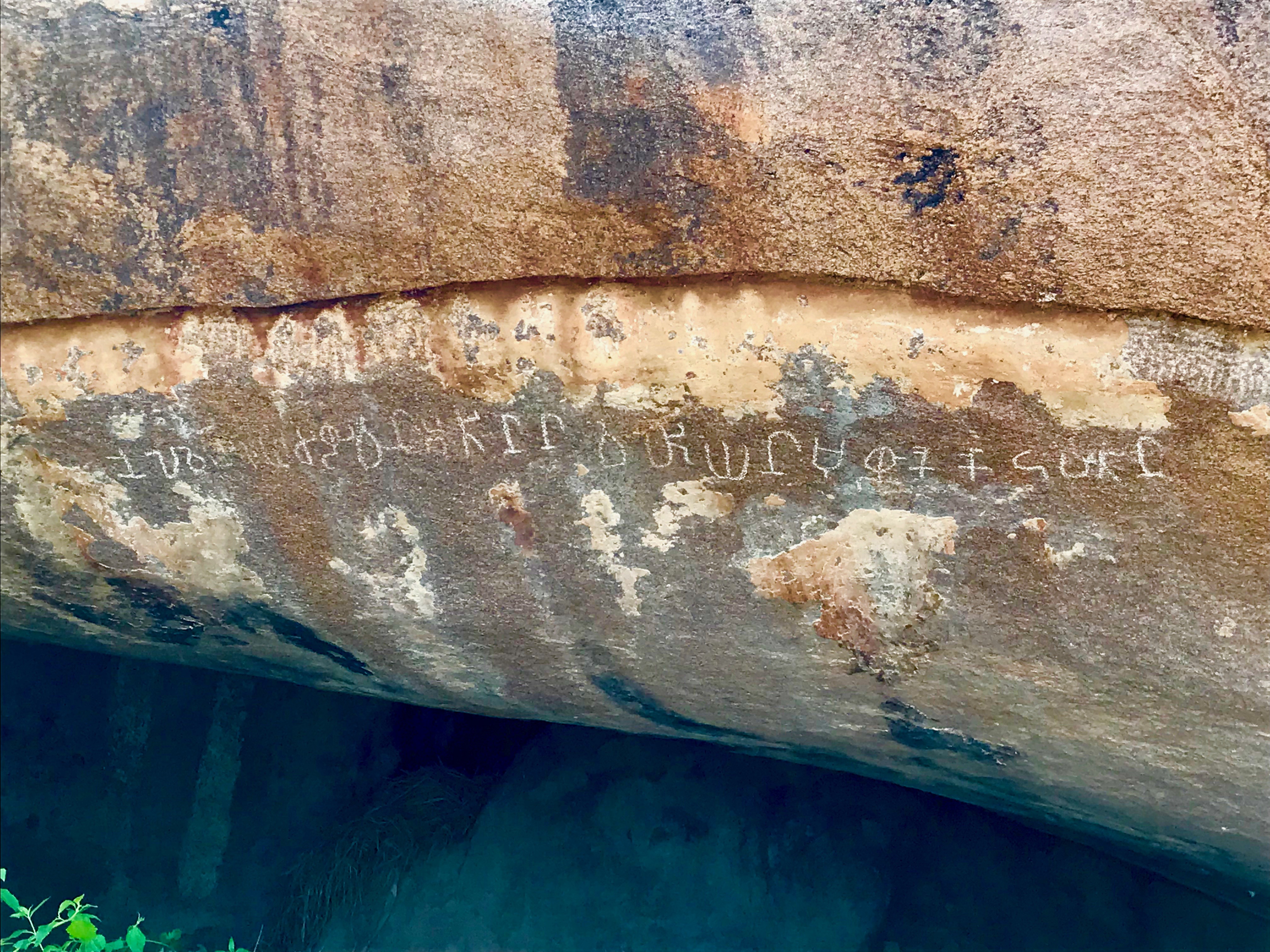
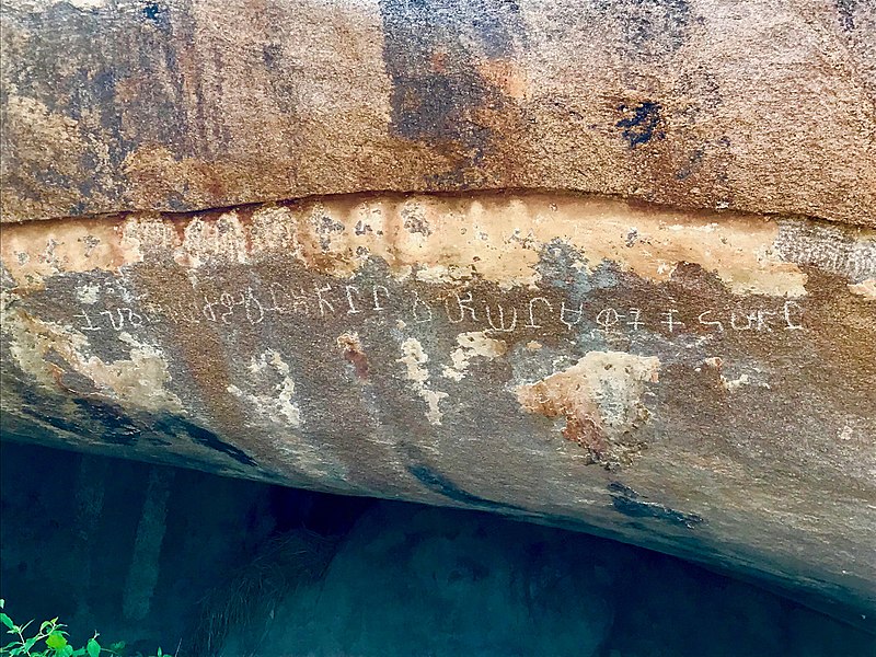
File:2nd century BCE Tamil Brahmi inscription Arittapatti Madurai India.jpg
Original file (4,032 × 3,024 pixels, file size: 2.98 MB, MIME type: image/jpeg)
| This is a file from the Wikimedia Commons. Information from its description page there is shown below. Commons is a freely licensed media file repository. You can help. |
Summary
| Description |
English: Arittapatti is also called Aritapatti or Pancha Pandava Padukkai from the Mahabharata legends.
Arittapatti is a village set near a rocky hill about 25 kilometers northeast of Madurai. It has one of the oldest known Tamil Brahmi inscriptions, as well the oldest known Shaivism-related Lakulisha iconography in Tamil Nadu and Jain monuments. The above Tamil Brahmi inscription is dated to about the 2nd-century BCE. It is located near the Jain tirthankara relief with Vatteluttu script inscription. Since this rounded script emerged and came into use in and after 6th-century, the tirthankara relief was likely carved into the rock about 800 or 900 years later. This, along with the 7th-century rock-cut Shiva temple on the western side of same rocky hills in the same village (but a long walk) attests to the use of this site in ancient Tamil lands for centuries. For further discussion of the Tamil Brahmi inscription, please see K. V. Raman and Y. Subbarayalu (1971), A new Tamil-Brahmi Inscription in Arittapatti, Journal of Indian History, Volume XLIX, pp. 229-232 |
| Date | |
| Source | Own work |
| Author | Ms Sarah Welch |
| Camera location | | View this and other nearby images on: OpenStreetMap |
|---|
Licensing
- You are free:
- to share – to copy, distribute and transmit the work
- to remix – to adapt the work
- Under the following conditions:
- attribution – You must give appropriate credit, provide a link to the license, and indicate if changes were made. You may do so in any reasonable manner, but not in any way that suggests the licensor endorses you or your use.
- share alike – If you remix, transform, or build upon the material, you must distribute your contributions under the same or compatible license as the original.
File history
Click on a date/time to view the file as it appeared at that time.
| Date/Time | Thumbnail | Dimensions | User | Comment | |
|---|---|---|---|---|---|
| current | 02:26, 9 October 2018 | | 4,032 × 3,024 (2.98 MB) | Ms Sarah Welch | User created page with UploadWizard |
File usage
Global file usage
The following other wikis use this file:
- Usage on ar.wikipedia.org
- Usage on bn.wikipedia.org
- Usage on hi.wikipedia.org
- Usage on id.wikipedia.org
- Usage on ml.wikipedia.org
- Usage on www.wikidata.org
- Usage on zh.wikipedia.org