
File:Salt evaporation ponds on San Francisco Bay.jpg
Size of this preview: 800 × 533 pixels. Other resolutions: 320 × 213 pixels | 640 × 427 pixels | 1,024 × 683 pixels | 1,280 × 853 pixels | 2,560 × 1,707 pixels | 3,504 × 2,336 pixels.
Original file (3,504 × 2,336 pixels, file size: 5.4 MB, MIME type: image/jpeg)
| This is a file from the Wikimedia Commons. Information from its description page there is shown below. Commons is a freely licensed media file repository. You can help. |
Summary
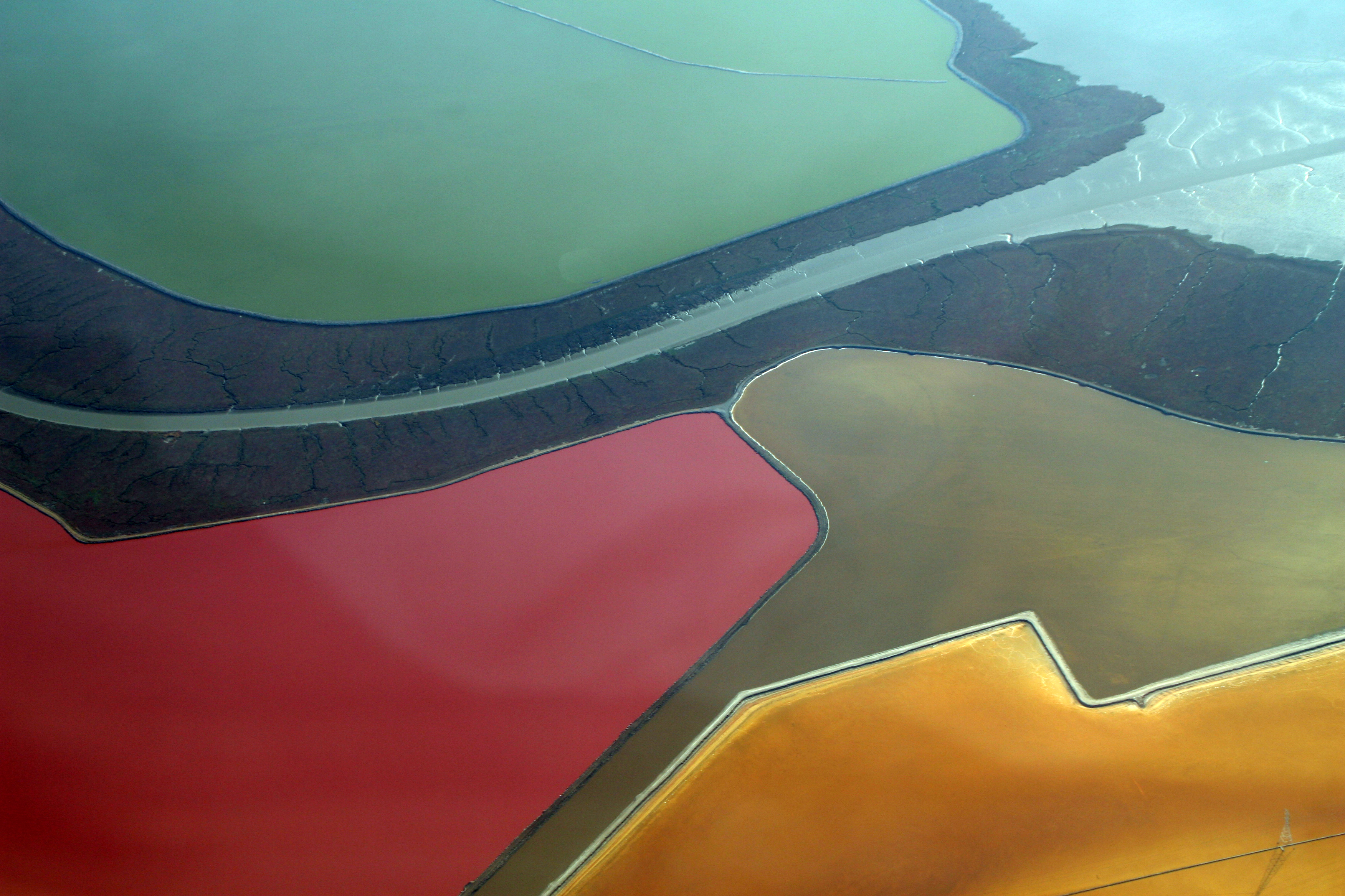
| Description | Salt evaporation ponds formed by salt water impounded within levees in former tidelands on the shores of San Francisco Bay. There are many of these ponds surrounding the South Bay. As the water evaporates, micro-organisms of several kinds come to predominate and change the color of the water. First come green algae, then darkening as orange brine shrimp predominate. Finally red predominates as dunaliella salina, a micro-algae containing high amounts of beta-carotene (itself with high commercial value), predominates. Other organisms can also change the hue of each pond. Colors include red, green, orange and yellow, brown and blue. Finally, when the water is evaporated, the white of salt alone remains. This is harvested with machines, and the process repeats. |
| Date | Taken on 31 October 2009, 18:58 |
| Source | 2009-10_31_BOS-SFO_398 |
| Author | Doc Searls from Santa Barbara, USA |
| Object location | | View this and other nearby images on: OpenStreetMap |
|---|
Licensing
This file is licensed under the Creative Commons Attribution 2.0 Generic license.
- You are free:
- to share – to copy, distribute and transmit the work
- to remix – to adapt the work
- Under the following conditions:
- attribution – You must give appropriate credit, provide a link to the license, and indicate if changes were made. You may do so in any reasonable manner, but not in any way that suggests the licensor endorses you or your use.
| This image was originally posted to Flickr by dsearls at https://flickr.com/photos/52614599@N00/4096329287. It was reviewed on 14 May 2020 by FlickreviewR 2 and was confirmed to be licensed under the terms of the cc-by-2.0. |
File history
Click on a date/time to view the file as it appeared at that time.
| Date/Time | Thumbnail | Dimensions | User | Comment | |
|---|---|---|---|---|---|
| current | 19:15, 14 May 2020 | | 3,504 × 2,336 (5.4 MB) | Evrik | Transferred from Flickr via #flickr2commons |
File usage
The following pages on the English Wikipedia use this file (pages on other projects are not listed):
- San Francisco Bay Salt Ponds
- User:Mercurywoodrose/SFBA galleries
- Wikipedia:Did you know/Statistics/Monthly DYK pageview leaders/2020
- Wikipedia:Did you know/Statistics/Monthly DYK pageview leaders/2020/June
- Wikipedia:Main Page history/2020 June 3
- Wikipedia:Recent additions/2020/June
- Template:Did you know nominations/San Francisco Bay Salt Ponds
- Portal:San Francisco Bay Area
- Portal:San Francisco Bay Area/Did you know/79
- Portal:San Francisco Bay Area/Did you know/Archive
- Portal:San Francisco Bay Area/Did you know/Current
- Portal:San Francisco Bay Area/Selected picture/233
- Portal:San Francisco Bay Area/Selected picture/Archive
Global file usage
The following other wikis use this file:
- Usage on fr.wikipedia.org
- Usage on vi.wikipedia.org
- Usage on www.wikidata.org