
File:1993-flood1.jpg
Size of this preview: 800 × 556 pixels. Other resolutions: 320 × 222 pixels | 640 × 445 pixels | 1,024 × 712 pixels | 1,400 × 973 pixels.
Original file (1,400 × 973 pixels, file size: 430 KB, MIME type: image/jpeg)
| This is a file from the Wikimedia Commons. Information from its description page there is shown below. Commons is a freely licensed media file repository. You can help. |
Summary
| Description |
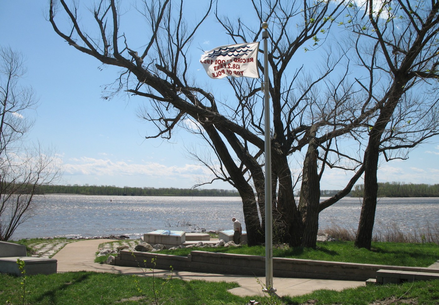
English: Monument to the Great Flood of 1993 at Jones-Confluence Point State Park at the confluence of the Missouri River and Mississippi River in St. Charles County. The flag says the water reached the top of the pole at an elevation of 438.2 feet. Photo by poster in April 2007. The Mississippi is on the left and the Missouri is on the right. |
| Date | Taken on 1 April 2007 (according to Exif data) |
| Source | Transferred from en.wikipedia to Commons by Vux using CommonsHelper. |
| Author | The original uploader was Americasroof at English Wikipedia. |
Licensing
This file is licensed under the Creative Commons Attribution-Share Alike 2.5 Generic license.
- You are free:
- to share – to copy, distribute and transmit the work
- to remix – to adapt the work
- Under the following conditions:
- attribution – You must give appropriate credit, provide a link to the license, and indicate if changes were made. You may do so in any reasonable manner, but not in any way that suggests the licensor endorses you or your use.
- share alike – If you remix, transform, or build upon the material, you must distribute your contributions under the same or compatible license as the original.
Original upload log
The original description page was here. All following user names refer to en.wikipedia.
- 2007-04-18 03:35 Americasroof 1400×973× (439837 bytes) Monument to the [[Great Flood of 1993]] at [[Jones-Confluence Point State Park]] at the confluence of the [[Missouri River]] and [[Mississippi River]] in [[St. Charles County, Missouri]]. The flag says the water reached the top of the pole and was 438.2
- 2007-04-18 03:15 Americasroof 640×853× (300209 bytes) Monument to the [[1993 Flood]] at [[Jones-Confluence Point State Park]] at the confluence of the [[Missouri River]] and [[Mississippi River]] in [[St. Charles County, Missouri]]. The flag says the water reached the top of the pole and was 438.2 feet deep
File history
Click on a date/time to view the file as it appeared at that time.
| Date/Time | Thumbnail | Dimensions | User | Comment | |
|---|---|---|---|---|---|
| current | 16:49, 19 May 2009 | | 1,400 × 973 (430 KB) | File Upload Bot (Magnus Manske) | {{BotMoveToCommons|en.wikipedia|year={{subst:CURRENTYEAR}}|month={{subst:CURRENTMONTHNAME}}|day={{subst:CURRENTDAY}}}} {{Information |Description={{en|Monument to the en:Great Flood of 1993 at en:Jones-Confluence Point State Park at the confl |
File usage
The following pages on the English Wikipedia use this file (pages on other projects are not listed):
Global file usage
The following other wikis use this file:
- Usage on de.wikipedia.org