
File:1983 US tors.png

Size of this preview: 800 × 496 pixels. Other resolutions: 320 × 198 pixels | 640 × 396 pixels | 1,130 × 700 pixels.
Original file (1,130 × 700 pixels, file size: 187 KB, MIME type: image/png)
| This is a file from the Wikimedia Commons. Information from its description page there is shown below. Commons is a freely licensed media file repository. You can help. |
Summary
| Description |
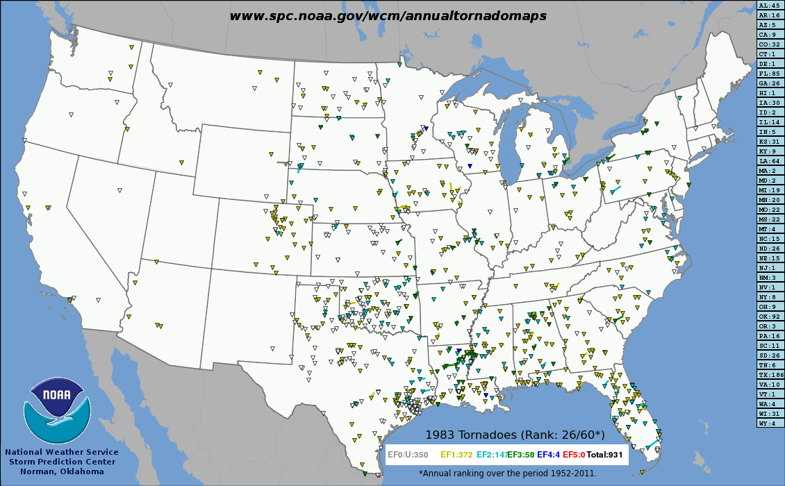
English: This map shows all recorded tornadoes in the United States in 1983 color-coded by rating |
| Date | |
| Source | http://www.spc.noaa.gov/wcm/annualtornadomaps/1983.png |
| Author | Storm Prediction Center |
Licensing
This image is in the public domain because it contains materials that originally came from the U.S. National Oceanic and Atmospheric Administration, taken or made as part of an employee's official duties.
|
File history
Click on a date/time to view the file as it appeared at that time.
| Date/Time | Thumbnail | Dimensions | User | Comment | |
|---|---|---|---|---|---|
| current | 22:25, 24 September 2016 | | 1,130 × 700 (187 KB) | Cmdrjameson | Compressed with pngout. Reduced by 108kB (36% decrease). |
| 22:34, 20 June 2013 |  | 1,130 × 700 (296 KB) | TornadoLGS | User created page with UploadWizard |
File usage
The following pages on the English Wikipedia use this file (pages on other projects are not listed):