
File:1975 map of canal system in Lowell, Massachusetts.png
Size of this preview: 800 × 534 pixels. Other resolutions: 320 × 214 pixels | 640 × 428 pixels | 1,024 × 684 pixels | 1,280 × 855 pixels | 2,560 × 1,710 pixels | 3,371 × 2,252 pixels.
Original file (3,371 × 2,252 pixels, file size: 1.95 MB, MIME type: image/png)
| This is a file from the Wikimedia Commons. Information from its description page there is shown below. Commons is a freely licensed media file repository. You can help. |
Summary
| Description |
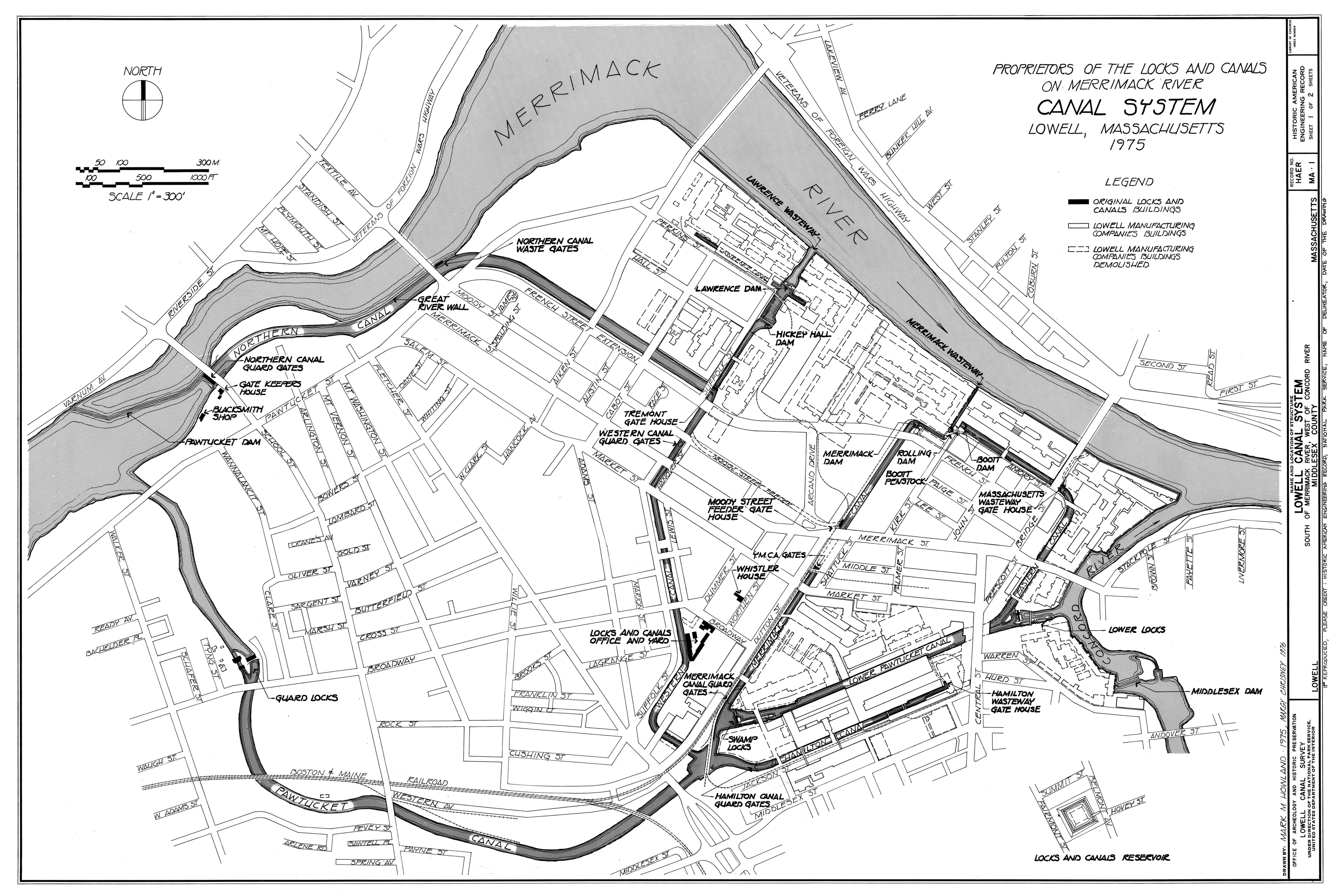
English: Canal system in Lowell, Massachusetts. Map as of 1975. |
|||||||||
| Source |
Lowell Canal System, Merrimack & Concord Rivers, Lowell, Middlesex County, MA, Historic American Engineering Record (Library of Congress), drawing 1. Image cropped to remove white space
|
|||||||||
| Creator |
Mark M. Howland, Margy Chrisney |
|||||||||
| Credit line | Historic American Engineering Record, National Park Service, Mark M. Howland and Margy Chrisney, 1975 | |||||||||
| Permission (Reusing this file) |
|
|||||||||
| Geotemporal data | ||||||||||
| Date depicted | ||||||||||
| Scale | 1:3600 | |||||||||
| Heading |
 |
|||||||||
| Bounding box |
|
|||||||||
| Georeferencing | ||||||||||
| Bibliographic data | ||||||||||
| Map sheet | 1 | |||||||||

File history
Click on a date/time to view the file as it appeared at that time.
| Date/Time | Thumbnail | Dimensions | User | Comment | |
|---|---|---|---|---|---|
| current | 03:12, 30 March 2011 | | 3,371 × 2,252 (1.95 MB) | Mikhail Ryazanov | 25% of the original size (to fit into 12.5 Mpix limit) |
| 03:02, 30 March 2011 |  | 13,485 × 9,006 (2.5 MB) | Mikhail Ryazanov | {{Information |Description ={{en|1=Canal system in Lowell, Massachusetts. Map as of 1975.}} |Source =Lowell Canal System, Merrimack & Concord Rivers, Lowell, Middlesex County, MA, Historic American Engineering Record (Library of Congress), draw |
File usage
The following pages on the English Wikipedia use this file (pages on other projects are not listed):
Global file usage
The following other wikis use this file:
- Usage on de.wikipedia.org
- Usage on eo.wikipedia.org
- Usage on sr.wikipedia.org
- Usage on www.wikidata.org