
File:1941-2018 Kimihia.jpg
Size of this preview: 799 × 286 pixels. Other resolutions: 320 × 115 pixels | 640 × 229 pixels | 1,024 × 367 pixels | 2,664 × 954 pixels.
Original file (2,664 × 954 pixels, file size: 1.04 MB, MIME type: image/jpeg)
| This is a file from the Wikimedia Commons. Information from its description page there is shown below. Commons is a freely licensed media file repository. You can help. |
Summary
| Description |
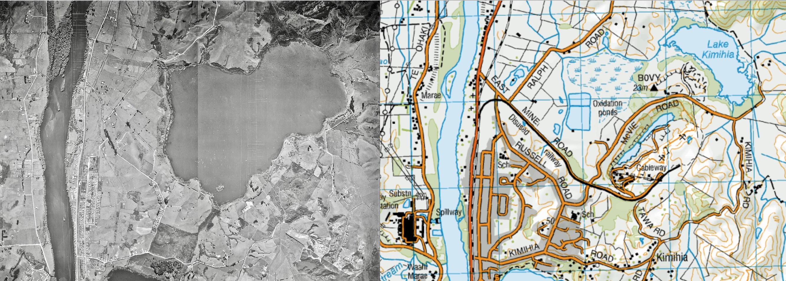
English: Lake Kimihia was largely drained to allow coal to be dug from its bed from 1944 to 1977 |
| Date | 18 April 1941 and 2018 |
| Source | Current LINZ map from http://www.topomap.co.nz/NZTopoMap/nz520/Lake-Kimihia/Waikato and Retrolens aerial photos of Kimihi at https://files.interpret.co.nz/Retrolens/Imagery/SN174/Crown_174_293_23/High.jpg and https://files.interpret.co.nz/Retrolens/Imagery/SN174/Crown_174_293_21/High.jpg |
| Author | LINZ |
Licensing
This file is licensed under the Creative Commons Attribution 3.0 Unported license.
- You are free:
- to share – to copy, distribute and transmit the work
- to remix – to adapt the work
- Under the following conditions:
- attribution – You must give appropriate credit, provide a link to the license, and indicate if changes were made. You may do so in any reasonable manner, but not in any way that suggests the licensor endorses you or your use.
File history
Click on a date/time to view the file as it appeared at that time.
| Date/Time | Thumbnail | Dimensions | User | Comment | |
|---|---|---|---|---|---|
| current | 23:31, 3 February 2019 | 2,664 × 954 (1.04 MB) | Johnragla | User created page with UploadWizard |
File usage
The following pages on the English Wikipedia use this file (pages on other projects are not listed):