
File:18th Green and Clubhouse.jpg
No higher resolution available.
18th_Green_and_Clubhouse.jpg (640 × 427 pixels, file size: 65 KB, MIME type: image/jpeg)
| This is a file from the Wikimedia Commons. Information from its description page there is shown below. Commons is a freely licensed media file repository. You can help. |
Summary
| Description |
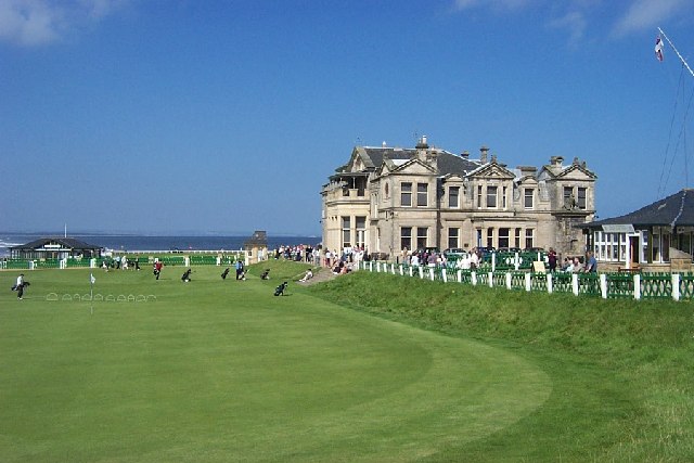
English: Royal and Ancient St Andrews |
| Date | |
| Source | From geograph.org.uk |
| Author | paul birrell |
| Permission (Reusing this file) |
Creative Commons Attribution Share-alike license 2.0 |
| Object location | | View this and other nearby images on: OpenStreetMap |
|---|
_region:GB-GBN_&language=en)
Licensing

|
This image was taken from the Geograph project collection. See this photograph's page on the Geograph website for the photographer's contact details. The copyright on this image is owned by paul birrell and is licensed for reuse under the Creative Commons Attribution-ShareAlike 2.0 license.
|
This file is licensed under the Creative Commons Attribution-Share Alike 2.0 Generic license.
Attribution: paul birrell
- You are free:
- to share – to copy, distribute and transmit the work
- to remix – to adapt the work
- Under the following conditions:
- attribution – You must give appropriate credit, provide a link to the license, and indicate if changes were made. You may do so in any reasonable manner, but not in any way that suggests the licensor endorses you or your use.
- share alike – If you remix, transform, or build upon the material, you must distribute your contributions under the same or compatible license as the original.
File history
Click on a date/time to view the file as it appeared at that time.
| Date/Time | Thumbnail | Dimensions | User | Comment | |
|---|---|---|---|---|---|
| current | 09:23, 12 April 2006 | | 640 × 427 (65 KB) | Cactus.man | {{geograph|17122|Paul Birrell}} Category:Scotland Category:Cities and villages in Scotland |
File usage
The following pages on the English Wikipedia use this file (pages on other projects are not listed):
- 1981 European Amateur Team Championship
- Golf in Scotland
- St Andrews
- User:Cactus.man/Contributions/Images
- User:Cactus.man/Sandbox/P-Sco/Selected2
- Wikipedia:Scottish Wikipedians' notice board/New images/Archives/March and April 2006
- Portal:Scotland/Selected article/2009
- Portal:Scotland/Selected article/Week 4, 2009
- Portal:Scotland/Selected articles
- Portal:Scotland/Selected articles/48
Global file usage
The following other wikis use this file:
- Usage on af.wikipedia.org
- Usage on ast.wikipedia.org
- Usage on azb.wikipedia.org
- Usage on ca.wikipedia.org
- Usage on da.wikipedia.org
- Usage on de.wikipedia.org
- Usage on eu.wikipedia.org
- Usage on fi.wikipedia.org
- Usage on fr.wikipedia.org
- Usage on hu.wikipedia.org
- Usage on id.wikipedia.org
- Usage on it.wikipedia.org
- Usage on ja.wikipedia.org
- Usage on nl.wikipedia.org
- Usage on ro.wikipedia.org
- Usage on sl.wikipedia.org
- Usage on sv.wikipedia.org
- Usage on test2.wikipedia.org
- Usage on th.wikipedia.org
- Usage on www.wikidata.org
- Usage on zh.wikipedia.org