
File:1876 5th Middlesex senate district map Massachusetts US.jpg

Size of this preview: 800 × 487 pixels. Other resolutions: 320 × 195 pixels | 640 × 390 pixels | 1,024 × 624 pixels | 1,280 × 780 pixels | 3,200 × 1,949 pixels.
Original file (3,200 × 1,949 pixels, file size: 1.1 MB, MIME type: image/jpeg)
| This is a file from the Wikimedia Commons. Information from its description page there is shown below. Commons is a freely licensed media file repository. You can help. |
Summary
| Description |
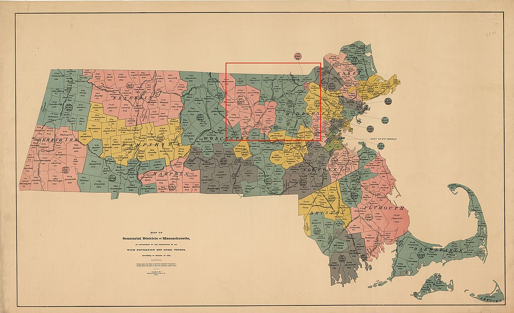
Map of districts of the Massachusetts state senate apportioned in 1876. The map includes 1885 population information. The location of the 5th Middlesex senate district is highlighted in red. Acts and Resolves of the Massachusetts General Court, 1876 Chap. 0190. An Act To Divide The Commonwealth Into Forty Districts For The Choice Of Senators: "...The towns of Acton, Ashby, Ayer, Boxborough, Carlisle, Chelmsford, Concord, Dracut, Dunstable, Groton, Hudson, Lincoln, Littleton, Maynard, Pepperell, Shirley, Stow, Sudbury, Townsend, Tyngsborough and Westford, shall constitute a district, to be known as the Fifth Middlesex District...." |
| Date | |
| Source | https://malegislature.gov/Redistricting/HistoricDistricts/Senate |
| Author | Rand, Avery & Co. |
This work is in the public domain in the United States because it was published (or registered with the U.S. Copyright Office) before January 1, 1929.
Public domain works must be out of copyright in both the United States and in the source country of the work in order to be hosted on the Commons. If the work is not a U.S. work, the file must have an additional copyright tag indicating the copyright status in the source country.
Note: This tag should not be used for sound recordings. |
File history
Click on a date/time to view the file as it appeared at that time.
| Date/Time | Thumbnail | Dimensions | User | Comment | |
|---|---|---|---|---|---|
| current | 11:53, 17 April 2020 | | 3,200 × 1,949 (1.1 MB) | M2545 | {{Information |description=Map of districts of the Massachusetts state senate apportioned in 1876. The map includes 1885 population information. The location of the 5th Middlesex senate district is highlighted in red. |date=1886 |source=https://malegislature.gov/Redistricting/HistoricDistricts/Senate |author= Rand, Avery & Co. |permission= |other versions= }} {{PD-US-expired}} |
File usage
The following pages on the English Wikipedia use this file (pages on other projects are not listed):
Global file usage
The following other wikis use this file:
- Usage on www.wikidata.org