
File:1838NSWMitchell.jpg

Original file (993 × 719 pixels, file size: 114 KB, MIME type: image/jpeg)
| This is a file from the Wikimedia Commons. Information from its description page there is shown below. Commons is a freely licensed media file repository. You can help. |
Summary
| Description |
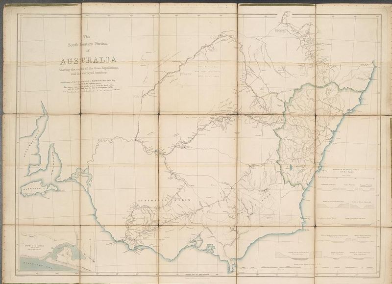
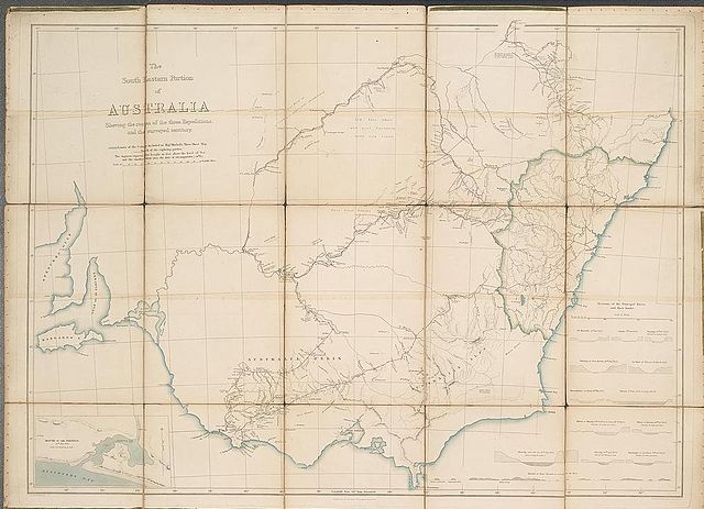
The south eastern portion of Australia showing the routes of the three expeditions and the surveyed territory. Mitchell's map of Victoria and New South Wales showing towns, major rivers and the limits of the Colony at the time. The map shows in red the routes taken by Mitchell's expedition and camps. Major Thomas L. Mitchell's expedition of 1836 was an exploratory one, the aim of which was to develop and expand the Colony of New South Wales and to seek potential grazing and farming land, as well as sites for new settlements. A landmark in Australian history, Mitchell exceeded his orders and discovered and explored a rich pastoral area which he called Australia Felix (Happy Australia) - now central and western Victoria. This map which he compiled is the first properly surveyed map of this part of southeast Australia and it remained in use for many years. |
| Date | |
| Source | National Library of Australia |
| Author | Sir Thomas Mitchell, 1792-1855; NSW Surveyor-General |
| Permission (Reusing this file) |
Public Domain - more than 100 years old |
Licensing
|
This work is in the public domain in its country of origin and other countries and areas where the copyright term is the author's life plus 70 years or fewer.
| |
| This file has been identified as being free of known restrictions under copyright law, including all related and neighboring rights. | |
File history
Click on a date/time to view the file as it appeared at that time.
| Date/Time | Thumbnail | Dimensions | User | Comment | |
|---|---|---|---|---|---|
| current | 23:03, 8 July 2006 | | 993 × 719 (114 KB) | Matilda | {{Information |Description= The south eastern portion of Australia showing the routes of the three expeditions and the surveyed territory. Mitchell's map of Victoria and New South Wales showing towns, major rivers and the limits of the Colony at the time |
File usage
Global file usage
The following other wikis use this file:
- Usage on bg.wikipedia.org