
File:1797 Faden (Mousehold Heath).jpg

Size of this preview: 800 × 566 pixels. Other resolutions: 320 × 226 pixels | 640 × 453 pixels | 1,024 × 724 pixels | 1,280 × 906 pixels | 1,600 × 1,132 pixels.
Original file (1,600 × 1,132 pixels, file size: 1.08 MB, MIME type: image/jpeg)
| This is a file from the Wikimedia Commons. Information from its description page there is shown below. Commons is a freely licensed media file repository. You can help. |
.jpg)
Summary
| Description |
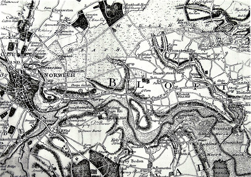
English: An extract from Faden's Map of Norfolk, showing the area north-east of Norwich |
| Date | |
| Source | http://easternbushchat.blogspot.co.uk/2016/01/heathland-haven.html An extract from Faden's 1797 map of Norfolk |
| Author | William Faden, a cartographer, engraver and publisher of maps, who became geographer to King George III and to the Prince of Wales. Surveying for this map was carried out between 1790 and 1794. |
Licensing
This file is licensed under the Creative Commons Attribution-Share Alike 4.0 International license.
- You are free:
- to share – to copy, distribute and transmit the work
- to remix – to adapt the work
- Under the following conditions:
- attribution – You must give appropriate credit, provide a link to the license, and indicate if changes were made. You may do so in any reasonable manner, but not in any way that suggests the licensor endorses you or your use.
- share alike – If you remix, transform, or build upon the material, you must distribute your contributions under the same or compatible license as the original.
File history
Click on a date/time to view the file as it appeared at that time.
| Date/Time | Thumbnail | Dimensions | User | Comment | |
|---|---|---|---|---|---|
| current | 17:17, 31 March 2018 | | 1,600 × 1,132 (1.08 MB) | Amitchell125 | User created page with UploadWizard |
File usage
The following pages on the English Wikipedia use this file (pages on other projects are not listed):
.jpg)