
File:127.26758E 40.36646N Changjin Air Force Base.png

Size of this preview: 800 × 493 pixels. Other resolutions: 320 × 197 pixels | 640 × 394 pixels | 990 × 610 pixels.
Original file (990 × 610 pixels, file size: 709 KB, MIME type: image/png)
| This is a file from the Wikimedia Commons. Information from its description page there is shown below. Commons is a freely licensed media file repository. You can help. |
| Description |
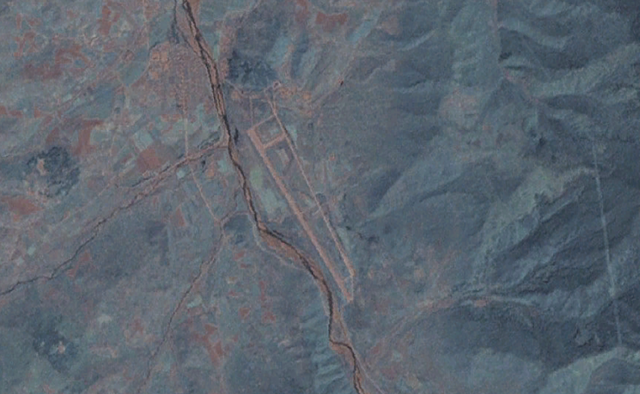
English: NASA Landsat 7 view of the Changjin Air Force Base in North Korea, seen at the center of the image. Approximate altitude of 6.7km. |
|||
| Date | Unknown date | |||
| Source | NASA Worldwind, Landsat 7 Visible overlay | |||
| Author | NASA | |||
| Permission (Reusing this file) |
|

File history
Click on a date/time to view the file as it appeared at that time.
| Date/Time | Thumbnail | Dimensions | User | Comment | |
|---|---|---|---|---|---|
| current | 03:09, 22 May 2013 | | 990 × 610 (709 KB) | Oaktree b | {{Information |Description ={{en|1=NASA Landsat 7 view of the Changjin Air Force Base in North Korea, seen at the center of the image. Approximate altitude of 6.7km. }} |Source =NASA Worldwind, Landsat 7 Visible overlay |Author =NASA... |
File usage
The following pages on the English Wikipedia use this file (pages on other projects are not listed):
Global file usage
The following other wikis use this file: