
File:1107LaLaurel Alfonso, Cavite Barangays Roadsurel Alfonso, Cavite Barangays Roads 23.jpg

Size of this preview: 800 × 600 pixels. Other resolutions: 320 × 240 pixels | 640 × 480 pixels | 1,024 × 768 pixels | 1,280 × 960 pixels | 2,560 × 1,920 pixels | 4,608 × 3,456 pixels.
Original file (4,608 × 3,456 pixels, file size: 6.72 MB, MIME type: image/jpeg)
| This is a file from the Wikimedia Commons. Information from its description page there is shown below. Commons is a freely licensed media file repository. You can help. |
Summary
| Description |
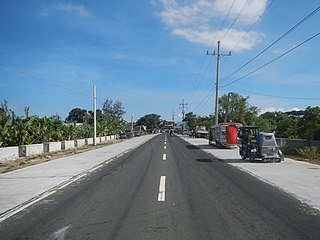
English: Amuyong, Alfonso, Cavite Grasslands in Alfonso, Cavite Skylines in Laurel, Batangas Dayap Itaas, Laurel, Batangas Twin Lakes Hotel Robinsons Supermarket Buck Estate, Alfonso, Cavite Amuyong–Kaytitingga Road Tagaytay–Nasugbu Highway Magallanes, Cavite along Maragondon–Magallanes–Amuyong Road Alfonso-Magallanes Road Category:Barangays of Cavite Barangays Kaytitinga I, II & III, Alfonso, Cavite 14.0987, 120.8360 Amuyong, Alfonso, Cavite 14.0776, 120.8481 Alfonso, Cavite bounded by Category:Barangays of Cavite Barangay Dayap Itaas, Laurel, Batangas Laurel, Batangas Philippine highway network (Note: Judge Florentino Floro, the owner, to repeat, Donor Florentino Floro of all these photos hereby donate gratuitously, freely and unconditionally Judge Floro all these photos to and for Wikimedia Commons, exclusively, for public use of the public domain, and again without any condition whatsoever). |
| Date | |
| Source | Own work |
| Author | Judgefloro |
| Camera location | | View this and other nearby images on: OpenStreetMap |
|---|
Amuyong, Alfonso, Cavite 14.0776, 120.8481
Licensing
I, the copyright holder of this work, hereby publish it under the following license:
| This file is made available under the Creative Commons CC0 1.0 Universal Public Domain Dedication. | |
| The person who associated a work with this deed has dedicated the work to the public domain by waiving all of their rights to the work worldwide under copyright law, including all related and neighboring rights, to the extent allowed by law. You can copy, modify, distribute and perform the work, even for commercial purposes, all without asking permission.
|
File history
Click on a date/time to view the file as it appeared at that time.
| Date/Time | Thumbnail | Dimensions | User | Comment | |
|---|---|---|---|---|---|
| current | 07:43, 4 April 2019 | | 4,608 × 3,456 (6.72 MB) | Judgefloro | User created page with UploadWizard |
File usage
The following pages on the English Wikipedia use this file (pages on other projects are not listed):