
File:05-017 Trobriand Is.png
Size of this preview: 630 × 599 pixels. Other resolutions: 252 × 240 pixels | 505 × 480 pixels | 807 × 768 pixels | 1,076 × 1,024 pixels | 1,769 × 1,683 pixels.
Original file (1,769 × 1,683 pixels, file size: 308 KB, MIME type: image/png)
| This is a file from the Wikimedia Commons. Information from its description page there is shown below. Commons is a freely licensed media file repository. You can help. |
Summary
| Description |
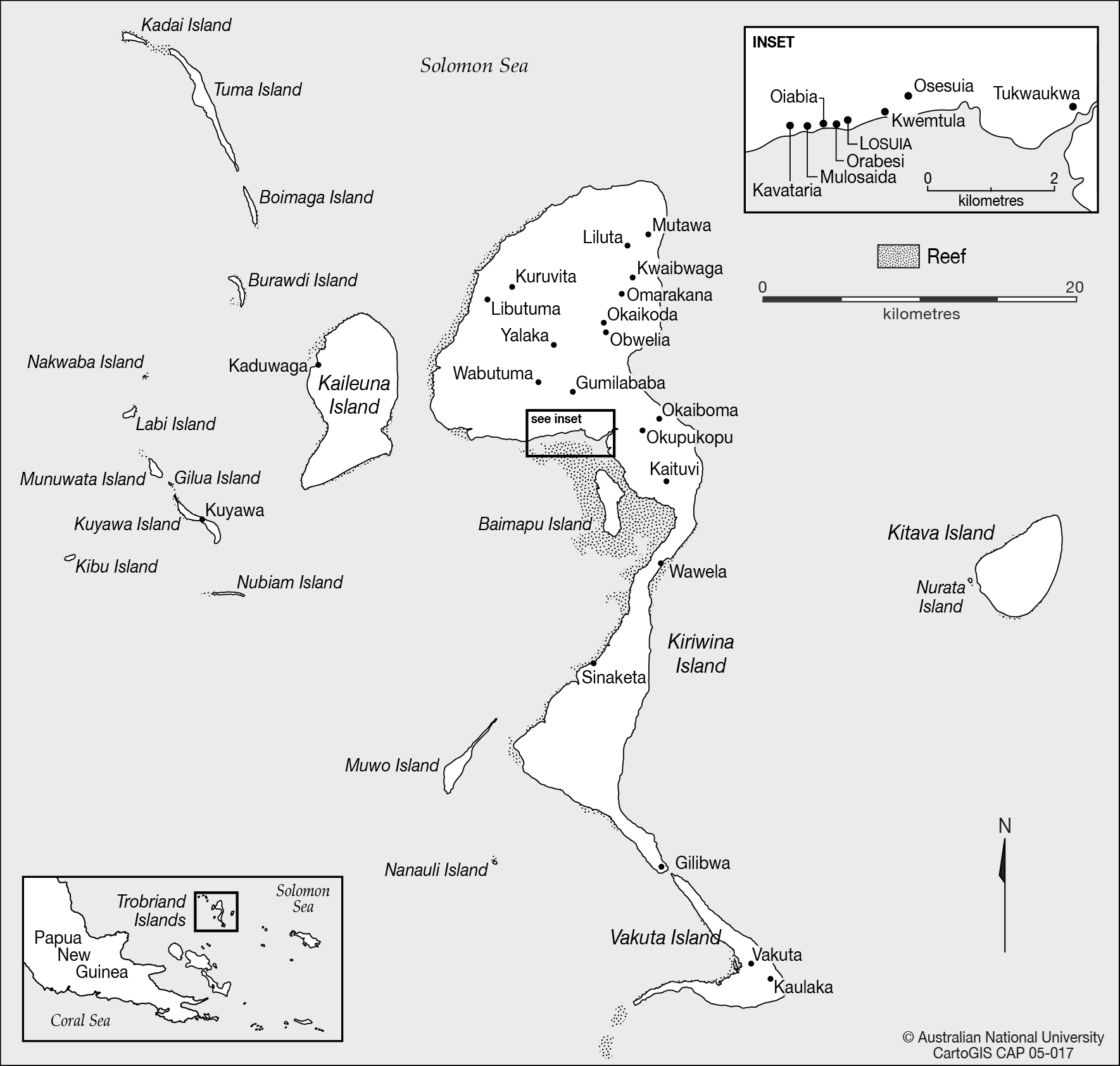
English: map of Trobriand Islands, Papua New Guinea, Solomon Sea, Pacific Ocean |
| Date | not stated |
| Source | CartoGIS, College of Asia and the Pacific, The Australian National University, http://asiapacific.anu.edu.au/mapsonline/base-maps/trobriand-islands |
| Author | CartoGIS, College of Asia and the Pacific, The Australian National University |
Licensing
This file is licensed under the Creative Commons Attribution-Share Alike 2.5 Generic license.
- You are free:
- to share – to copy, distribute and transmit the work
- to remix – to adapt the work
- Under the following conditions:
- attribution – You must give appropriate credit, provide a link to the license, and indicate if changes were made. You may do so in any reasonable manner, but not in any way that suggests the licensor endorses you or your use.
- share alike – If you remix, transform, or build upon the material, you must distribute your contributions under the same or compatible license as the original.
File history
Click on a date/time to view the file as it appeared at that time.
| Date/Time | Thumbnail | Dimensions | User | Comment | |
|---|---|---|---|---|---|
| current | 20:36, 17 September 2016 | | 1,769 × 1,683 (308 KB) | Ratzer | User created page with UploadWizard |
File usage
The following pages on the English Wikipedia use this file (pages on other projects are not listed):
Global file usage
The following other wikis use this file:
- Usage on ast.wikipedia.org
- Usage on cs.wikipedia.org
- Usage on de.wikipedia.org
- Usage on de.wikivoyage.org
- Usage on fa.wikipedia.org
- Usage on www.wikidata.org