
File:00 5891 Monument Valley. - Navajo Indian Reservation.jpg

Size of this preview: 800 × 533 pixels. Other resolutions: 320 × 213 pixels | 640 × 427 pixels | 1,024 × 683 pixels | 1,280 × 853 pixels | 2,160 × 1,440 pixels.
Original file (2,160 × 1,440 pixels, file size: 2.54 MB, MIME type: image/jpeg)
| This is a file from the Wikimedia Commons. Information from its description page there is shown below. Commons is a freely licensed media file repository. You can help. |
Summary
| Description |
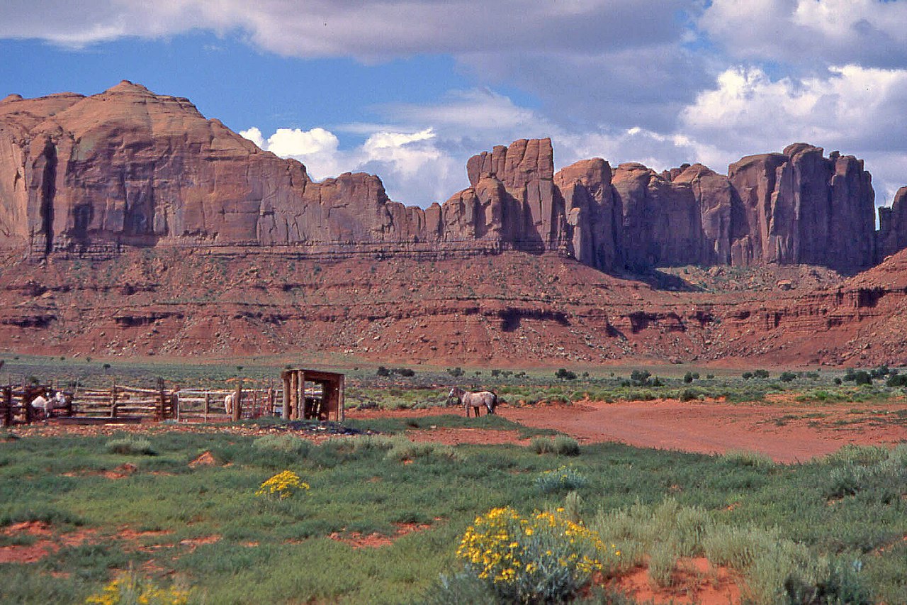
Deutsch: Monument Valley ist eine Navajo Indian Reservation in einem Gebiet an den Grenzen der Bundesstaaten Arizon (NO) und Utha (SO). Die Region ist bekannt für seine bis zu 600 Meter hohen monolithischen Sandsteingebilden.
Simple English: Monument Valley is a Navajo Indian Reservation in an area bordering the states of Arizona (NO) and Utha (SO). The region is known for its up to 600 meters high monolithic sandstone formations. |
| Date | |
| Source | Own work |
| Author | W. Bulach |
| Camera location | | View this and other nearby images on: OpenStreetMap |
|---|
Licensing
I, the copyright holder of this work, hereby publish it under the following license:
This file is licensed under the Creative Commons Attribution-Share Alike 4.0 International license.
- You are free:
- to share – to copy, distribute and transmit the work
- to remix – to adapt the work
- Under the following conditions:
- attribution – You must give appropriate credit, provide a link to the license, and indicate if changes were made. You may do so in any reasonable manner, but not in any way that suggests the licensor endorses you or your use.
- share alike – If you remix, transform, or build upon the material, you must distribute your contributions under the same or compatible license as the original.
Die Aufnahme entstand im Jahre 1985 mittels einem Diapositivfilm. Das gerahmte Einzeldia wurde im Jahre 2006 mit einem Diascanner in das JPEG-Format. umgewandelt und zur Bildverbesserung mit Adobe Photoshop Elements 18.0 bearbeitet.
File history
Click on a date/time to view the file as it appeared at that time.
| Date/Time | Thumbnail | Dimensions | User | Comment | |
|---|---|---|---|---|---|
| current | 09:24, 28 January 2019 | | 2,160 × 1,440 (2.54 MB) | W. Bulach | User created page with UploadWizard |
File usage
The following pages on the English Wikipedia use this file (pages on other projects are not listed):
Global file usage
The following other wikis use this file:
- Usage on eo.wikipedia.org
- Usage on www.wikidata.org