
File:0040jfVigils demonstrations Media coverages Ferdinand Edralin Marcos Burial Cases Judgmentfvf 02.jpg

Size of this preview: 800 × 600 pixels. Other resolutions: 320 × 240 pixels | 640 × 480 pixels | 1,024 × 768 pixels | 1,280 × 960 pixels | 2,560 × 1,920 pixels | 4,608 × 3,456 pixels.
Original file (4,608 × 3,456 pixels, file size: 6.57 MB, MIME type: image/jpeg)
| This is a file from the Wikimedia Commons. Information from its description page there is shown below. Commons is a freely licensed media file repository. You can help. |
Summary
| Description |
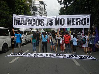
English: Ermita, Manila, List of barangays of Metro Manila Legislative districts of Manila 5th District, Barangays 669, Zone 72, 675, 676, Zone 73, 686, 687, 688, 694, 695, Zone 75, District V, Ermita, Manila, City of Manila United Nations Avenue along Taft Avenue United Nations LRT Station corner Padre Faura Street Padre Faura 14°34'42"N 120°58'59"E Vigil, prayer and rallies - Media coverages in the Ferdinand Edralin Marcos Burial Cases November 8, 2016 Judgment (Padre Faura Street, Supreme Court of the Philippines) Supreme Court of the Philippines SC favors dictator Marcos’ burial t Libingan ng mga Bayani Burial of Ferdinand Marcos Heroes' Cemetery Marcos Burial Cases Saturnino C. Ocampo, et al. Vs. Rear Admiral Ernesto C. Enriquez, et al. Rep. Edcel C. Lagman, et al. Vs. Executive Secretary Salvador C. Medialdea G.R. No. 225973 November 8, 2016 Neri Colmenares Neri Javier Colmenares, Susan Enriquez Kay Susan Tayo James Hookway (Note: Judge Florentino Floro, the owner, to repeat, Donor Florentino Floro of all these photos hereby donate gratuitously, freely and unconditionally all these photos to and for Wikimedia Commons, exclusively, for public use of the public domain, and again without any condition whatsoever). |
| Date | |
| Source | Own work |
| Author | Judgefloro |
| Camera location | | View this and other nearby images on: OpenStreetMap |
|---|
Padre Faura 14°34'42"N 120°58'59"E
Licensing
I, the copyright holder of this work, hereby publish it under the following license:
| This file is made available under the Creative Commons CC0 1.0 Universal Public Domain Dedication. | |
| The person who associated a work with this deed has dedicated the work to the public domain by waiving all of their rights to the work worldwide under copyright law, including all related and neighboring rights, to the extent allowed by law. You can copy, modify, distribute and perform the work, even for commercial purposes, all without asking permission.
|
File history
Click on a date/time to view the file as it appeared at that time.
| Date/Time | Thumbnail | Dimensions | User | Comment | |
|---|---|---|---|---|---|
| current | 17:54, 10 November 2016 | | 4,608 × 3,456 (6.57 MB) | Judgefloro | User created page with UploadWizard |
File usage
The following pages on the English Wikipedia use this file (pages on other projects are not listed):