
File:Карта Вятской Губернии (1822).jpg

Size of this preview: 609 × 599 pixels. Other resolutions: 244 × 240 pixels | 488 × 480 pixels | 780 × 768 pixels | 1,040 × 1,024 pixels | 2,081 × 2,048 pixels | 4,834 × 4,758 pixels.
Original file (4,834 × 4,758 pixels, file size: 7.44 MB, MIME type: image/jpeg)
| This is a file from the Wikimedia Commons. Information from its description page there is shown below. Commons is a freely licensed media file repository. You can help. |
.jpg)
Summary
| Description |
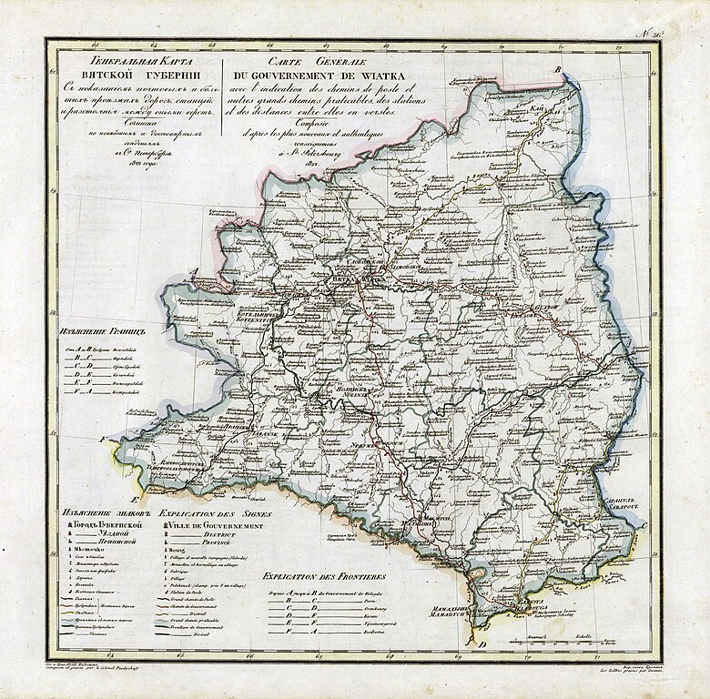
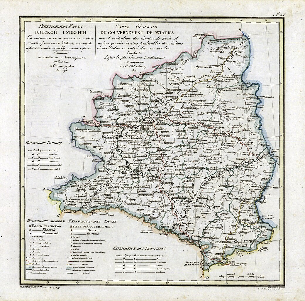
Русский: Карта Вятской Губернии из атласа 1821 года
English: Vyatka Governorate map from geographic atlas of the Russian Empire (1821) |
| Date | |
| Source |
Geographic atlas of the Russian Empire is located in governorates in Russian and French (1821) |
| Author | Пядышев |
Licensing
|
This work is in the public domain in its country of origin and other countries and areas where the copyright term is the author's life plus 100 years or fewer. | |
| This file has been identified as being free of known restrictions under copyright law, including all related and neighboring rights. | |
Original upload log
The original description page was here. All following user names refer to ru.wikipedia.
- 2008-04-04 12:53 AGOT 4834×4758× (7801071 bytes) {{Изображение | Описание = Карта Вятской Губернии | Автор = Пядышев | Время создания = 1821 | Источник = Атлас Российской империи }}
File history
Click on a date/time to view the file as it appeared at that time.
| Date/Time | Thumbnail | Dimensions | User | Comment | |
|---|---|---|---|---|---|
| current | 13:43, 26 October 2009 | | 4,834 × 4,758 (7.44 MB) | Transcend (rus) | {{Information |Description={{ru|Карта Вятской Губернии из атласа 1821 года}} {{en|Vyatka Governorate map from geographic atlas of the Russian Empire (1821)}} |Source=Geographic atlas of the Russian Empire is located in gove |
File usage
No pages on the English Wikipedia use this file (pages on other projects are not listed).
Global file usage
The following other wikis use this file:
- Usage on azb.wikipedia.org
- Usage on ba.wikipedia.org
- Usage on be.wikipedia.org
- Usage on ca.wikipedia.org
- Usage on cs.wikipedia.org
- Usage on de.wikipedia.org
- Usage on fi.wikipedia.org
- Usage on fr.wikipedia.org
- Usage on it.wikipedia.org
- Usage on ko.wikipedia.org
- Usage on nl.wikipedia.org
- Usage on pl.wikipedia.org
- Usage on ru.wikipedia.org
- Usage on sv.wikipedia.org
- Usage on tr.wikipedia.org
- Usage on tt.wikipedia.org
- Usage on uk.wikipedia.org
- Usage on www.wikidata.org
.jpg)