
File:Île de la Possession.png
No higher resolution available.
Île_de_la_Possession.png (372 × 244 pixels, file size: 47 KB, MIME type: image/png)
| This is a file from the Wikimedia Commons. Information from its description page there is shown below. Commons is a freely licensed media file repository. You can help. |
Summary
| Description |
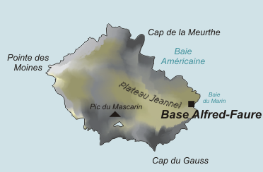
Deutsch: Karte der Île de la Possession, Crozetinseln, im südlichen Indischen Ozean
English: Map of Île de la Possession, Crozet Islands, in the Southern Indian Ocean |
| Date | |
| Source | Own work, based on original from Varp |
| Author | modified by PoM |
| Other versions |

Licensing
| |
This work has been released into the public domain by its author, Varp, at the [[:commons:|English Wikipedia]] project. This applies worldwide. In case this is not legally possible: |
File history
Click on a date/time to view the file as it appeared at that time.
| Date/Time | Thumbnail | Dimensions | User | Comment | |
|---|---|---|---|---|---|
| current | 16:33, 9 September 2021 | | 372 × 244 (47 KB) | Maisrimer | Pleateau Jeannel added |
| 15:06, 30 October 2006 |  | 372 × 244 (49 KB) | PoM | Zoom de Image:Crozet_Map.png Category:Southern territories of France Category:Sub-antarctic islands |
File usage
The following pages on the English Wikipedia use this file (pages on other projects are not listed):
Global file usage
The following other wikis use this file:
- Usage on af.wikipedia.org
- Usage on ar.wikipedia.org
- Usage on az.wikipedia.org
- Usage on cs.wikipedia.org
- Usage on de.wikipedia.org
- Usage on de.wikivoyage.org
- Usage on eo.wikipedia.org
- Usage on es.wikipedia.org
- Usage on fa.wikipedia.org
- Usage on fr.wikipedia.org
- Usage on gl.wikipedia.org
- Usage on hr.wikipedia.org
- Usage on hu.wikipedia.org
- Usage on it.wikipedia.org
- Usage on ja.wikipedia.org
- Usage on mk.wikipedia.org
- Usage on nn.wikipedia.org
- Usage on pl.wikipedia.org
- Usage on ru.wikipedia.org
- Usage on uk.wikipedia.org
- Usage on www.wikidata.org
- Usage on zh.wikipedia.org