Bould

Coordinates: 51°53′13″N 1°38′49″W / 51.887°N 01.647°W / 51.887; -01.647
From Wikipedia, the free encyclopedia

Bould
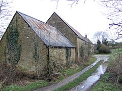
Lower Farm, Bould
Bould is located in Oxfordshire
Bould
Bould
Location within Oxfordshire
OS grid referenceSP2420
Civil parish
District
Shire county
Region
CountryEngland
Sovereign stateUnited Kingdom
Post townChipping Norton
Postcode districtOX7
PoliceThames Valley
FireOxfordshire
AmbulanceSouth Central
UK Parliament
List of places
UK
England
Oxfordshire
51°53′13″N 1°38′49″W / 51.887°N 01.647°W / 51.887; -01.647

Bould is a hamlet in Idbury civil parish, Oxfordshire,[1] about 4.5 miles (7.2 km) southeast of Stow-on-the-Wold in neighbouring Gloucestershire.[citation needed] The hamlet is near the Bould Wood.[1]

References[edit]

  1. ^ a b Gelling, Margaret (1954). The Place-names of Oxfordshire. Pennsylvania State University Press. pp. 357, 495.

External links[edit]

Media related to Bould at Wikimedia Commons