Borgloon
Borgloon
Looz (French) | |
|---|---|
City and municipality | |
 Borgloon city hall | |
| Coordinates: 50°48′N 05°20′E / 50.800°N 5.333°E | |
| Country | |
| Community | Flemish Community |
| Region | Flemish Region |
| Province | Limburg |
| Arrondissement | Tongeren |
| Government | |
| • Mayor | Jo Feytons (Open Vld-Stroop) |
| • Governing party/ies | OpenVLD-Stroop, Vooruit |
| Area | |
| • Total | 51.32 km2 (19.81 sq mi) |
| Population (2018-01-01)[1] | |
| • Total | 10,697 |
| • Density | 210/km2 (540/sq mi) |
| Postal codes | 3840 |
| NIS code | 73009 |
| Area codes | 012 |
| Website | www.borgloon.be |
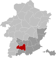
Borgloon (Dutch pronunciation: [ˈbɔr(ə)xˌloːn] ⓘ; French: Looz, French pronunciation: [lo]; Limburgish: Loeën) is a city and municipality located in the Belgian province of Limburg. On January 1, 2006, Borgloon had a total population of 10,697. The total area is 51.12 km2 (19.74 sq mi) which gives a population density of 209 inhabitants per km2 (514/sq mi). Borgloon gave its name to the former county of Loon and was its capital until 1200.
The municipality includes the following 13 sub-municipalities: Bommershoven, Borgloon proper, Broekom, Gors-Opleeuw, Gotem, Groot-Loon, Hendrieken, Hoepertingen, Jesseren, Kerniel, Kuttekoven, Rijkel, and Voort.
History[edit]
County of Loon 11th century–1366
Prince-Bishopric of Liège 1366–1789
Republic of Liège 1789–1791
Prince-Bishopric of Liège 1791–1795
French Republic 1795–1804
French Empire 1804–1815
Kingdom of the Netherlands 1815–1830
Kingdom of Belgium 1830–present

References[edit]
- ^ "Wettelijke Bevolking per gemeente op 1 januari 2018". Statbel. Retrieved 9 March 2019.
External links[edit]
 Media related to Borgloon at Wikimedia Commons
- Official website (in Dutch)


