Wikipedia:Featured picture candidates/Stielers Handatlas 1891 59.jpg
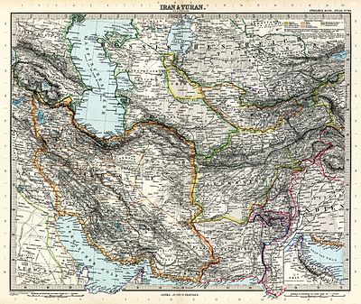
Map of Iran and Turan in Qajar dynasty drawn by Adolf Stieler - 1891[edit]
Voting period is over. Please don't add any new votes. Voting period ends on 5 Jun 2015 at 12:24:01 (UTC)

- Reason
- HQ + EV
- Articles in which this image appears
- Adolf Stieler
Stielers Handatlas
Turan - FP category for this image
- Wikipedia:Featured pictures/Diagrams, drawings, and maps/Maps
- Creator
- Adolf Stieler
- Support as nominator – Alborzagros (talk) 12:24, 26 May 2015 (UTC)
- Support in principle, though I wonder why this particular plate was chosen. Stielers is a wonderful cartographic and historical resource, beautifully executed with lavish detail. (I have this one matted & framed as a kind of souvenir of my Baltic adventures.) Sca (talk) 13:52, 26 May 2015 (UTC)
- Oppose - Very useful map, but the JPG artefacting is pretty darn bad. — Chris Woodrich (talk) 16:17, 26 May 2015 (UTC)
- Support-Jobas (talk) 01:03, 5 June 2015 (UTC)
Not Promoted --Armbrust The Homunculus 12:37, 5 June 2015 (UTC)
