
Tyson Research Center
| Tyson Research Center | |
|---|---|
 | |
| General information | |
| Classification | Biological Field Research Area |
| Location | West St. Louis County |
| Coordinates | 38°31′N 90°33′W / 38.517°N 90.550°W |
| Named for | The Tyson Valley |
| Inaugurated | Acquired in 1963 |
| Owner | Washington University in St. Louis |
| Website | |
| https://tyson.wustl.edu/ | |
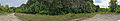
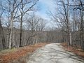
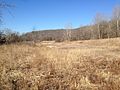
Tyson Research Center is a 2,000-acre (8.1 km2) environmental field station owned and operated by Washington University in St. Louis in the St. Louis, Missouri metropolitan area east of Eureka. It is part of the Henry Shaw Ozark Corridor which consists of over 8,000 acres (32 km2) of protected lands. It is a member of the Organization of Biological Field Stations (OBFS).[1]
Tyson provides opportunities for environmental research and education for students and faculty from Washington University and beyond. Infrastructure and programs facilitate multi-scale research and teaching opportunities and collaboration across disciplines, institutions, and levels of academic training.[2]
Tyson Research Center was originally part of the Tyson Valley Powder Plant in World War II.[3] It is bordered to the east by Lone Elk County Park, to the west by West Tyson County Park, to the north by Castlewood State Park, and to the south by Interstate 44.
Tyson Research Center hosts the Endangered Wolf Center.
Tyson also has a weather station and monitors acid rain as part of the National Atmospheric Deposition Program.[4]
-
 Headquarters building
 -
 A bunker at Tyson
 -
 Minke Quarry site
 -
-


References[edit]
- ^ "Washington University Tyson Research Center". Organization of Biological Field Stations. Retrieved April 24, 2015.
- ^ "Home". Tyson Research Center. Retrieved 2017-12-15.
- ^ "Proposed Plan for Selected Areas of Concern and Areas of Interest" (PDF). Missouri Department of Natural Resources. May 2014. Retrieved April 24, 2015.
- ^ "NTN Data Access". National Atmospheric Deposition Program. Retrieved April 24, 2015.
External links[edit]
| Academics |  | |
|---|---|---|
| Centers and institutes | ||
| Campus | ||
| Athletics | ||
| People | ||
| History | ||
| Campus life | ||
| Miscellaneous | ||