
Sistan and Baluchestan province
Sistan and Baluchestan Province
استان سیستان و بلوچستان | |
|---|---|
 | |
 Map of Iran with Sistan and Baluchestan province highlighted | |
| Coordinates: 28°17′N 61°07′E / 28.283°N 61.117°E[1] | |
| Country | |
| Capital | Zahedan |
| Counties | 26 |
| Government | |
| • Governor-general | Mohammad Karami |
| • MPs of Assembly of Experts | Abbas-Ali Soleimani and Ali Ahmad Salami |
| • Representative of the Supreme Leader | Mostafa Mahami |
| Area | |
| • Total | 180,726 km2 (69,779 sq mi) |
| Population (2016)[2] | |
| • Total | 2,775,014 |
| • Density | 15/km2 (40/sq mi) |
| Demonym | Baloch |
| Time zone | UTC+03:30 (IRST) |
| ISO 3166 code | IR-11 |
| Main language(s) | Baluchi Persian |
| HDI (2017) | 0.688[3] medium · 31st |
Sistan and Baluchestan province (Persian: استان سيستان و بلوچستان)[a] is the second largest of the 31 provinces of Iran, after Kerman province, with an area of 180,726 km2. Its capital is the city of Zahedan.[4] The province is in the southeast of the country, bordering Afghanistan and Pakistan.[5][6]
At the time of the 2006 National Census, the province had a population of 2,349,049 in 468,025 households.[7] The following census in 2011 counted 2,534,327 inhabitants living in 587,921 households.[8] At the most recent census in 2016, the population had increased to 2,775,014 in 704,888 households.[2]
The Baloch form a majority of the population and the Persian Sistani a minority. Smaller communities of Kurds (in the eastern highlands and near Iranshahr); the expatriate Brahui (along the border with Pakistan); and other resident and itinerant ethnic groups, such as the Romani, are also found within the province.
History[edit]
In the epigraphs of Bistoon and Persepolis, Sistan is mentioned as one of the eastern territories of Darius the Great. The name Sistan, as mentioned above, is derived from Saka (also sometimes Saga, or Sagastan), a Central Asian tribe that had taken control over this area in the year 128 BC. During the Arsacid dynasty (248 BC to 224 AD), the province became the seat of Suren-Pahlav Clan. From the Sassanid period until the early Islamic period, Sistan flourished considerably.
During the reign of Ardashir I of Persia, Sistan came under the jurisdiction of the Sassanids, and in 644 AD, the Arab Muslims gained control as the Persian empire was in its final moments of collapsing.
During the reign of the second Sunni caliph, Omar ibn Al-Khattab, this territory was conquered by the Arabs and an Arab commander was assigned as governor. The famous Persian ruler Ya'qub-i Laith Saffari, whose descendants dominated this area for many centuries, later became governor of this province. In 916 AD, Baluchestan was ruled by the Daylamids and thereafter the Seljuqids, when it became a part of Kerman. Dynasties such as the Saffarids, Samanids, Qaznavids, and Seljuqids, also ruled over this territory.
In 1508 AD, Shah Ismail I of the Safavid dynasty conquered Sistan. After the assassination of Nader Shah in 1747, Sistan and Balochistan became part of the Brahui Khanate of Kalat, which ruled it till 1896. Afterwards, it became part of Qajar Iran.[9]
Geography[edit]
The whole of the province had been previously called Baluchestan, but the government added Sistan to the end of Baluchestan. After the 1979 revolution, the name of the province was changed to Sistan and Baluchestan.
Today, Sistan refers to the area comrising Zabol, Hamun, Hirmand, Zehak and Nimruz counties.[10] The province borders South Khorasan province in the north, Kerman province and Hormozgan province in the west, the Gulf of Oman in the south, and Afghanistan and Pakistan in the east.
Sistan and Baluchestan province is one of the driest regions of Iran, with a slight increase in rainfall from east to west, and a rise in humidity in the coastal regions. The province is subject to seasonal winds from different directions, the most important of which are the 120-day wind of Sistan, known in Baluchi as Levar; the seventh wind (Gav-kosh); the south wind (Nambi); the Hooshak wind; the humid and seasonal winds of the Indian Ocean; the north wind (Gurich); and the western wind (Gard).
In 2023, Sistan region was affected by several dust events, occurring in April,[11] June,[10] and August. The latter sent 1120 people to hospitals from 10 to 14 August. Winds reached a speed of 108 km/h (67 mph) in Zabol station and reduced visibility to 600 m (2,000 ft).[12]
Administrative divisions[edit]

The population history and structural changes of Sistan and Baluchestan province's administrative divisions over three consecutive censuses are shown in the following table.
| Counties | 2006[7] | 2011[8] | 2016[2] |
|---|---|---|---|
| Bampur[b] | — | — | — |
| Chabahar | 214,017 | 264,051 | 283,204 |
| Dalgan[c] | — | 62,813 | 67,857 |
| Dashtiari[d] | — | — | — |
| Fanuj[e] | — | — | 49,161 |
| Golshan[f] | — | — | — |
| Hamun[g] | — | — | 41,017 |
| Hirmand[h] | — | 65,471 | 63,979 |
| Iranshahr | 264,226 | 219,796 | 254,314 |
| Khash | 161,918 | 155,652 | 173,821 |
| Konarak | 68,605 | 82,001 | 98,212 |
| Lashar[i] | — | — | — |
| Mehrestan[j] | — | 62,756 | 70,579 |
| Mirjaveh[k] | — | — | 45,357 |
| Nik Shahr | 185,355 | 212,963 | 141,894 |
| Nimruz[g] | — | — | 48,471 |
| Qasr-e Qand[l] | — | — | 61,076 |
| Rask[m] | — | — | — |
| Saravan | 239,950 | 175,728 | 191,661 |
| Sarbaz | 162,960 | 164,557 | 186,165 |
| Sib and Suran[n] | — | 73,189 | 85,095 |
| Taftan[o] | — | — | — |
| Zabol | 317,357 | 259,356 | 165,666 |
| Zahedan | 663,822 | 660,575 | 672,589 |
| Zarabad[p] | — | — | — |
| Zehak | 70,839 | 75,419 | 74,896 |
| Total | 2,349,049 | 2,534,327 | 2,775,014 |
Cities[edit]
According to the 2016 census, 1,345,642 people (over 48% of the population of Sistan and Baluchestan province) live in the following cities:[2]
| City | Population |
|---|---|
| Adimi | 3,613 |
| Ali Akbar | 4,779 |
| Bampur | 12,217 |
| Bazman | 5,192 |
| Bent | 5,822 |
| Bonjar | 3,760 |
| Chabahar | 106,739 |
| Dust Mohammad | 6,621 |
| Espakeh | 4,719 |
| Fanuj | 13,070 |
| Galmurti | 10,292 |
| Gosht | 4,992 |
| Hiduj | 1,674 |
| Iranshahr | 113,750 |
| Jaleq | 18,098 |
| Khash | 56,584 |
| Konarak | 43,258 |
| Mehrestan | 12,245 |
| Mirjaveh | 9,359 |
| Mohammadabad | 3,468 |
| Mohammadan | 10,302 |
| Mohammadi | 5,606 |
| Negur | 5,670 |
| Nik Shahr | 17,732 |
| Nosratabad | 5,238 |
| Nukabad | 5,261 |
| Pishin | 16,011 |
| Qasr-e Qand | 11,605 |
| Rask | 10,115 |
| Saravan | 60,014 |
| Sarbaz | 2,020 |
| Sirkan | 2,196 |
| Suran | 13,580 |
| Zabol | 134,950 |
| Zahedan | 587,730 |
| Zarabad | 4,003 |
| Zehak | 13,357 |
The following table shows the ten largest cities of Sistan and Baluchestan province:[2]
| Rank | Name | Population (2016) |
|---|---|---|
| 1 | Zahedan | 587,730 |
| 2 | Zabol | 134,950 |
| 3 | Iranshahr | 113,750 |
| 4 | Chabahar | 106,739 |
| 5 | Saravan | 60,014 |
| 6 | Khash | 56,584 |
| 7 | Konarak | 43,258 |
| 8 | Jaleq | 18,098 |
| 9 | Nik Shahr | 17,732 |
| 10 | Pishin | 16,011 |
Demographics[edit]

Most of the population are Balōch and speak the Baluchi language, although there also exists among them a small community of speakers of the Indo-Aryan language Jadgali.[25]: 25 Baluchestan means "Land of the Balōch"; Sistani are the second largest ethnic group in this province who speak the Sistani dialect of Persian.[citation needed]
Religion[edit]
The minority Sistani people of Sistan and Baluchestan province are Shia Muslims, and the majority Baloch people of the Baluchestan area in the province are Sunni Muslims, specially Deobandis.[26][27][28]
Sistan and Baluchestan today[edit]

Sistan and Baluchestan is the poorest of Iran's 31 provinces, with a HDI score of 0.688.[3]
The government of Iran has been implementing new plans such as creating the Chabahar Free Trade-Industrial Zone.

Economy[edit]

Industry is new to the province. Efforts have been done and tax, customs and financial motivations have caused more industrial investment, new projects, new producing jobs and improvement of industry. The most important factories are the Khash cement factory with production of 2600 tons cement daily and three other cement.
Factories under construction:
- Cotton cloth and fishing net weaving factories and the brick factory can be named as well.
The province has important geological and metal mineral potentials such as chrome, copper, granite, antimony, talc, manganese, iron, lead, zinc, tin, nickel, platinum, gold and silver.
One of the main mines in this province is Chel Kooreh copper mine in 120 km north of Zahedan.
Sistan embroidery has been an ancient handicraft of the region that has been traced as far back as 5th-century BC, originating from the Scythians.[29]
Transportation[edit]
Road transport[edit]
This section is empty. You can help by adding to it. (March 2022) |
National rail network[edit]
The city of Zahedan has been connected to Quetta in Pakistan for a century with a broad gauge railway. It has weekly trains for Kovaitah. Recently a railway from Bam, Iran to Zahedan has been inaugurated. There may be plans to build railway lines from Zahedan to Chabahar.[30]
Airports[edit]

Sistan and Baluchistan province has two main passenger airports:
- Zahedan Airport
- Chabahar Airport (Konarak Airport)
Ports[edit]
The Port of Chabahar in the south of the province is the main port. It is to be connected by a new railway to Zahedan. India is investing on this port. The port stands on the Coast of Makran and is 70 km west of Gwadar, Pakistan.[31]
Higher education[edit]
- University of Sistan and Baluchestan
- Chabahar Maritime University
- Zabol University
- Islamic Azad University of Iranshahr
- Islamic Azad University of Zahedan[32]
- Zahedan University of Medical Sciences[33]
- Zabol University of Medical Sciences
- International University of Chabahar
- Velayat University of Iranshar
- Jamiah Darul Uloom Zahedan
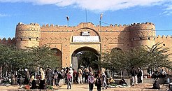
Landmarks such as the Firuzabad Castle, Rostam Castle and the Naseri Castle are located in the province.
-
 Naseri Castle, Iranshahr
 -


See also[edit]
- Bazman, volcano mountain
- Baloch people
- Sistan region
- Balochistan region
- Balochistan, Afghanistan
- Balochistan, Pakistan
![]() Media related to Sistan and Baluchestan Province at Wikimedia Commons
Media related to Sistan and Baluchestan Province at Wikimedia Commons
Notes[edit]
- ^ Also romanized as Ostân-e Sistân o Balučestân; Balochi: سیستان ءُ بلۏچستان اوستان, romanized as Sistàn o Balòcestàn ostàn or Asli Baluchestan
- ^ Separated from Iranshahr County after the 2016 census[13]
- ^ Separated from Iranshahr County after the 2006 census[14]
- ^ Separated from Chabahar County after the 2016 census[15]
- ^ Separated from Nik Shahr County after the 2011 census
- ^ Separated from Saravan County after the 2016 census[16]
- ^ a b Separated from Zabol County after the 2011 census[17]
- ^ Separated from Zabol County after the 2006 census[18]
- ^ Separated from Nik Shahr County after the 2016 census[19]
- ^ Separated from Saravan County and Sarbaz County after the 2006 census[20]
- ^ Separated from Zahedan County after the 2011 census[21]
- ^ Separated from Chabahar County and Nik Shahr County after the 2011 census[22]
- ^ Separated from Sarbaz County after the 2016 census
- ^ Separated from Saravan County after the 2006 census[20]
- ^ Separated from Khash County after the 2016 census[23]
- ^ Separated from Konarak County after the 2016 census[24]
References[edit]
- ^ OpenStreetMap contributors (24 May 2024). "Sistan and Baluchestan Province" (Map). OpenStreetMap. Retrieved 24 May 2024.
- ^ a b c d e "Census of the Islamic Republic of Iran, 1395 (2016)". AMAR (in Persian). The Statistical Center of Iran. p. 11. Archived from the original (Excel) on 23 December 2021. Retrieved 19 December 2022.
- ^ a b "Sub-national HDI – Area Database – Global Data Lab". hdi.globaldatalab.org. Retrieved 13 September 2018.
- ^ Habibi, Hassan (21 June 1369). "Approval of the organization and chain of citizenship of the elements and units of the national divisions of Sistan and Baluchestan province, centered in the city of Zahedan". Research Center of the System of Laws of the Islamic Council of the Farabi Library of Mobile Users (in Persian). Ministry of Interior, Defense Political Commission of the Government Board. Archived from the original on 24 July 2013. Retrieved 29 December 2023.
- ^ "معرفی استان سیستان و بلوچستان". hprc.zaums.ac.ir. Retrieved 13 March 2021.
- ^ "آشنایی با استان سیستان و بلوچستان". hamshahrionline.ir. 25 May 2007. Retrieved 13 March 2021.
- ^ a b "Census of the Islamic Republic of Iran, 1385 (2006)". AMAR (in Persian). The Statistical Center of Iran. p. 11. Archived from the original (Excel) on 20 September 2011. Retrieved 25 September 2022.
- ^ a b "Census of the Islamic Republic of Iran, 1390 (2011)". Syracuse University (in Persian). The Statistical Center of Iran. p. 11. Archived from the original (Excel) on 25 November 2022. Retrieved 19 December 2022.
- ^ "Brahui". Encyclopedia Irannica.
- ^ a b "Storm in Sistan sent 330 people to medical centers" توفان در سیستان ۳۳۰ نفر را راهی مراکز درمانی کرد, Tabnak (in Persian), Tabnak, 25 June 2023, 1180454, retrieved 9 April 2024.
- ^ "The storm sent 99 people to the hospital in Sistan region" توفان در منطقه سیستان ۹۹ نفر را راهی بیمارستان کرد, Tabnak (in Persian), Tabnak, 18 April 2023, 1171738, retrieved 9 April 2024.
- ^ "1120 people went to hospital in Sistan and Baluchistan" ۱۱۲۰ نفر در سیستان و بلوچستان راهی بیمارستان شدند. tabnak.ir (in Persian). Tabnak. 14 August 2023. Retrieved 9 April 2024.
{{cite web}}: CS1 maint: postscript (link) - ^ Jahangiri, Ishaq (13 August 2017). "Letter of approval regarding reforms and divisional changes in Sistan and Baluchestan province". Qavanin (in Persian). Ministry of Interior, Council of Ministers. Archived from the original on 7 April 2023. Retrieved 7 April 2023.
- ^ Davodi, Parviz (24 July 1386). "Approval letter regarding the reforms of country divisions in Sistan and Baluchestan province, Iranshahr County". Research Center of the Islamic Council (in Persian). Ministry of Interior. Archived from the original on 3 February 2013. Retrieved 7 April 2023.
- ^ Jahangiri, Ishaq (13 September 2018). "Letter of approval regarding the country divisions of Chabahar County, Sistan and Baluchestan province". Qavanin (in Persian). Ministry of Interior, Council of Ministers. Archived from the original on 7 April 2023. Retrieved 7 April 2023.
- ^ Jahangiri, Ishaq (21 December 2019). "Approval letter regarding some country divisions in Saravan County of Sistan and Baluchestan province". Laws and Regulations Portal of Iran (in Persian). Ministry of Interior, Board of Ministers. Archived from the original on 21 January 2021. Retrieved 10 April 2023.
- ^ Rahimi, Mohammad Reza (29 September 2013). "Carrying out national divisions about Saberi and Teymurabad and Nimruz and Hamun Counties of Sistan and Baluchestan province". Qavanin (in Persian). Ministry of Interior, Council of Ministers. Archived from the original on 16 April 2023. Retrieved 18 November 2023.
- ^ Davodi, Parviz (18 September 1386). "Reforms of country divisions in Sistan and Baluchestan Province, Zabol County". Qavanin (in Persian). Ministry of Interior, Board of Ministers. Archived from the original on 21 July 2023. Retrieved 31 December 2023.
- ^ Jahangiri, Ishaq (13 April 1400). "Letter of approval regarding country divisions in Fanuj and Nik Shahr Counties in Sistan and Baluchestan province". Qavanin (in Persian). Ministry of Interior, Council of Ministers. Archived from the original on 31 October 2022. Retrieved 7 April 2023.
- ^ a b Davoudi, Parviz (29 July 1386). "The approval letter of the Ministers of the Political-Defense Commission of the Government Board regarding some changes and divisions of the country in Sistan and Baluchestan province". Lamtakam (in Persian). Ministry of Interior, Political-Defense Commission of the Government Board. Archived from the original on 30 December 2023. Retrieved 30 December 2023.
- ^ Rahimi, Mohammadreza. "Seven new counties were added to the map of country divisions". DOLAT (in Persian). Ministry of Interior, Board of Ministers. Archived from the original on 8 January 2013. Retrieved 10 April 2023.
- ^ Rahimi, Mohammad Reza (29 September 2013). "Carrying out reforms of country divisions in Sistan and Baluchestan province". Qavanin (in Persian). Ministry of Interior, Council of Ministers. Archived from the original on 22 March 2023. Retrieved 31 December 2023.
- ^ Jahangiri, Ishaq (13 September 2018). "Approval letter regarding the country divisions of Khash County of Sistan and Baluchestan province". Islamic Parliament Research Center of the Islamic Republic of Iran (in Persian). Ministry of Interior, Council of Ministers. Archived from the original on 24 January 2020. Retrieved 30 December 2023.
- ^ Jahangiri, Ishaq (13 April 1400). "National divisions in Dashtiari and Chabahar Counties of Sistan and Baluchestan province". DOTIC (in Persian). Ministry of Interior, Council of Ministers. Archived from the original on 11 July 2021. Retrieved 7 April 2023.
- ^ Delforooz, Behrooz Barjasteh (2008). "A sociolinguistic survey of among the Jagdal in Iranian Balochistan". In Jahani, Carina; Korn, Agnes; Titus, Paul Brian (eds.). The Baloch and others: linguistic, historical and socio-political perspectives on pluralism in Balochistan. Wiesbaden: Reichert Verlag. pp. 23–44. ISBN 978-3-89500-591-6.
- ^ Sistan and Baluchestan Province tabnak.ir. Retrieved 20 July 2020
- ^ "Ahmady, Kameel. A Peace-Oriented Investigation of the Ethnic Identity Challenge in Iran (A Study of Five Iranian Ethnic Groups with the GT Method), 2022, 13th Eurasian Conferences on Language and Social Sciences pp.591-624". 13th Eurasian Conferences on Language and Social Sciences. 2022. Pp.591-624.
- ^ "Baluchistan | History, People, Religion, & Map | Britannica". www.britannica.com. 7 August 2023. Retrieved 7 September 2023.
- ^ "هفتهزار سال هنر در یک سرزمین" [Seven thousand years of art in one land]. ایسنا (in Persian). 15 March 2017. Retrieved 7 October 2022.
- ^ Projects Invest Iran [dead link]
- ^ "From Gwadar to Chabahar, the Makran Coast Is Becoming an Arena for Rivalry Between Powers". The Wire.
- ^ "دانشگاه آزاد اسلامی واحد زاهدان". iauzah.ac.ir. Retrieved 25 November 2021.
- ^ "Zahedan University of Medical Sciences(zdmu)". 17 July 2007. Archived from the original on 17 July 2007. Retrieved 25 November 2021.
Bibliography[edit]
- W. Barthold (1984). "Sistan, the Southern Part of Afghanistan, and Baluchistan". An Historical Geography of Iran. Translated by Svat Soucek. Princeton University Press. pp. 64–86. ISBN 978-1-4008-5322-9.
- Kameel Ahmady (2019). From border to border. Comprehensive research study on identity and ethnicity in Iran. London: Mehri publication. ISBN 9781914165221.
External links[edit]
- Official website of Sistan and Baluchestan Governorship
- Chabahar Free Trading Zone, Sistan and Baluchistan
Places adjacent to Sistan and Baluchestan province | ||||||||||||||||
|---|---|---|---|---|---|---|---|---|---|---|---|---|---|---|---|---|
| ||||||||||||||||
| Authority control databases: National |
|---|
