
Raamsdonk
Raamsdonk | |
|---|---|
Village | |
 Catholic church Saint-Bavo | |
 Raamsdonk Location in the province of North Brabant in the Netherlands  Raamsdonk Raamsdonk (Netherlands) | |
| Coordinates: 51°41′16″N 4°54′29″E / 51.68778°N 4.90806°E | |
| Country | Netherlands |
| Province | North Brabant |
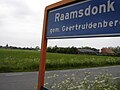
| Municipality | Geertruidenberg |
| Area | |
| • Total | 13.70 km2 (5.29 sq mi) |
| Elevation | 2.4 m (7.9 ft) |
| Population (2021)[1] | |
| • Total | 2,255 |
| • Density | 160/km2 (430/sq mi) |
| Time zone | UTC+1 (CET) |
| • Summer (DST) | UTC+2 (CEST) |
| Postal code | 4944[1] |
| Dialing code | 0162 |
Raamsdonk is a village in the province of North Brabant, Netherlands. It is located in the municipality of Geertruidenberg, about 15 km northeast of Breda.
Toponymy[edit]
Raamsdonk (as "Dunc") is mentioned for the first time in 1253 as Ramesdunc and 1330 as Raemsdonc. A "dunc" or "dark" is a sand hill in a marshy area. The " Raams " prefix may indicate the presence of a certain type of plant, the wild garlic. However, it may also be the name of a person.
History[edit]
In 1609, the St. Lambert church became part of the Reformed Church. In 1611, the first pastor came.
The Catholic people were allowed, in 1690, to establish a church in a barn. In the hamlet Waspikse the Benedenkerk. In 1787, another church in a barn was installed in Raamsdonk. This church was dedicated to Saint-Bavo and was in Bergenstraat. In 1798, however, Catholics demanded to return to the St. Lambert church. They did not succeed but received a sum of money in compensation. The barn church served the community until 1888. Then a new monumental St. Bavo Church, was built according to the plans of the architect Carl Weber. It is located in the present village.
At Raamsdonk until about 1850 existed a small French community.[3]
Raamsdonk was a separate municipality until 1997, when it became part of Geertruidenberg.[4]
Gallery[edit]
-
 Entrance Wielstraat, view Raamsdonk-Dorp and Church of Saint-Bavo
 -
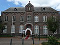 Ontmoetingscentrum


References[edit]
- ^ a b c "Kerncijfers wijken en buurten 2021". Central Bureau of Statistics. Retrieved 16 April 2022.
- ^ "Postcodetool for 4944AA". Actueel Hoogtebestand Nederland (in Dutch). Het Waterschapshuis. Retrieved 16 April 2022.
- ^ Regionaal Archief Tilburg
- ^ Ad van der Meer and Onno Boonstra, Repertorium van Nederlandse gemeenten, KNAW, 2011.
| Authority control databases: National |
|---|