Portal:Tropical cyclones
The Tropical Cyclones Portal
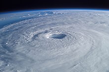
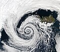
A tropical cyclone is a storm system characterized by a large low-pressure center, a closed low-level circulation and a spiral arrangement of numerous thunderstorms that produce strong winds and heavy rainfall. Tropical cyclones feed on the heat released when moist air rises, resulting in condensation of water vapor contained in the moist air. They are fueled by a different heat mechanism than other cyclonic windstorms such as Nor'easters, European windstorms and polar lows, leading to their classification as "warm core" storm systems. Most tropical cyclones originate in the doldrums, approximately ten degrees from the Equator.
The term "tropical" refers to both the geographic origin of these systems, which form almost exclusively in tropical regions of the globe, as well as to their formation in maritime tropical air masses. The term "cyclone" refers to such storms' cyclonic nature, with anticlockwise rotation in the Northern Hemisphere and clockwise rotation in the Southern Hemisphere. Depending on its location and intensity, a tropical cyclone may be referred to by names such as "hurricane", "typhoon", "tropical storm", "cyclonic storm", "tropical depression" or simply "cyclone".
Types of cyclone: 1. A "Typhoon" is a tropical cyclone located in the North-west Pacific Ocean which has the most cyclonic activity and storms occur year-round. 2. A "Hurricane" is also a tropical cyclone located at the North Atlantic Ocean or North-east Pacific Ocean which have an average storm activity and storms typically form between May 15 and November 30. 3. A "Cyclone" is a tropical cyclone that occurs in the South Pacific and Indian Oceans.
Selected named cyclone -
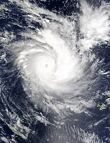
Severe Tropical Cyclone Zoe was the second-most intense tropical cyclone on record within the Southern Hemisphere and was the strongest tropical cyclone worldwide in 2002. The system was first noted on December 23, 2002, as a tropical depression that had developed, within the South Pacific Convergence Zone to the east of Tuvalu. Over the next couple of days, the system moved southwestwards and crossed the International Dateline early on December 25. After this, the system became better organized and was declared to be a tropical cyclone and named Zoe later that day. Zoe subsequently rapidly intensified in very favorable conditions as it continued to move west-southwest towards the Solomon Islands. The system subsequently became a Category 5 tropical cyclone on both the Australian tropical cyclone intensity scale and the Saffir-Simpson hurricane wind scale on December 27. The system subsequently affected the Solomon Islands Temotu Province during that day, before it peaked with 10-minute sustained wind speeds of 240 km/h (150 mph). As the system peaked, it performed a small clockwise cyclonic loop within the vicinity of Tikopia island, as a result of the steering flow over the cyclone becoming weak and variable. The system subsequently started to move towards the southeast during December 29, in response to a strengthening steering flow, provided by an upper level trough of low pressure and a baroclinic system near New Caledonia. Over the next few days the system weakened and degenerated into a tropical depression during January 1, 2003. The system was subsequently last noted during January 4, while it was located to the southeast of New Caledonia.
Cyclone Zoe severely affected areas of Rotuma, the Solomon Islands, and Vanuatu. Heavy rainfall and strong winds were particularly disastrous to the Solomon Islands, especially on the islands of Anuta and Tikopia. There, numerous crops and fruit–bearing trees were destroyed. Beaches were also heavily eroded due to the high waves generated by the cyclone. Although effects were lesser in Vanuatu, the country's northernmost islands experienced heavy flooding and beaches destroyed by high waves. After this usage of the name Zoe, the name was retired. (Full article...)Selected article -
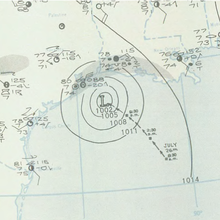
The 1943 Surprise Hurricane was the first hurricane to be entered by a reconnaissance aircraft. The first tracked tropical cyclone of the 1943 Atlantic hurricane season, this system developed as a tropical storm while situated over the northeastern Gulf of Mexico on July 25. The storm gradually strengthened while tracking westward and reached hurricane status late on July 26. Thereafter, the hurricane curved slightly west-northwestward and continued intensifying. Early on July 27, it became a Category 2 hurricane on the modern-day Saffir–Simpson hurricane wind scale and peaked with winds of 105 mph (165 km/h). The system maintained this intensity until landfall on the Bolivar Peninsula in Texas late on July 27. After moving inland, the storm initially weakened rapidly, but remained a tropical cyclone until dissipating over north-central Texas on July 29.
Because the storm occurred during World War II, information and reports were censored by the government of the United States and news media. Advisories also had to be cleared through the Weather Bureau office in New Orleans, resulting in late releases. This in turn delayed preparations ahead of the storm. In Louisiana, the storm produced gusty winds and heavy rains, though no damage occurred. The storm was considered the worst in Texas since the 1915 Galveston hurricane. Wind gusts up to 132 mph (212 km/h) were reported in the Galveston-Houston area. Numerous buildings and houses were damaged or destroyed. The storm caused 19 fatalities, 14 of which occurred after two separate ships sank. Overall, damage reached approximately $17 million (equivalent to $299 million in 2023). (Full article...)Selected image -

Selected season -

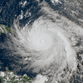
The 2003 Atlantic hurricane season was a very active season with tropical cyclogenesis occurring before and after the official bounds of the season—the first such occurrence since the 1970 season. The season produced 21 tropical cyclones, of which 16 developed into named storms; seven of those attained hurricane status, of which three reached major hurricane status. The strongest hurricane of the season was Hurricane Isabel, which reached Category 5 status on the Saffir–Simpson hurricane scale northeast of the Lesser Antilles; Isabel later struck North Carolina as a Category 2 hurricane, causing $3.6 billion in damage (2003 USD) and a total of 51 deaths across the Mid-Atlantic region of the United States.
Although the bounds of the season are typically from June 1 to November 30, the season began early with the formation of Subtropical Storm Ana on April 20, and it ended relatively late on December 11 with the dissipation of Tropical Storm Peter. In early September, Hurricane Fabian struck Bermuda as a Category 3 hurricane, where it was the worst hurricane since 1926; on the island it caused four deaths and $300 million in damage (2003 USD). Hurricane Juan caused considerable destruction to Nova Scotia, particularly Halifax, as a Category 2 hurricane, the first hurricane of significant strength to hit the province since 1893. Additionally, Hurricanes Claudette and Erika struck Texas and Mexico, respectively, as minimal hurricanes. In December, Tropical Storm Odette struck the Dominican Republic, and Tropical Storm Peter formed in the eastern portion of the basin. (Full article...)Related portals
Currently active tropical cyclones

Italicized basins are unofficial.
- North Atlantic (2024)
- No active systems
- East and Central Pacific (2024)
- No active systems
- West Pacific (2024)
- No active systems
- North Indian Ocean (2024)
- No active systems
- Mediterranean (2023–24)
- No active systems
- South-West Indian Ocean (2023–24)
- No active systems
- Australian region (2023–24)
- No active systems
- South Pacific (2023–24)
- No active systems
- South Atlantic (2023–24)
- No active systems
Last updated: 21:54, 8 May 2024 (UTC)
Tropical cyclone anniversaries

May 14
- 1997 - Cyclone Rhonda reached its peak intensity in the open Indian Ocean with winds of 185 km/h (115 mph).
- 2007 - Cyclone Akash (pictured) damages a total of US$982 million over in Bangladesh and Burma, also killing a total of 14.
- 2020 - Typhoon Vongfong makes landfall over Visayas, Philippines as a Category 3 typhoon.

May 15
- 1982 - Tropical Storm Claudia (pictured) affects the Solomon Islands as a weak cyclone.
- 1996 - Typhoon Bart reaches Category 4 typhoon intensity just northeast of Luzon.
- 2024 - The 2024 East Pacific hurricane season officially begins.

May 16
- 1989 - Typhoon Brenda (pictured) passed over the Philippines, causing torrential flooding that killed at least 140 people.
- 2004 - Typhoon Nida reaches peak intensity as an intense typhoon, off the coast of eastern Philippines, causing minor damage.
- 2015 - Typhoon Dolphin reaches peak intensity, impacting the Mariana Islands with $14 million in damages.
Did you know…
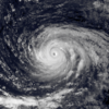


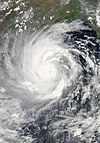
- …that the Joint Typhoon Warning Center considers that Typhoon Vera (pictured) of 1986 is actually two distinct systems, formed from two separated low-level circulations?
- …that Hurricane Agatha (pictured) was the strongest Pacific hurricane to make landfall in Mexico in May since records began in 1949?
- …that Cyclone Raquel (track pictured) travelled between the Australian and South Pacific basins between the 2014–15 and 2015–16 seasons, spanning both seasons in both basins?
- …that Cyclone Amphan (pictured) in 2020 was the first storm to be classified as a Super Cyclonic Storm in the Bay of Bengal since 1999?
General images -

The 2015 Pacific hurricane season was the second-most active Pacific hurricane season on record, and featured the strongest tropical cyclone ever observed in the Western Hemisphere: Hurricane Patricia. The season officially started on May 15 in the Eastern Pacific—east of 140°W—and on June 1 in the Central Pacific—between the International Date Line and 140°W—and ended on November 30. These dates typically cover the period of each year when most tropical cyclones form in the Northeastern Pacific tropical cyclone basin. The season's first storm, Hurricane Andres, developed on May 28; the season's final storm, Tropical Depression Nine-C, dissipated on December 31, well after the official end of the season.
Throughout the season, 31 tropical depressions developed, 26 of which became tropical storms, a record-tying 16 of them reached hurricane strength, and a record-breaking 11 achieved major hurricane intensity. Activity in the Central Pacific shattered records, with 16 tropical cyclones forming in or entering the basin; the previous highest was 11 during the 1992 and 1994 seasons. On August 30, three hurricanes at Category 4 strength—Ignacio, Jimena, and Kilo—existed simultaneously in the Northeastern Pacific, which was a first for the basin. On October 23, Hurricane Patricia became the strongest hurricane ever recorded in the Western Hemisphere, with a minimum atmospheric pressure of 872 mbar (hPa; 25.75 inHg) and maximum sustained winds of 215 mph (345 km/h). Activity in the basin was boosted by the strong 2014–16 El Niño event, which brought anomalously high sea surface temperatures and low vertical wind shear that helped the numerous systems form and intensify. (Full article...)Topics
Subcategories
Related WikiProjects
WikiProject Tropical cyclones is the central point of coordination for Wikipedia's coverage of tropical cyclones. Feel free to help!
WikiProject Weather is the main center point of coordination for Wikipedia's coverage of meteorology in general, and the parent project of WikiProject Tropical cyclones. Three other branches of WikiProject Weather in particular share significant overlaps with WikiProject Tropical cyclones:
- The Non-tropical storms task force coordinates most of Wikipedia's coverage on extratropical cyclones, which tropical cyclones often transition into near the end of their lifespan.
- The Floods task force takes on the scope of flooding events all over the world, with rainfall from tropical cyclones a significant factor in many of them.
- WikiProject Severe weather documents the effects of extreme weather such as tornadoes, which landfalling tropical cyclones can produce.
Things you can do
 |
Here are some tasks awaiting attention:
|
Wikimedia
The following Wikimedia Foundation sister projects provide more on this subject:
-
Commons
Free media repository -
Wikibooks
Free textbooks and manuals -
Wikidata
Free knowledge base -
Wikinews
Free-content news -
Wikiquote
Collection of quotations -
Wikisource
Free-content library -
Wikiversity
Free learning tools -
Wikivoyage
Free travel guide -
Wiktionary
Dictionary and thesaurus

