
File:USGS map of the Mother Lode belt in California.jpg
Size of this preview: 563 × 600 pixels. Other resolutions: 225 × 240 pixels | 451 × 480 pixels | 719 × 766 pixels.
Original file (719 × 766 pixels, file size: 131 KB, MIME type: image/jpeg)
| This is a file from the Wikimedia Commons. Information from its description page there is shown below. Commons is a freely licensed media file repository. You can help. |
Summary
| Description |
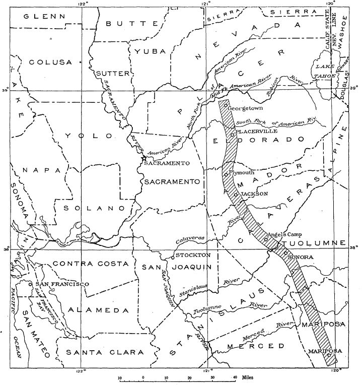
English: USGS map of the Mother Lode belt in California |
| Date | |
| Source | The Mother Lode System of California, USGS Professional Paper 157, https://pubs.usgs.gov/pp/0157/report.pdf |
| Author | Adolf Knopf |
Licensing
This image is in the public domain in the United States because it only contains materials that originally came from the United States Geological Survey, an agency of the United States Department of the Interior. For more information, see the official USGS copyright policy.
|
File history
Click on a date/time to view the file as it appeared at that time.
| Date/Time | Thumbnail | Dimensions | User | Comment | |
|---|---|---|---|---|---|
| current | 12:07, 11 October 2021 | | 719 × 766 (131 KB) | Pi3.124 | Uploaded a work by Adolf Knopf from The Mother Lode System of California, https://pubs.usgs.gov/pp/0157/report.pdf with UploadWizard |
File usage
The following pages on the English Wikipedia use this file (pages on other projects are not listed):