
File:USA New Hampshire location map.svg

Size of this PNG preview of this SVG file: 342 × 599 pixels. Other resolutions: 137 × 240 pixels | 274 × 480 pixels | 438 × 768 pixels | 584 × 1,024 pixels | 1,168 × 2,048 pixels | 639 × 1,120 pixels.
Original file (SVG file, nominally 639 × 1,120 pixels, file size: 251 KB)
| This is a file from the Wikimedia Commons. Information from its description page there is shown below. Commons is a freely licensed media file repository. You can help. |
Summary
| Description |
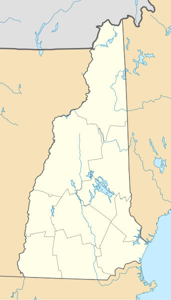
Quadratische Plattkarte, N-S-Streckung 140.0 %. Geographische Begrenzung der Karte:
Equirectangular projection, N/S stretching 140.0 %. Geographic limits of the map:
|
| Date | |
| Source | Own work |
| Author | Alexrk2 |
| Other versions |
Derivative works of this file: |

|
This map has been made or improved in the German Kartenwerkstatt (Map Lab). You can propose maps to improve as well.
|
Licensing
I, the copyright holder of this work, hereby publish it under the following licenses:

|
Permission is granted to copy, distribute and/or modify this document under the terms of the GNU Free Documentation License, Version 1.2 or any later version published by the Free Software Foundation; with no Invariant Sections, no Front-Cover Texts, and no Back-Cover Texts. A copy of the license is included in the section entitled GNU Free Documentation License. |
This file is licensed under the Creative Commons Attribution 3.0 Unported license.
- You are free:
- to share – to copy, distribute and transmit the work
- to remix – to adapt the work
- Under the following conditions:
- attribution – You must give appropriate credit, provide a link to the license, and indicate if changes were made. You may do so in any reasonable manner, but not in any way that suggests the licensor endorses you or your use.
You may select the license of your choice.
File history
Click on a date/time to view the file as it appeared at that time.
| Date/Time | Thumbnail | Dimensions | User | Comment | |
|---|---|---|---|---|---|
| current | 15:37, 26 June 2009 | | 639 × 1,120 (251 KB) | Alexrk2 | == Beschreibung == {{Information |Description= {{de|Positionskarte von New Hampshire, USA}} Quadratische Plattkarte, N-S-Streckung 140.0 %. Geographische Begrenzung der Karte: * N: 45.5° N * S: 42.5° N * W: 72.8° W * O |
File usage
More than 100 pages use this file. The following list shows the first 100 pages that use this file only. A full list is available.
- Amherst, New Hampshire
- Antrim (CDP), New Hampshire
- Barrett House (New Ipswich, New Hampshire)
- Boston Red Sox Radio Network
- Bretton Woods, New Hampshire
- Bretton Woods Mountain Resort
- Bristol (CDP), New Hampshire
- Camp Yavneh
- Candia Four Corners, New Hampshire
- Canterbury Shaker Village
- Cascade, New Hampshire
- Castle in the Clouds
- Center Sandwich, New Hampshire
- Chesham, New Hampshire
- Citizens' Hall
- Conway (CDP), New Hampshire
- Cornish Flat, New Hampshire
- Derry (CDP), New Hampshire
- Dixville Notch, New Hampshire
- Durham (CDP), New Hampshire
- East Merrimack, New Hampshire
- East Rochester, New Hampshire
- Elkins, New Hampshire
- Enfield (CDP), New Hampshire
- Epping (CDP), New Hampshire
- Etna, New Hampshire
- Exeter (CDP), New Hampshire
- Farmington (CDP), New Hampshire
- Fort William and Mary
- Fort at Number 4
- Glencliff, New Hampshire
- Gonic, New Hampshire
- Gorham (CDP), New Hampshire
- Governor John Langdon House
- Greenville (CDP), New Hampshire
- Groveton, New Hampshire
- Hampton (CDP), New Hampshire
- Hanover (CDP), New Hampshire
- Henniker (CDP), New Hampshire
- Hillsborough (CDP), New Hampshire
- Hinsdale (CDP), New Hampshire
- Hooksett (CDP), New Hampshire
- Hudson (CDP), New Hampshire
- Intervale, New Hampshire
- Jaffrey (CDP), New Hampshire
- Kearsarge, New Hampshire
- Lancaster (CDP), New Hampshire
- Lisbon (CDP), New Hampshire
- List of New Hampshire state parks
- Littleton (CDP), New Hampshire
- Lochmere, New Hampshire
- Londonderry (CDP), New Hampshire
- MacDowell (artists' residency and workshop)
- Marlborough (CDP), New Hampshire
- Melvin Village, New Hampshire
- Meredith (CDP), New Hampshire
- Meriden, New Hampshire
- Milford (CDP), New Hampshire
- Milton Mills, New Hampshire
- Mine Falls Gatehouse
- Mount Washington Hotel
- Mount Washington State Park
- New Boston Space Force Station
- New Hampshire State Prison for Men
- Newmarket (CDP), New Hampshire
- Newport (CDP), New Hampshire
- North Conway, New Hampshire
- North Stratford, New Hampshire
- North Woodstock, New Hampshire
- Northern New Hampshire Correctional Facility
- Palace Theatre (Manchester, New Hampshire)
- Penacook, New Hampshire
- Peterborough (CDP), New Hampshire
- Pinardville, New Hampshire
- Pittsfield (CDP), New Hampshire
- Plymouth (CDP), New Hampshire
- Poocham, New Hampshire
- Raymond (CDP), New Hampshire
- Richard Jackson House
- Sanborn Seminary
- Sanbornville, New Hampshire
- Searles Castle (New Hampshire)
- Silver Lake, New Hampshire
- South Sutton, New Hampshire
- Spruce Hole Bog
- The Fly (climb)
- Twin Mountain, New Hampshire
- USS Albacore (AGSS-569)
- Union, New Hampshire
- University System of New Hampshire
- Valley Cemetery
- WRLP Tower
- Weirs Beach, New Hampshire
- West Hopkinton, New Hampshire
- West Lebanon, New Hampshire
- West Swanzey, New Hampshire
- Whitefield (CDP), New Hampshire
- Wilton (CDP), New Hampshire
- Winchester (CDP), New Hampshire
- Wolfeboro (CDP), New Hampshire
View more links to this file.
Global file usage
The following other wikis use this file:
- Usage on an.wikipedia.org
- Usage on ar.wikipedia.org
- Usage on azb.wikipedia.org
- کانوی ، نیوهمپشایر
- اشلند ، نیوهمپشایر
- دری شرقی، نیوهمپشایر
- کسکید، نیوهمپشایر
- برتون وودز، نیوهمپشایر
- ویرز بیچ، نیوهمپشایر
- کاندیا فورکورنرز، نیوهمپشایر
- رداستون، نیوهمپشر
- ویکفیلد شرقی، نیوهمپشایر
- قلنکلیف، نیوهمپشایر
- الکینز، نیوهمپشایر
- کاندیا شرقی، نیوهمپشایر
- چوکوروا، نیوهمپشایر
- مریدن، نیوهمپشایر
- قلن، نیو همپشایر
- اتنا، نیوهمپشایر
- کونکورد، نیوهمپشایر
- ناشوا، نیوهمپشایر
- آمهرزت، نیوهمپشایر
- پاریس، نیوهمپشایر
- بالوچ، نیوهمپشایر
- پلئیس، نیوهمپشایر
- پوچام، نیوهمپشایر
- یونیون، نیوهمپشایر
- قونیک، نیوهمپشایر
- قرووتون، نیوهمپشایر
- قویلد، نیوهمپشایر
- ایسپوفورد، نیوهمپشایر
- Usage on az.wikipedia.org
- Usage on be-tarask.wikipedia.org
- Usage on bg.wikipedia.org
View more global usage of this file.