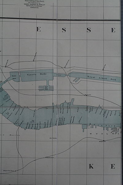
File:Thames wharf map bottom middle third.jpg

Size of this preview: 400 × 600 pixels. Other resolutions: 160 × 240 pixels | 320 × 480 pixels | 512 × 768 pixels | 682 × 1,024 pixels | 1,365 × 2,048 pixels | 3,456 × 5,184 pixels.
Original file (3,456 × 5,184 pixels, file size: 6.81 MB, MIME type: image/jpeg)
Summary[edit]
| Description |
English: Wharf Map of the River Thames, bottom middle segment (2/3) |
|---|---|
| Source |
Wharf map of the River Thames between Nine Elms and Barking'. Scale: 8 inches to 1 nautical mile. Compiled by G D Evans of The Erith & Dartford Lighterage Co Ltd, 4 Catherine Court, London; lithographed by Dunn, Collin & Co, Brown's Buildings, St Mary Axe, London; published by Henry Hughes & Son, 59 Fenchurch Street, London |
| Date |
1905 |
| Author |
G D Evans |
| Permission (Reusing this file) |
See below.
|
Working file for Graphics Lab - this image is not to be copied to Wikimedia Commons
| This image is in the public domain in the United States. In most cases, this means that it was first published prior to January 1, 1929 (see the template documentation for more cases). Other jurisdictions may have other rules, and this image might not be in the public domain outside the United States. See Wikipedia:Public domain and Wikipedia:Copyrights for more details. |
| This media file is either in the public domain or published under a free license, and contains no inbound file links. If this media file is useful, then it should be transferred to the Wikimedia Commons. If this media is not useful, then please propose it for deletion or list it at files for discussion. |
File history
Click on a date/time to view the file as it appeared at that time.
| Date/Time | Thumbnail | Dimensions | User | Comment | |
|---|---|---|---|---|---|
| current | 21:17, 2 April 2015 |  | 3,456 × 5,184 (6.81 MB) | Prioryman (talk | contribs) | =={{int:filedesc}}== {{Information |description={{en|1=Wharf Map of the River Thames, bottom middle segment (2/3)}} |date=1905 |source=Wharf map of the River Thames between Nine Elms and Barking'. Scale: 8 inches to 1 nautical mile. Compiled by G D Eva... |
You cannot overwrite this file.
File usage
No pages on the English Wikipedia use this file (pages on other projects are not listed).
