
File:Thailand-map-CIA-thai.png

Size of this preview: 409 × 600 pixels. Other resolutions: 164 × 240 pixels | 327 × 480 pixels | 974 × 1,428 pixels.
Original file (974 × 1,428 pixels, file size: 127 KB, MIME type: image/png)
| This is a file from the Wikimedia Commons. Information from its description page there is shown below. Commons is a freely licensed media file repository. You can help. |
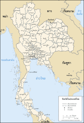
แผนที่แสดงจังหวัดในประเทศไทย Map of Thailand in Thai
This image is in the public domain because it contains materials that originally came from the United States Central Intelligence Agency's World Factbook.
|
 |
File history
Click on a date/time to view the file as it appeared at that time.
| Date/Time | Thumbnail | Dimensions | User | Comment | |
|---|---|---|---|---|---|
| current | 20:37, 20 September 2006 | | 974 × 1,428 (127 KB) | Electionworld | แผนที่แสดงจังหวัดในประเทศไทย Map of Thailand in Thai {{PD-USGov-CIA-WF}} Category:Maps of Thailand |
File usage
The following pages on the English Wikipedia use this file (pages on other projects are not listed):
Global file usage
The following other wikis use this file:
- Usage on pl.wikipedia.org
- Usage on th.wikipedia.org
- ผู้ใช้:ZenithZealotry
- ผู้ใช้:Poompong1986
- ผู้ใช้:ZenithZealotry/templates/Thailand
- ผู้ใช้:Toeyez
- ผู้ใช้:Jimmy Classic
- ผู้ใช้:Mahatee
- ผู้ใช้:Luckpong
- ผู้ใช้:Mahatee/กล่องผู้ใช้
- ผู้ใช้:Mr.nana
- ผู้ใช้:Sazaja
- ผู้ใช้:Mr.nana/สมุดจด
- ผู้ใช้:RodKren
- ผู้ใช้:Lephill
- ผู้ใช้:Shoshui
- ผู้ใช้:Ns11721
- ผู้ใช้:บุญพฤทธิ์ ทวนทัย
- ผู้ใช้:พุทธามาตย์
- ผู้ใช้:Armkungup
- ผู้ใช้:Oatkridsana/แนะนำตัวและประวัติส่วนตัว
- ผู้ใช้:Noobythailand
- ผู้ใช้:Levi Kambai
- ผู้ใช้:Levi Kambai/แนะนำตัวและประวัติส่วนตัว