
File:Superstorm Sandy on 10-30-2012.png
Size of this preview: 800 × 549 pixels. Other resolutions: 320 × 220 pixels | 640 × 439 pixels | 1,024 × 703 pixels | 1,280 × 879 pixels | 2,560 × 1,757 pixels | 3,036 × 2,084 pixels.
Original file (3,036 × 2,084 pixels, file size: 9.5 MB, MIME type: image/png)
| This is a file from the Wikimedia Commons. Information from its description page there is shown below. Commons is a freely licensed media file repository. You can help. |
Summary
| Description |
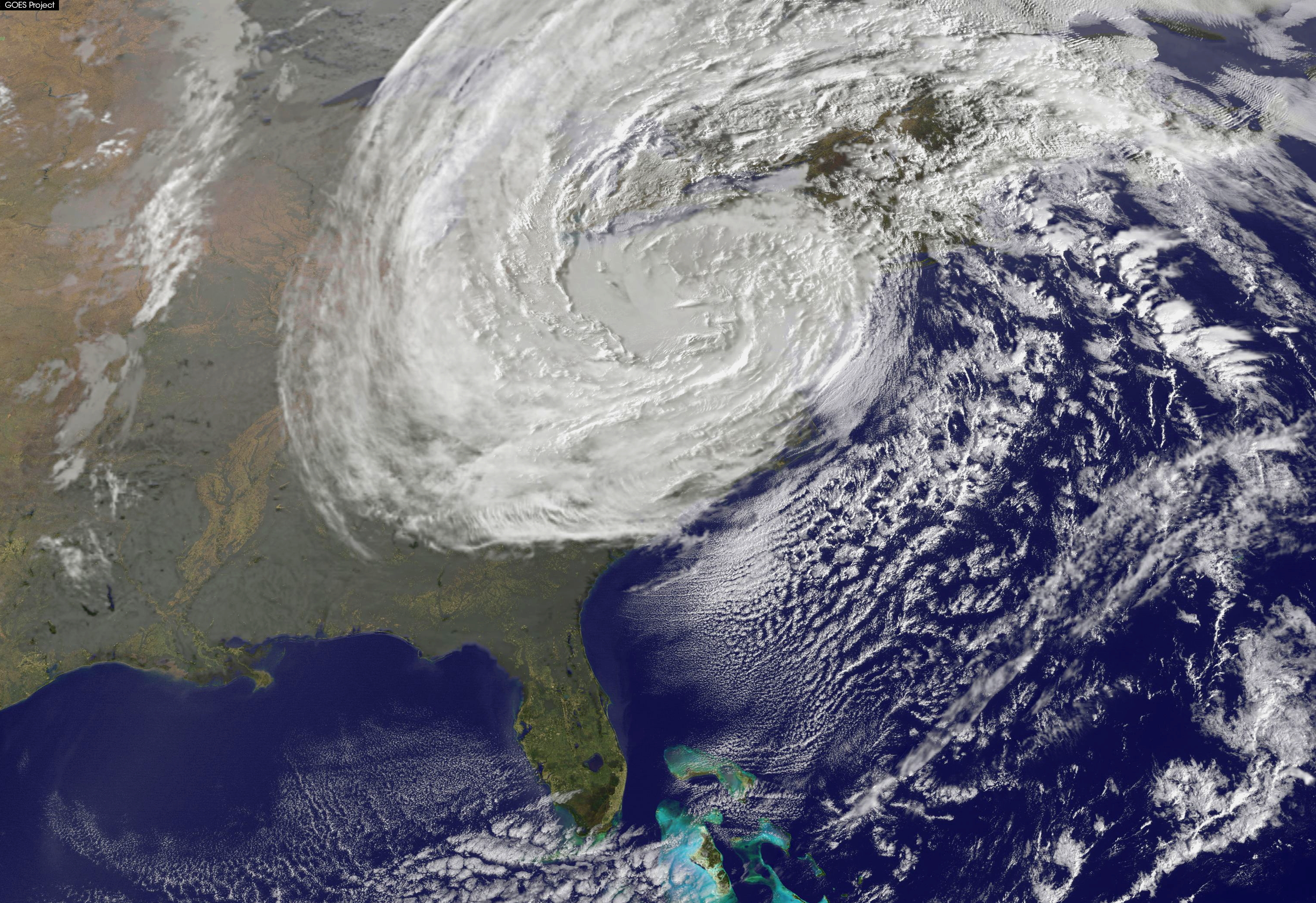
English: Visible satellite image of Superstorm Sandy over the Eastern United States, on the morning of Tuesday, October 30, 2012. The storm is currently at its maximum extratropical size, about a day after it's extratropical transition and landfall in southern New Jersey. The image has been resized, cropped, and brightened from its original version, in order to have the image focus more on the Superstorm, and to better depict the system. |
| Date | |
| Source | Satellite View of Post-Tropical Cyclone Sandy on Oct. 30 |
| Author | NASA |
Licensing
| This file is in the public domain in the United States because it was solely created by NASA. NASA copyright policy states that "NASA material is not protected by copyright unless noted". (See Template:PD-USGov, NASA copyright policy page or JPL Image Use Policy.) | ||
 |
Warnings:
|
| Annotations | This image is annotated: View the annotations at Commons |
File history
Click on a date/time to view the file as it appeared at that time.
| Date/Time | Thumbnail | Dimensions | User | Comment | |
|---|---|---|---|---|---|
| current | 01:58, 12 September 2013 | | 3,036 × 2,084 (9.5 MB) | BlueHypercane761 | Upload didn't work. |
| 01:56, 12 September 2013 |  | 3,036 × 2,084 (9.5 MB) | BlueHypercane761 | Much higher resolution. | |
| 01:39, 12 September 2013 |  | 857 × 592 (922 KB) | BlueHypercane761 | Slightly darkened. | |
| 00:50, 1 September 2013 |  | 857 × 592 (922 KB) | BlueHypercane761 | User created page with UploadWizard |
File usage
The following pages on the English Wikipedia use this file (pages on other projects are not listed):
Global file usage
The following other wikis use this file:
- Usage on gl.wikipedia.org