
File:Site of Battle of Pwll Melyn (sometimes known as Castle Oak Pond).jpg
No higher resolution available.
Site_of_Battle_of_Pwll_Melyn_(sometimes_known_as_Castle_Oak_Pond).jpg (640 × 426 pixels, file size: 122 KB, MIME type: image/jpeg)
| This is a file from the Wikimedia Commons. Information from its description page there is shown below. Commons is a freely licensed media file repository. You can help. |
.jpg)
Summary
| Description |
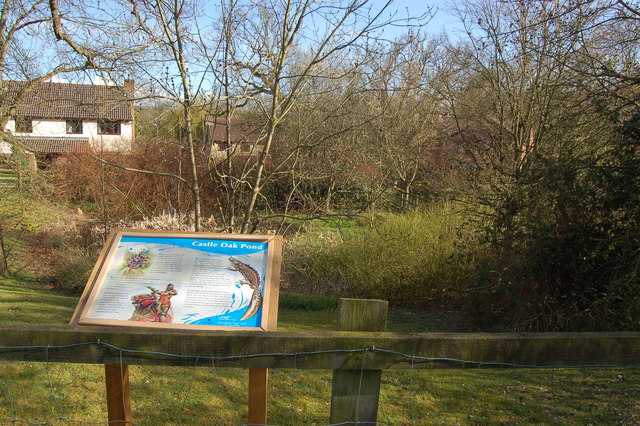
English: Castle Oak pond, Usk This pond was originally excavated in the 1850s to provide water for the steam trains on the line between Little Mill and Monmouth. During the excavation skeletons were found believed to be those slain at the battle of Pwll Melyn in 1405 when Owen Glendower's forces were heavily defeated by those of Henry IV. The line was closed in 1955 by Lord Beeching. Despite now being totally surrounded by the Castle Oak housing estate the pond is home to a rare amphibian -the greater crested newt. |
| Date | |
| Source | From geograph.org.uk |
| Author | Roger Davies |
| Attribution (required by the license) | Roger Davies / Castle Oak pond, Usk / |
| Camera location | | View this and other nearby images on: OpenStreetMap |
|---|
.jpg¶ms=051.707020_N_-002.901200_E_globe:Earth_type:camera_source:geograph-osgb36(SO37820130)_heading:157.00&language=en)
| Object location | | View this and other nearby images on: OpenStreetMap |
|---|
.jpg¶ms=051.706750_N_-002.901000_E_globe:Earth_class:object_type:object_source:geograph-osgb36(SO37830127)_heading:157.00&language=en)
Licensing

|
This image was taken from the Geograph project collection. See this photograph's page on the Geograph website for the photographer's contact details. The copyright on this image is owned by Roger Davies and is licensed for reuse under the Creative Commons Attribution-ShareAlike 2.0 license.
|
This file is licensed under the Creative Commons Attribution-Share Alike 2.0 Generic license.
Attribution: Roger Davies
- You are free:
- to share – to copy, distribute and transmit the work
- to remix – to adapt the work
- Under the following conditions:
- attribution – You must give appropriate credit, provide a link to the license, and indicate if changes were made. You may do so in any reasonable manner, but not in any way that suggests the licensor endorses you or your use.
- share alike – If you remix, transform, or build upon the material, you must distribute your contributions under the same or compatible license as the original.
File history
Click on a date/time to view the file as it appeared at that time.
| Date/Time | Thumbnail | Dimensions | User | Comment | |
|---|---|---|---|---|---|
| current | 10:57, 19 February 2011 | | 640 × 426 (122 KB) | GeographBot | == {{int:filedesc}} == {{Information |description={{en|1=Castle Oak pond, Usk This pond was originally excavated in the 1850s to provide water for the steam trains on the line between Little Mill and Monmouth. During the excavation skeletons were found be |
File usage
The following pages on the English Wikipedia use this file (pages on other projects are not listed):
Global file usage
The following other wikis use this file:
- Usage on cy.wikipedia.org
- Usage on de.wikipedia.org
- Usage on fr.wikipedia.org
- Usage on www.wikidata.org
.jpg)