
File:Seitzersdorf Wolfpassing FranzXaver.jpg

Size of this preview: 450 × 600 pixels. Other resolutions: 180 × 240 pixels | 360 × 480 pixels | 576 × 768 pixels | 1,200 × 1,600 pixels.
Original file (1,200 × 1,600 pixels, file size: 184 KB, MIME type: image/jpeg)
| This is a file from the Wikimedia Commons. Information from its description page there is shown below. Commons is a freely licensed media file repository. You can help. |
Summary
| Description |
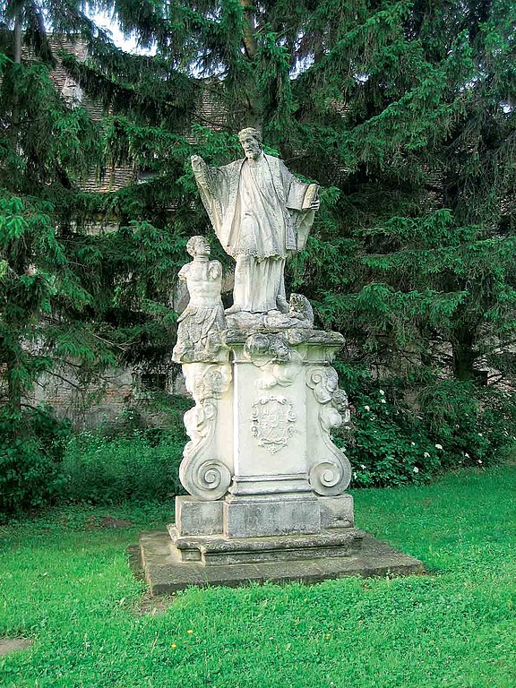
Deutsch: Am Ende der Kirchenalle vor dem Haghof/Gutshof
Position: 16° 5' 32,3 Ost, 48° 24' 29,0 Nord, H.ü.Nn. 211 m; DEHIO S. 1079 Errichtet 1749, zuletzt renoviert 1992/93. In der Nähe der Schlosskapelle in Wolfpassing befindet sich eine barocke Statue des hl. Franz Xaver. Der Heilige tauft gerade einen Inder. Die Statue hat Graf Karl Hardegg gestiftet, dessen Wappen auf der Südseite des Volutensockel zu sehen ist. |
| Date | |
| Source | Own work, aus Alfred Auer und Herbert Fritz: Klein- und Flurdenkmale - sowie sonstige vom Menschen geschaffene Merkwürdigkeiten - in der Marktgemeinde und Pfarre Hausleiten „Marterlführer“; Edition Club Hausleiten; Hausleiten 2008, ISBN 978-3-902368-19-5 |
| Author |
Karen und Herbert Fritz. Original uploader was DrBigT at de.wikipedia |
| Permission (Reusing this file) |
Released into the public domain (by the author). |
| Object location | | View this and other nearby images on: OpenStreetMap |
|---|
Licensing
| I, the copyright holder of this work, release this work into the public domain. This applies worldwide. In some countries this may not be legally possible; if so: I grant anyone the right to use this work for any purpose, without any conditions, unless such conditions are required by law. |
Original upload log
The original description page was here. All following user names refer to de.wikipedia.
- 2011-07-29 07:17 DrBigT 1200×1600× (187978 bytes) {{Information |Beschreibung = Am Ende der Kirchenalle vor dem Haghof/Gutshof Position: 16° 5' 32,3'' Ost, 48° 24' 29,0'' Nord, H.ü.Nn. 211 m; DEHIO S. 1079 Errichtet 1749, zuletzt renoviert 1992/ 93. In der Nähe der Schlosskapelle in Wolfpassing befin
File history
Click on a date/time to view the file as it appeared at that time.
| Date/Time | Thumbnail | Dimensions | User | Comment | |
|---|---|---|---|---|---|
| current | 18:38, 15 November 2011 | | 1,200 × 1,600 (184 KB) | File Upload Bot (Magnus Manske) | {{BotMoveToCommons|de.wikipedia|year={{subst:CURRENTYEAR}}|month={{subst:CURRENTMONTHNAME}}|day={{subst:CURRENTDAY}}}} {{Information |Description={{de|Am Ende der Kirchenalle vor dem Haghof/Gutshof Position: 16° 5' 32,3'' Ost, 48° 24' 29,0'' Nord, H.ü |
File usage
The following pages on the English Wikipedia use this file (pages on other projects are not listed):
Global file usage
The following other wikis use this file:
- Usage on de.wikipedia.org
- Usage on www.wikidata.org