
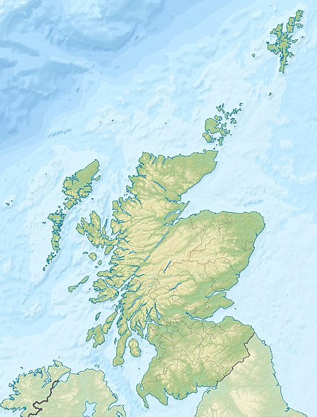
File:Scotland relief location map.jpg

Size of this preview: 456 × 600 pixels. Other resolutions: 182 × 240 pixels | 365 × 480 pixels | 584 × 768 pixels | 1,128 × 1,483 pixels.
Original file (1,128 × 1,483 pixels, file size: 927 KB, MIME type: image/jpeg)
| This is a file from the Wikimedia Commons. Information from its description page there is shown below. Commons is a freely licensed media file repository. You can help. |
Summary
| Description | Quadratische Plattkarte, N-S-Streckung 170 %. Geographische Begrenzung der Karte: * N: 61.0° N * S: 54.5° N * W: 8.8° W * O: 0.4° W Equirectangular projection, N/S stretching 170 %. Geographic limits of the map: * N: 61.0° N * S: 54.5° N * W: 8.8° W * E: 0.4° W |
| Date | (UTC) |
| Source | Own work |
| Author |
|
| Other versions |
|

Licensing
I, the copyright holder of this work, hereby publish it under the following licenses:
This file is licensed under the Creative Commons Attribution-Share Alike 3.0 Unported license.
Attribution: Eric Gaba, NordNordWest, Uwe Dedering
- You are free:
- to share – to copy, distribute and transmit the work
- to remix – to adapt the work
- Under the following conditions:
- attribution – You must give appropriate credit, provide a link to the license, and indicate if changes were made. You may do so in any reasonable manner, but not in any way that suggests the licensor endorses you or your use.
- share alike – If you remix, transform, or build upon the material, you must distribute your contributions under the same or compatible license as the original.

|
Permission is granted to copy, distribute and/or modify this document under the terms of the GNU Free Documentation License, Version 1.2 or any later version published by the Free Software Foundation; with no Invariant Sections, no Front-Cover Texts, and no Back-Cover Texts. A copy of the license is included in the section entitled GNU Free Documentation License. |
You may select the license of your choice.
Original upload log
This image is a derivative work of the following images:
- File:Scotland_location_map.svg licensed with Cc-by-sa-3.0, GFDL
- 2008-10-09T18:27:35Z NordNordWest 1128x1483 (829918 Bytes) {{Information |Description= {{de|Positionskarte von [[:de:Schottland|Schottland]], [[:de:Vereinigtes Königreich|Vereinigtes Königreich]]}} Quadratische Plattkarte, N-S-Streckung 170 %. Geographische Begrenzung der Karte: *
Uploaded with derivativeFX
File history
Click on a date/time to view the file as it appeared at that time.
| Date/Time | Thumbnail | Dimensions | User | Comment | |
|---|---|---|---|---|---|
| current | 23:30, 25 June 2010 | | 1,128 × 1,483 (927 KB) | Uwe Dedering | {{Information |Description={{de|Positionskarte von Schottland, Vereinigtes Königreich}} Quadratische Plattkarte, N-S-Streckung 170 %. Geographische Begrenzung der Karte: * N: 61.0° N * S: 54.5° N * W: |
File usage
More than 100 pages use this file. The following list shows the first 100 pages that use this file only. A full list is available.
- Aberdeen
- Alfred Dunhill Links Championship
- Ardnamurchan Point
- Arthur's Seat
- Battle of Aberdeen (1644)
- Battle of Alford
- Battle of Auldearn
- Battle of Cromdale
- Battle of Dun Nechtain
- Battle of Dunkeld
- Battle of Glen Shiel
- Battle of Halidon Hill
- Battle of Harlaw
- Battle of Inverlochy (1645)
- Battle of Killiecrankie
- Battle of Kilsyth
- Battle of Largs
- Battle of Philiphaugh
- Battle of Sheriffmuir
- Battle of Stirling Bridge
- Battle of Tippermuir
- Beinn Alligin
- Beinn a' Bheithir
- Ben Lomond
- Ben Macdui
- Ben Nevis
- Ben Rinnes
- Ben Stack
- Bennachie
- Braeriach
- Buachaille Etive Mòr
- Burnt Islands
- Cairngorms
- Cairnpapple Hill
- Calton Hill
- Cape Wrath
- Cromarty Firth
- David Stevenson (engineer)
- Dundee
- Dunfermline
- Dunsinane Hill
- Eas a' Chual Aluinn
- Edinburgh
- Ettrick Water
- Fairy Lochs
- Falls of Clyde (waterfalls)
- Faraid Head
- Firth of Clyde
- Firth of Forth
- Firth of Tay
- Glasgow
- Harald Hardrada
- Inchgarvie
- Inveraray Castle
- Inverness
- Johnnie Walker Championship at Gleneagles
- Loch Eriboll
- Loch Garten
- Loch Leven (Kinross)
- Loch Lomond
- Lochleven Castle
- Lochnagar
- Lochs of Spiggie and Brow
- Mainland, Shetland
- Massacre of Glencoe
- Merrick (Galloway)
- Montrose, Angus
- Moray Firth
- Mounth
- Muirfield
- North Rona
- Northern Isles
- Northern Lighthouse Board
- Old Course at St Andrews
- Orkney
- Out Stack
- Outer Hebrides
- Pentland Firth
- Pentland Hills
- Perth, Scotland
- Prestwick Golf Club
- Rannoch
- Rannoch Moor
- River Esk, Lothian
- River Teviot
- River Tummel
- Robert Stevenson (civil engineer)
- Sand, Applecross
- Scapa Flow
- Scottish Open (golf)
- Shetland
- Sidlaws
- Sleat
- Solway Firth
- St Abb's Head
- St Andrews Castle
- St Ninian's Isle
- Stirling
- Sule Skerry
- Sule Stack
View more links to this file.
Global file usage
The following other wikis use this file:
- Usage on ab.wikipedia.org
- Usage on am.wikipedia.org
- Usage on ar.wikipedia.org
- Usage on arz.wikipedia.org
- Usage on ast.wikipedia.org
- Usage on as.wikipedia.org
- Usage on awa.wikipedia.org
- Usage on azb.wikipedia.org
- Usage on az.wikipedia.org
- Usage on ba.wikipedia.org
- Usage on be-tarask.wikipedia.org
- Usage on be.wikipedia.org
View more global usage of this file.