
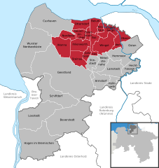
File:Samtgemeinde Land Hadeln in CUX.svg

Size of this PNG preview of this SVG file: 568 × 600 pixels. Other resolutions: 227 × 240 pixels | 455 × 480 pixels | 727 × 768 pixels | 970 × 1,024 pixels | 1,940 × 2,048 pixels | 1,771 × 1,870 pixels.
Original file (SVG file, nominally 1,771 × 1,870 pixels, file size: 457 KB)
| This is a file from the Wikimedia Commons. Information from its description page there is shown below. Commons is a freely licensed media file repository. You can help. |
Summary
| Description |
|
|||||||||||||||||||||||||
| Date | ||||||||||||||||||||||||||
| Source |
Own work This W3C-unspecified vector image was created with Adobe Illustrator. |
|||||||||||||||||||||||||
| Author |
Hagar66 based on work of TUBS |
|||||||||||||||||||||||||
| Other versions |
|

Licensing
NordNordWest, TUBS & Hagar66, the copyright holder of this work, hereby publishes it under the following licenses:

|
Permission is granted to copy, distribute and/or modify this document under the terms of the GNU Free Documentation License, Version 1.2 or any later version published by the Free Software Foundation; with no Invariant Sections, no Front-Cover Texts, and no Back-Cover Texts. A copy of the license is included in the section entitled GNU Free Documentation License. |
This file is licensed under the Creative Commons Attribution-Share Alike 3.0 Unported license.
Attribution: NordNordWest, TUBS & Hagar66
- You are free:
- to share – to copy, distribute and transmit the work
- to remix – to adapt the work
- Under the following conditions:
- attribution – You must give appropriate credit, provide a link to the license, and indicate if changes were made. You may do so in any reasonable manner, but not in any way that suggests the licensor endorses you or your use.
- share alike – If you remix, transform, or build upon the material, you must distribute your contributions under the same or compatible license as the original.
You may select the license of your choice.

|
I'd greatly appreciate, that you attribute this media file to Wikimedia Commons, if used outside Wikipedia or Commons. For use in publications such as books, newspapers, blogs, websites, please insert here the following line:
|
File history
Click on a date/time to view the file as it appeared at that time.
| Date/Time | Thumbnail | Dimensions | User | Comment | |
|---|---|---|---|---|---|
| current | 17:51, 31 October 2016 | | 1,771 × 1,870 (457 KB) | NordNordWest | upd |
| 15:42, 2 January 2015 |  | 1,771 × 1,870 (457 KB) | NordNordWest | upd | |
| 16:11, 1 January 2014 |  | 1,771 × 1,870 (626 KB) | NordNordWest | upd | |
| 08:09, 2 November 2011 |  | 1,771 × 1,870 (652 KB) | Hagar66 | incorporation of Appeln, Bokel, Frelsdorf, Heerstedt, Hollen, Kirchwistedt, Lunestedt and Stubben into Beverstedt | |
| 09:40, 10 December 2010 |  | 1,771 × 1,870 (1.09 MB) | Hagar66 | == {{int:filedesc}} == {{Information |Description= {{DeLocMaps |mun=Samtgemeinde Land Hadeln |munlink= |lk=Landkreis Cuxhaven |enlk=District of Cuxhaven |enlklink=Cuxhaven (district) |frlk=L'arrondissement de Cuxhaven |frlklink=Arrondissement de Cuxhaven |
File usage
The following pages on the English Wikipedia use this file (pages on other projects are not listed):
Global file usage
The following other wikis use this file:
- Usage on da.wikipedia.org
- Usage on de.wikipedia.org
- Usage on eo.wikipedia.org
- Usage on et.wikipedia.org
- Usage on fa.wikipedia.org
- Usage on it.wikipedia.org
- Usage on ja.wikipedia.org
- Usage on nds.wikipedia.org
- Usage on nl.wikipedia.org
- Usage on pl.wikipedia.org
- Usage on ru.wikipedia.org
- Usage on www.wikidata.org