
File:SEQ location map.svg

Original file (SVG file, nominally 1,200 × 1,800 pixels, file size: 652 KB)
| This is a file from the Wikimedia Commons. Information from its description page there is shown below. Commons is a freely licensed media file repository. You can help. |
Summary
| Description |
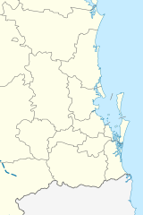
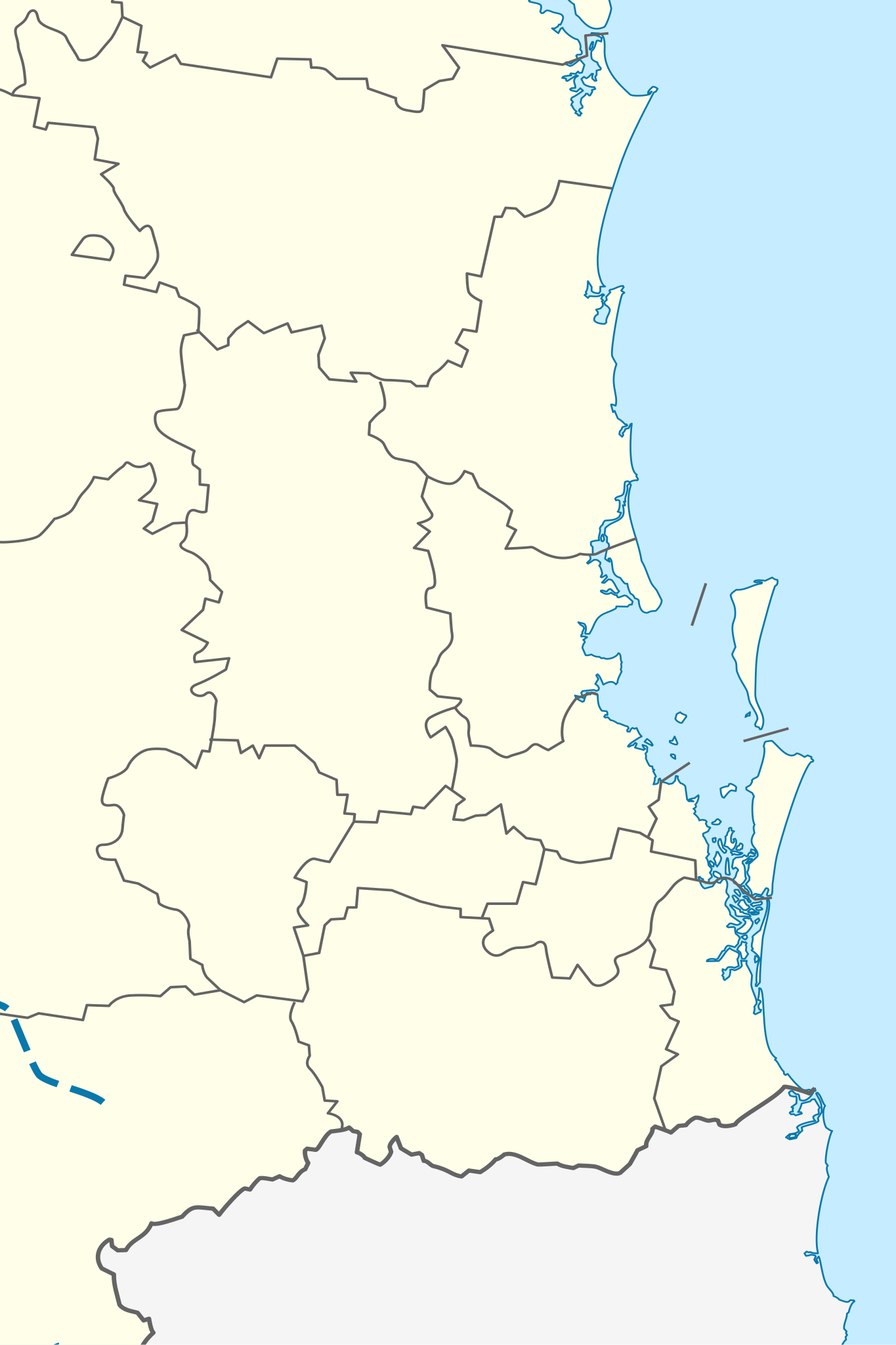
English: Location map of the South East Queensland region in Australia, and the local government areas bordering it. Haven't added the map data module yet. I'm also starting to think the Australia infobox template won't allow two maps to exist, so for using this the Queensland map would have to be replaced, or it would have to be put on a spot somewhere else in the article (assuming that is even possible) This is derived from https://commons.wikimedia.org/wiki/File:Australia_Queensland_location_map.svg In terms of using it on pages, typing (without quotes) "Australia Queensland SEQ" allows the map to be used in infoboxes Equirectangular projection, N/S should be the same scale as E/W (or at least x1.000033135)
return { name = 'South East Queensland', top = -25.74, bottom = -27.74, left = 151.73, right = 153.73, image = 'SEQ location map.svg', image1 = '400px-SEQ_location_map.svg.png' } |
| Date | |
| Source |
Own work, derived from
|
| Author | Iamthinking2202 |
Licensing
- You are free:
- to share – to copy, distribute and transmit the work
- to remix – to adapt the work
- Under the following conditions:
- attribution – You must give appropriate credit, provide a link to the license, and indicate if changes were made. You may do so in any reasonable manner, but not in any way that suggests the licensor endorses you or your use.
- share alike – If you remix, transform, or build upon the material, you must distribute your contributions under the same or compatible license as the original.
File history
Click on a date/time to view the file as it appeared at that time.
| Date/Time | Thumbnail | Dimensions | User | Comment | |
|---|---|---|---|---|---|
| current | 05:59, 17 July 2022 | | 1,200 × 1,800 (652 KB) | Ham105 | reduce stroke-widths to 20% of previous version |
| 04:51, 28 April 2020 |  | 1,200 × 1,800 (669 KB) | Iamthinking2202 | Boundary of SEQ not standardised (eg Toowoomba and Gympie?), and isn't a separate state, but an informal region part of a state | |
| 06:08, 28 March 2020 |  | 1,200 × 1,800 (725 KB) | Iamthinking2202 | Reverted to version as of 06:06, 28 March 2020 (UTC) | |
| 06:06, 28 March 2020 |  | 1,200 × 1,800 (669 KB) | Iamthinking2202 | Reverted to version as of 12:20, 6 February 2020 (UTC) | |
| 06:06, 28 March 2020 |  | 1,200 × 1,800 (725 KB) | Iamthinking2202 | South East Queensland councils now in light orange | |
| 12:20, 6 February 2020 |  | 1,200 × 1,800 (669 KB) | Iamthinking2202 | User created page with UploadWizard |
File usage
- 2024 U20 Rugby Championship
- Queensland Reds
- Sunshine Coast Airport
- Venues of the 2032 Summer Olympics and Paralympics
- User:Iamthinking2202/sandbox
- Module:Location map/data/Australia Queensland SEQ
- Module:Location map/data/Australia Queensland SEQ/doc
- Module:Location map/data/SEQ
- Module:Location map/data/SEQ/doc
Global file usage
The following other wikis use this file:
- Usage on simple.wikipedia.org
- Usage on si.wikipedia.org